Join us at our 2nd Annual Blizzard Ball

Forecast for the Skyline Area Mountains

Brett Kobernik
Issued by Brett Kobernik on
Monday morning, December 30, 2024
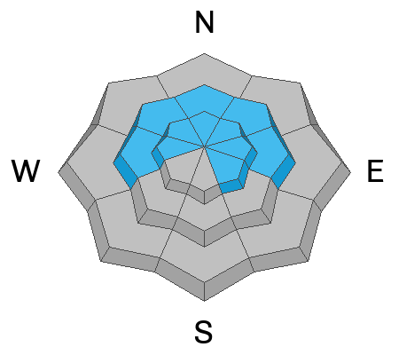
The avalanche danger remains HIGH on steep upper elevation slopes that face northwest through east.
Human triggered avalanches are almost certain in this terrain.
Avalanches can be triggered from a distance so it is important to not only stay off of steep slopes but avoid being below them.
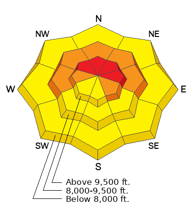
Low
Moderate
Considerable
High
Extreme
Learn how to read the forecast here
Weather and Snow
Current Conditions: After a crazy warm windy day on Sunday, temperatures have dropped to around 20˚F and the wind has slowed into the light to moderate speed categories from the southwest. Areas north of Horseshoe Mtn picked up 5 inches of snow overnight. There's a little less in Ephraim Canyon and areas south. Riding conditions on Sunday were funky but I bet this new powder that we recieved overnight is going to greatly improve things.
Mountain Weather: There's light snowfall as of 6am which might continue through the morning with possibly a little more accumulation. Skies should clear later this afternoon. Temperatures won't warm much and will actually cool into the teens late this afternoon. The weather looks unsettled through the week with chances for light snowfall here and there but I don't really see much chance of any accumulations until the weekend.
Recent Avalanches
The only avalanche activity reported from Sunday was some minor wet activity in the lower elevations mainly in the form of rollerballs and small sluffs.
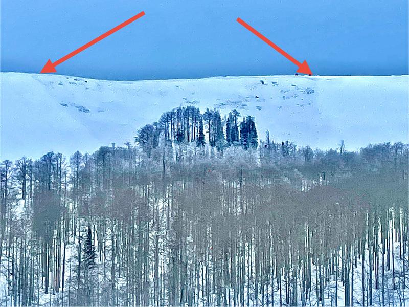
Below is a photo where you can make out the slab avalanche that released naturally on the Wedding Ring Ridge early Saturday morning. MORE DETAILS
Ad
Avalanche Problem #1
Persistent Weak Layer
Type
Location
Likelihood
Size
Description
We will be dealing with the old buried faceted Persistent Weak Layer for a while still. There were reports of widespread collapsing in the Fairview/Electric Lake zones on Sunday. Check out Chris Magerls excellent account of what he found on Sunday as far as avalanche and riding conditions: DETAILS HERE
Things are going to get a bit deceptive with this problem. You may not see obvious signs of danger like recent avalanches or plumes coming off the peaks and loading slopes below. You might not even experience collapsing or whumpfing of the snowpack underneath you. But I assure you that the weak layers of snow still exist and can be lethal.
Continue to avoid all steep slopes in the mid and upper elevations that face west, north and east. I would even be leary of high elevation southeast facing slopes.
General Announcements
This forecast is from the U.S.D.A. Forest Service, which is solely responsible for its content. This forecast describes general avalanche conditions and local variations always occur.