Join us at our 2nd Annual Blizzard Ball

Forecast for the Skyline Area Mountains

Brett Kobernik
Issued by Brett Kobernik on
Tuesday morning, December 31, 2024
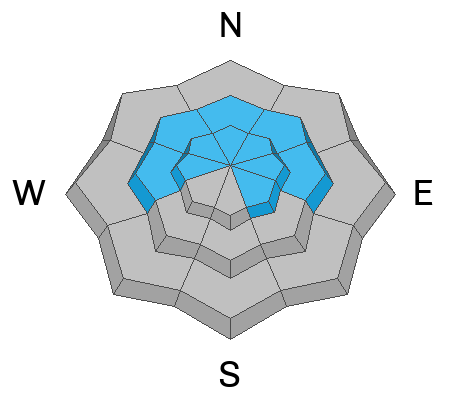
The avalanche danger is rated at CONSIDERABLE on mid and upper elevation slopes that face northwest through east.
Human triggered avalanches breaking into old weak faceted snow are likely in this terrain.
Signs of avalanche danger are not going to be as obvious as they were but be sure, the snowpack remains lethal.
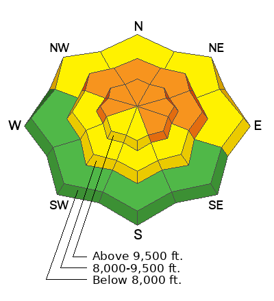
Low
Moderate
Considerable
High
Extreme
Learn how to read the forecast here
Weather and Snow
Current Conditions: New snow on Monday and cooler temperatures greatly improved riding conditions. The snowpack is quite supportable on skis but you'll trench deep still on snowmachines. Step off your skis or machine and you'll punch right to the ground in many places. Chris Magerl compiled another excellent description of what he was seeing in the backcountry on Monday. DETAILS HERE. Wind from the southwest was slightly breezy on Monday but nothing like we've seen. Temperatures have continue to drop and many locations are in the single digits with some below zero.
Mountain Weather: We'll see a good amount of sun today with some clouds moving in later this afternoon. Temperatures are only going to warm up to around 20˚F. Wind from the northwest should remain fairly light in speed. The weather is a little unsettled for our area through the week but I don't think we'll see any significant snow accumulations until this weekend.
Recent Avalanches
No avalanche activity was reported from Monday. You can always find all of the avalanche reports from the link below in Additional Information.
Ad
Avalanche Problem #1
Persistent Weak Layer
Type
Location
Likelihood
Size
Description
Collapsing or Whumpfing of the snowpack continued on Monday. This is basically all you need to know to alert you that conditions are unstable. Anytime the snowpack makes a whumpfing noise underneath you, this is Mother Nature screaming at you that things are dangerous.
If you dig a deep trench with your machine or if you punch your boots through to the ground, grab a handful of snow from down there and you'll notice it's just like sugar. This is another big clue.
When we have sugary faceted snow buried in the snowpack, it is by far the most dangerous situation we encounter. This is what causes the majority of avalanche accidents in Utah. All you can do is avoid the steep slopes until we see the snowpack stabilize. This is going to take some time. Have patience. Thankfully, there are miles and miles of low angle meadows where we can go enjoy the fresh snow and stay out of avalanche danger.
General Announcements
This forecast is from the U.S.D.A. Forest Service, which is solely responsible for its content. This forecast describes general avalanche conditions and local variations always occur.