Forecast for the Salt Lake Area Mountains

Issued by Mark Staples on
Thursday morning, February 14, 2019
Thursday morning, February 14, 2019
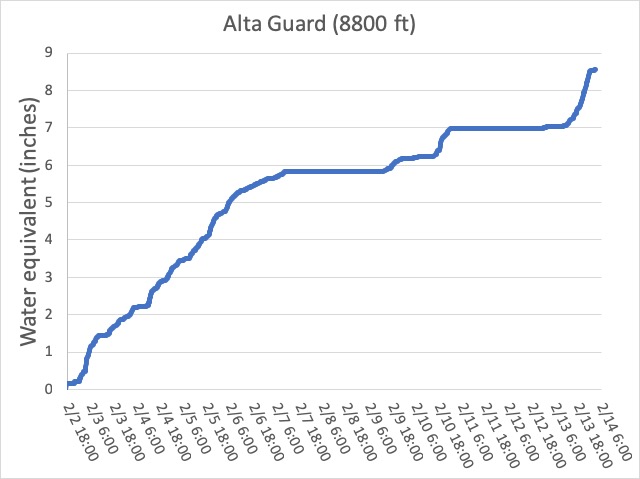
Today there are a bunch of avalanche problems. Slabs of new snow, wind drifted snow and possibly wet snow could fracture and produce an avalanches 1-4 feet deep. With a heavy load of snow overnight and additional wind loading, big, deep, hard slab avalanches breaking on buried weak layers are a possibility. These larger slides could be 8-10 feet deep.
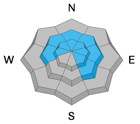
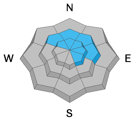
For these reasons, the avalanche danger is HIGH at upper elevations where strong southerly winds are depositing snow and avalanche terrain should be avoided. All other elevations and aspects have a CONSIDERABLE danger which means you need to have careful snowpack evaluation, cautious route-finding, and conservative decision making.
If headed out today - Stay away from and don't get under slopes steeper than 30 degrees. Go to wind sheltered slopes less than 30 degrees in steepness above 8000 feet.
ROOF AVALANCHES - With such warm temperatures and rain possible, watch for avalanches sliding off roofs. Be especially watchful of kids playing near any house with a large load of snow on the roof. Roof avalanches have killed children in the past.

Low
Moderate
Considerable
High
Extreme
Learn how to read the forecast here