Forecast for the Salt Lake Area Mountains

Issued by Evelyn Lees on
Friday morning, February 15, 2019
Friday morning, February 15, 2019
It will be day of increasing avalanche danger, with natural avalanches possible this afternoon and tonight as winds increase and heavy snowfall occurs.
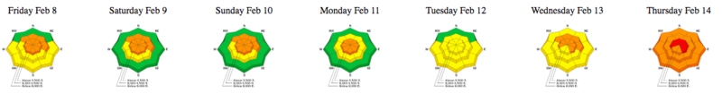
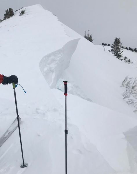
This morning - the avalanche danger is CONSIDERABLE on steep slopes at the mid and upper elevations, especially those recently drifted with snow. Considerable means human triggered avalanches are likely, and careful snowpack evaluation, cautious route finding and conservative decision making are necessary for backcountry travel. Watch for avalanches sliding off roofs. Be especially watchful of kids playing near any house with a large load of snow on the roof.
This afternoon - the avalanche danger will increase to HIGH when the winds strengthen and tonight during periods of heavy snowfall.
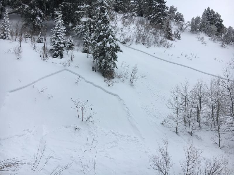
Turning and riding will be excellent on the untracked, classic wind sheltered, low angle terrain the Wasatch has so much of. (slopes less steep than about 30 degrees and above about 8,000')

Low
Moderate
Considerable
High
Extreme
Learn how to read the forecast here