Forecast for the Salt Lake Area Mountains

Drew Hardesty
Issued by Drew Hardesty on
Sunday morning, December 8, 2019
Areas of CONSIDERABLE danger exist on mid and upper elevation northwest through north through easterly facing aspects. Large and deadly human triggered avalanches 2-3' are possible and are likely to be triggered from a distance or well above you. With additional snow and wind, the danger will rise to MODERATE for shallow wind drifts and new snow avalanches on a variety of aspects.
Low
Moderate
Considerable
High
Extreme
Learn how to read the forecast here
Special Announcements
Thanks to the generous support of our Utah ski resorts and Ski Utah, we have discount lift tickets available. All proceeds from these go towards paying for avalanche forecasting and education! Get your tickets HERE.

Get one of these cool t-shirts to support the UAC and other avalanche centers across the U.S. INFO
Weather and Snow
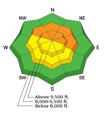
As of 5am, snowfall totals are 2-3" on the storm boards in the upper Cottonwoods, and with a snow-water-equivalent of 0.41", it's little surprise that it's graupel bring reported. The Park City ridgeline has a trace to two with the Ogden and Provo mountains about half that. With the passing of the wave, winds are continuing to veer (moving clockwise from southwest to west) this morning and are blowing 15-20mph. Temperatures are in the mid to upper 20s and dropping. Total snow depths are 3-4' in the upper Cottonwoods and 2-3' along the PC ridgeline.

For today we'll have off and on snowfall with light snow falling down to the benches. 5-10" possible in the mountains by tomorrow. Winds will be 10-15mph from the west/northwest. Temperatures will be falling to the low 20s.
A shortwave ridge builds in for Monday night through early Wednesday with a quick cold front slated for later Wednesday. Additional storms arrive on a westerly flow follows for Thursday through the weekend.
Visit the Week in Review for a summary of the weather and avalanche activity from the past week.
Recent Avalanches
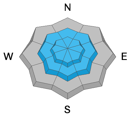
Ski area control teams continue to trigger large and impressive avalanches into the old snow near the ground. Yesterday, in mid-Little Cottonwood, a single explosive pulled out a very large avalanche 3-4' deep and a couple hundred feet wide on a steep northwest facing slope at roughly 10,700'. Parts of the slab had old black holes from previous work with the howitzer. This well mirrors the inconsistent yet eye-opening situation in the backcountry: land mines continue to be found every day, keeping us all on our toes, taking nothing for granted.
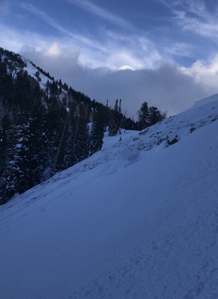
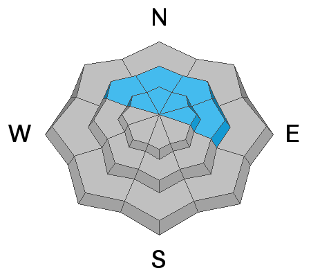
In upper Big Cottonwood Canyon yesterday, two people were caught and carried in the Hidden Canyon area along the Brighton periphery. This was on a northwest facing slope at 8800', 2' deep and 100' wide. Little more is known - and thanks to the reporting party; I'll try to follow up more with them today. (pc: Mace)
Across the range, however, some steep lines continue to be ridden in suspect terrain with no incident. These we call "non-event" feedback and I would caution people to build confidence based upon what we know of our snow structure.

In the Bear River Range just north of the border into Idaho, two snowmobilers were caught and carried with one partial burial in an avalanche but ended up ok. INFO.
Ad
Avalanche Problem #1
Persistent Weak Layer
Type
Location
Likelihood
Size
Description
It remains a bit of a tenuous situation with the snowpack. We're now eight days past the Thanksgiving massacre and still we cannot let our guard down. Many areas have avalanched (we keep getting more reports of what ran naturally during the cycle) but many have not. Some have run, reloaded, and have run again (confirmed only in upper LCC with control work at Alta) - we call these repeaters.
Higher end numbers of precipitation today and tomorrow, however, will add additional stress to this conditionally unstable snow structure and I wouldn't be surprised to see a couple more avalanches into this layering by the afternoon.
I continue to avoid being on or beneath the suspect terrain of steep northwest to east facing slopes at the mid and upper elevations.
Avalanche Problem #2
New Snow
Type
Location
Likelihood
Size
Description
Forecaster Greg Gagne's observation yesterday points out the professional's approach to heading into the backcountry. Before heading out, he compiled his questions about the snowpack and targeted his terrain, observations and snowpits to address these questions. I'll link to it here.
While it appears that wind, sun, and warmth has jettisoned, if not degraded, the previous weak snow surfaces, this morning's graupel may instead act as a weak layer that sits on a variety of hard sun and wind crusts. Today, target your inquiry to see how sensitive the storm snow is as it slowly adds up in the mountains. Test slopes and quick hand pits often provide some clue to the situation. Shooting cracks also provide evidence. If we see the higher end of snow totals, it should be possible to trigger new storm snow avalanches on a variety of aspects.