Forecast for the Logan Area Mountains

Paige Pagnucco
Issued by Paige Pagnucco on
Monday morning, February 10, 2025
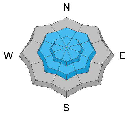
The avalanche danger is CONSIDERABLE in upper-elevation terrain steeper than 30°. Human-triggered avalanches are likely on steep slopes where a persistent weak layer is buried 1 to 3 feet deep.
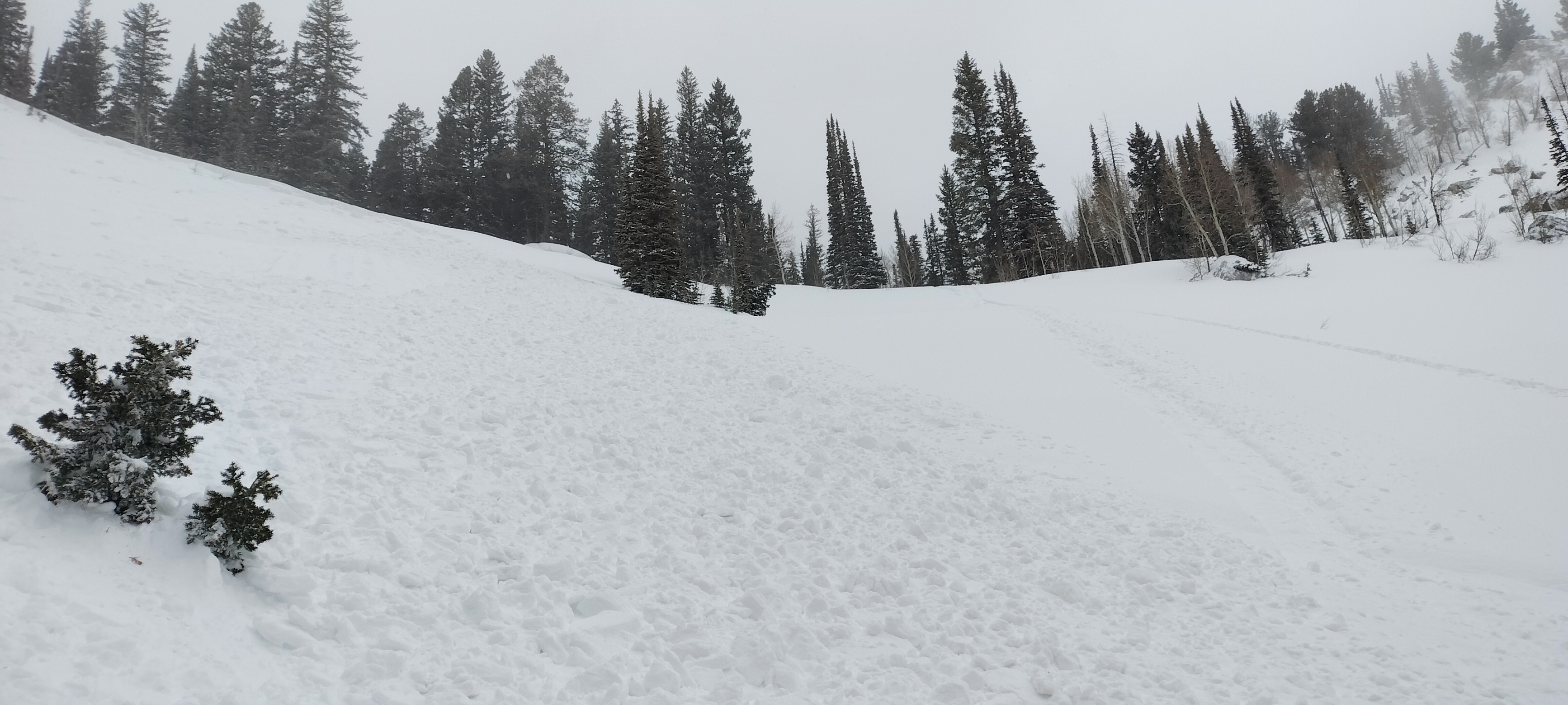
  • Careful snowpack evaluation, cautious route-finding, and conservative decision-making are essential for safe backcountry travel today.
  • Avoid travel on or under steep drifted slopes and ridge-top cornices.
Low
Moderate
Considerable
High
Extreme
Learn how to read the forecast here
Special Announcements
We are deeply saddened to report an avalanche fatality in East Bowl of Silverfork in the Salt Lake Area Mountains that happened Saturday. UAC staff has visited the site, and we will provide a full accident report in the coming days.
Weather and Snow
It finally feels and looks like winter in the mountains, with white slopes and very cold temperatures. You'll find excellent shallow powder riding conditions across the zone with a right-side-up snowpack. The biggest concern for today is triggering an avalanche on a buried, persistent, weak layer. Areas of wind-drifted snow from the weekend storm are particularly suspect, especially in leeward, upper-elevation terrain. While I expect the problem to be pockety in nature, the easiest way to avoid it is to stick to slopes less than 30 degrees. Just last Friday, a rider was fully buried by a PWL avalanche, so there may be some suspect slopes out there just waiting for a trigger.

-The Tony Grove Snotel at 8400 feet has picked up about 1 inch of SWE since Friday morning. It's 8° F, with 72 inches of total snow. At our Card Canyon weather station at 8800 feet, it's 4° F, and there is 52 inches of total snow.
-At the CSI Logan Peak weather station at 9700 feet, winds are blowing from the northwest 19 to 31 mph, it's 3° F, and the wind chill is -18° F. On Paris Peak, at 9500 feet, it is 3° F, and the winds are blowing from the west-northwest 6 to 12 mph creating a -8° F wind chill value.

It's going to be a cold, sunny day in the mountains. The high will be 19° F at 8500' and winds will blow from the west at 6 to 10 MPH. A small system moves through tomorrow, bringing a chance of snow, but little accumulation is expected. Temperatures continue to plummet through Thursday morning when our next significant storm moves into the zone.

For more information, visit the UAC weather page here: Weather - Utah Avalanche Center
For Logan-specific weather, go here: Logan Mountain Weather - Utah Avalanche Center
Recent Avalanches
  • A rider was caught, carried, and buried in the Franklin Basin Area on Friday. The buried rider, with only a hand and a bit of their deployed airbag sticking out of the snow, was found and rescued by a companion. Report is HERE.
  • Observers reported numerous red flags of instability last week, including long shooting cracks and extensive whumpfs.
    Read about all avalanches and observations in the Logan Zone HERE.
***Remember, the information you share about avalanches you see or trigger in the backcountry could save lives.
Ad
Avalanche Problem #1
Persistent Weak Layer
Type
Location
Likelihood
Size
Description
In late January, the Logan area mountains developed a widespread layer of weak and sugary surface snow. Wind drifting and recent accumulations built thick slabs on top of this layer and now, many slopes are plagued by a persistent weak layer buried 1 to 3 feet deep. Today, people are likely to trigger dangerous soft and hard slab avalanches failing on this persistent weak layer in upper-elevation terrain, possibly even in more sheltered terrain.
  • Avalanches could be triggered remotely (from a distance) or from below.
  • Audible collapses (whumpfs) and shooting cracks are sure signs of instability but may not always be present.
  • Getting caught in a PWL avalanche can be deadly.
  • The easiest way to avoid this problem is to avoid steep slopes with this type of poor snowpack structure.
  • Plenty of excellent powder riding can be found on slopes less than 30 degrees.
General Announcements
-National Forest Winter Recreation Travel Maps show where it's open to ride: UWCNF Logan, Ogden LRD Tony Grove, Franklin Basin CTNF Montpelier
-For all questions on forecasts, education, Know Before You Go, events, online purchases, or fundraising, call 801-365-5522.
-Remember the information you provide could save lives, especially if you see or trigger an avalanche. To report an avalanche or submit an observation from the backcountry, go HERE.
-Receive forecast region-specific text message alerts to receive messages about changing avalanche conditions, watches, and warnings. Sign up and update your preferences HERE.

This forecast is from the U.S.D.A. Forest Service, which is solely responsible for its content. This forecast describes general avalanche conditions, and local variations always occur.