Avalanche Warning
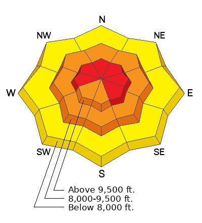
What: The avalanche danger for the warning area is HIGH today
When In effect from 6am MST this morning to 6am MST Sunday
Where: For the mountains of Northern and Central Utah, and Southeastern Idaho, including the Wasatch Plateau (Skyline)...Wasatch Range...Bear River Range...Wellsville Mountains
Impacts: Heavy snow combined with strong wind is creating widespread areas of unstable snow. Both human-triggered and natural avalanches are likely
What to do: Avoid all avalanche terrain. Stay off of and out from under slopes steeper than 30 degrees. Carry and know how to use avalanche rescue equipment. Find safer riding conditions on slopes less than 30° with no overhead hazard
Current Conditions:
Snow: The Skyline picked up a good shot of snow over the last 24 hours and it is snowing as of 6am this morning. Here are some snow and water equivalent numbers from various Snotel weather stations on the Skyline since Christmas eve:
Fairview Canyon (Mammoth Cottonwood) 12" snow, 1.9" h2o
Skyline Summit (Huntington Horse) 18" snow, 3" h2o
Ephraim Canyon (GBRC Meadows) 9"snow, 1.5" h2o
12 Mile Canyon (Mt Baldy) 13" snow, 2.2" h2o
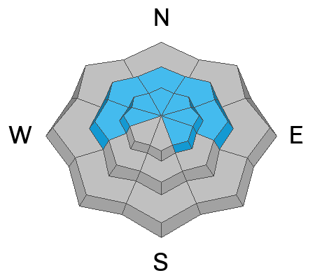
Wind: We have seen consistent wind from the west in the moderate to strong speed category for the last 48 hours, especially along the higher ridges and peaks.
Temperatures: They have been relatively warm which is a big contributor to the high density snow. Temperatures have been fluctuating from the mid to upper 20s throughout this stormy period. Most stations are around 25˚F this morning.
Mountain Weather: We should see more snowfall today in a "warm air advection" regime. I find warm fronts difficult to forecast. My best guess is that we'll see 3 to 8 inches of new high density snow by Sunday morning. Anticipate warming temperatures during the day with the rain/snow level getting up around 7000 to 7500 feet. Temperatures will top out in the upper 20s. Wind will continue to be moderate to strong through the day from the west. We'll see a little break on Sunday then a cold front will bring one more shot of snow Sunday night into Monday.
The only "confirmed" avalanche activity was some snowplow triggered avalanches in Huntington Canyon near the Electric Lake dam. The snowpack there consists of a base of loose sugary facets with about a foot of snow on top of it that fell since Christmas Eve. All this tells me that there are many other unstable slopes out there.


