Forecast for the Salt Lake Area Mountains

Issued by Evelyn Lees on
Thursday morning, March 7, 2019
Thursday morning, March 7, 2019
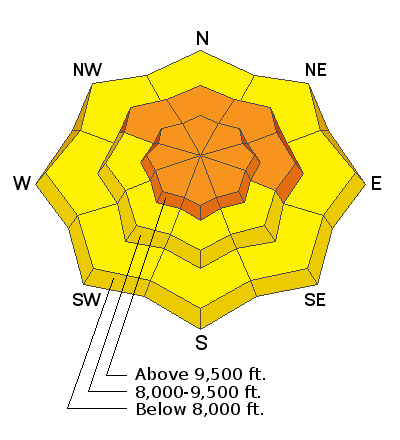
The avalanche danger is CONSIDERABLE on all aspects at the upper elevations and mid elevation slopes facing northwest through easterly with wind drifts - triggering a 2 foot deep wind drift is likely, and natural avalanches are possible. Even in wind sheltered terrain, new snow slides a foot deep can be triggered. Careful snowpack evaluation, cautious route finding and conservative decision making are essential for backcountry travel today.
A MODERATE avalanche danger exists on other mid elevation slopes for triggering a new snow slide or wind drift, and there is a MODERATE danger on low elevation slopes for triggering a wet, loose sluff.

Low
Moderate
Considerable
High
Extreme
Learn how to read the forecast here


