Forecast for the Salt Lake Area Mountains

Evelyn Lees
Issued by Evelyn Lees on
Thursday morning, December 20, 2018
The avalanche danger is LOW, and the snowpack mostly stable. But Low danger doesn’t mean no danger - avalanches can be triggered on isolated terrain features. The most likely slopes would be those facing north through easterly at the upper elevations, or any steep slope with a recent drift of wind blown snow.
Carry and practice with your beacon, shovel and probe. Travel one at a time in steep terrain, keep your partner in sight and be in position to get to them quickly should there be an avalanche.
Low
Moderate
Considerable
High
Extreme
Learn how to read the forecast here
Special Announcements
The new UAC IOS mobile app is now available on the app store. Check out the new "My Weather" feature.

Check out the new free online avalanche course series developed by the Utah Avalanche Center. This is a great way to refresh your skills or prepare you for a Backcountry 101 or Level 1 class.
Weather and Snow
Yesterday’s storm - of furious winds and a trace to 2” of graupel - is moving to the east, and being replaced by strong high pressure. Temperatures are in the teens and 20s this morning, and will soar into the mid 40s at the 8000’ level, and low 30s at 10,000’ by afternoon under sunny skies. Winds are shifting back to a more southerly direction, and should remain in the 10 to 20 mph range, with the high peaks averaging 25 to 35 mph.
Amid a sea of wind and sun crusts, savvy travelers found some good turns where the graupel pooled.
Recent Avalanches
No new avalanches reported yesterday. Looking back at the avalanche observations, the last explosive triggered avalanches into the old October snow was in upper LCC on December 14th. The last human triggered slide into this layering was in Main Porter Fork (an avalanche accident) on December 8th.
Ad
Avalanche Problem #1
Normal Caution
Type
Location
Likelihood
Size
Description
The snowpack seems just plain worn out from weeks of alternating heat and wind, and triggering an avalanche is unlikely today. However, winter travel in the mountains always has avalanche risk so evaluate the snowpack carefully if you are getting into steep terrain.
Wind slabs: Yesterday’s strong winds eroded a lot of snow, but drifts were small, isolated and not very sensitive to skis. Mountain terrain channels the wind in odd ways, so look for these hard, rounded, hollow sounding wind slabs or drifts on a variety of aspects and elevations. They will be on the lee sides of ridge crests and around terrain features, like gully walls, sub ridges and down into open bowls at both the mid and upper elevations.
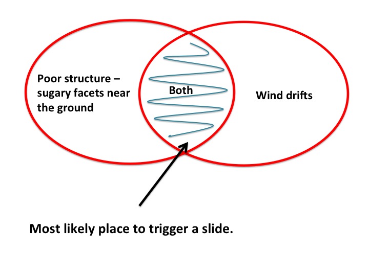
Persistent weak layer: Poor snowpack structure remains on shady mid and upper elevation slopes. While this hasn’t produced avalanches in the backcountry for 12 days, it’s hard to completely trust the layering of a stronger slab over a weak, faceted snow layer. Steep, rocky north and northeast facing terrain with fresh wind drifts is particularly suspect, and even slopes that have already slid this season can slide again.
in.
General Announcements
This information does not apply to developed ski areas or highways where avalanche control is normally done. This forecast is from the U.S.D.A. Forest Service, which is solely responsible for its content. This forecast describes general avalanche conditions and local variations always occur.