Forecast for the Uintas Area Mountains

Andrew Nassetta
Issued by Andrew Nassetta on
Sunday morning, February 23, 2025
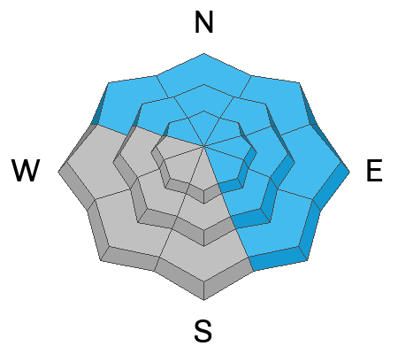
Today's avalanche danger is CONSIDERABLE and human-triggered avalanches are LIKELY on mid and upper-elevation slopes facing northwest through east through southeast. We can remotely trigger persistent slab avalanches from a distance breaking 4' deep, up to a football field wide, and failing near the ground. It is also POSSIBLE to trigger a small avalanche within wind-drifted snow on upper elevation, leeward slopes that have an easterly component.
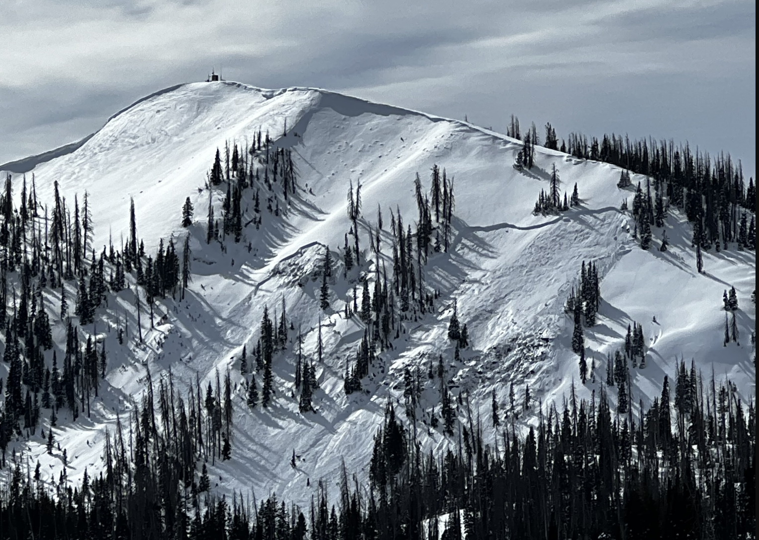
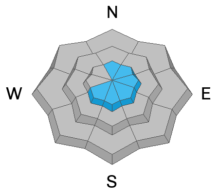
For the best riding today, I am seeking low angle, cold powder stashes on the north half of the compass and avoiding obvious avalanche paths and steep slopes above me.
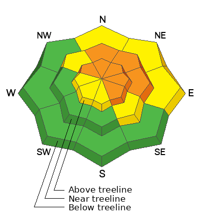
Low
Moderate
Considerable
High
Extreme
Learn how to read the forecast here
Special Avalanche Bulletin
The Utah Avalanche Center is issuing a Special Avalanche Bulletin after a series of storms in the last week has left a thick blanket of snow at all elevations, creating excellent powder riding conditions while also elevating the backcountry avalanche danger. Don't let the fresh snow and sunshine influence your decision-making - avalanche conditions remain dangerous, and careful snowpack and terrain analysis are required for backcountry travel. Fortunately, there are great riding and travel conditions away from avalanche terrain on slopes less than 30° in steepness.
Weather and Snow
Nowcast
Another beautiful, sunny, spring like morning in the Uintas is on our hands. Sunday morning kicks off with 8,000' temperatures near 15℉, and 20℉ at 10,000'. Skies are clear and winds are blowing from the northwest around 20 MPH gusting closer to 30 near ridges and the high peaks.
Forecast
Expect mostly blue skies and temperatures climbing into the 30's by 1200 PM. Winds continue and shift west between 10 and 20 MPH, bumping to 30 MPH this afternoon ushering in increasing clouds that lend way to a pinch of moisture for this evening and the chance for a trace to a few inches in the mountains.
Futurecast
We wont say the tap is dry, but we are definitely not pouring right now. High-pressure sits in place through most of the week, with a little hope for something next weekend.
Recent Avalanches
Across the range on Friday and Saturday, avalanches were triggered remotely failing on persistent weak layers within the upper portions of our snowpack, even stepping down to the ground in a few instances. Many of these slopes were repeaters, or areas that had previously avalanched this season making them more shallow and weak compared to other slopes. Get more intel on what is going on across the range and beyond by checking out the obs page, here.
This avalanche was remotely triggered from the ridge above on a ESE slope, at 9,600'. It failed into faceted snow and broke down to weak snow near the ground running full width, and track of the avalanche path. Many riders cruise right under this slope everyday to access Duchesne ridge without thinking twice -- More info, found here.
Ad
Avalanche Problem #1
Persistent Weak Layer
Type
Location
Likelihood
Size
Description
Avalanches triggered by riders remotely yesterday broke into weak snow buried 2-4' beneath the surface -- This is a huge red flag. Areas where it is thin and shallow around 3' or has previously avalanched have greater chances of producing an avalanche compared to areas where it is much deeper, up to 6'. The persistent slab problem remains complex, and the consequences severe, if we do trigger one of today's avalanches. My mindset continues to be avoidance, and my crew and I keep steering clear of this problem and towards non-avalanche terrain on the polars, or heading to sunny solars with no stress of triggering the "big one".
This avalanche is from Currant Creek Peak on a northeast slope, at 9,800' that has avalanche frequently this season producing similar avalanches -- Check out the full ob here, thanks Jon C!
Avalanche Problem #2
Wind Drifted Snow
Type
Location
Likelihood
Size
Description
Northwest winds around 20 MPH blew since yesterday and created fresh, soft drifts at upper elevations on slopes with an easterly touch. Although not the in your face, today's wind drifts could get out of hand fast in consequential terrain, or if the slide steps down into weaker layers deeper in the pack. This is a straight-forward avalanche problem managed with good travel protocol, and simply more, avoided by getting out of the windzone and into sheltered terrain.
General Announcements
We are always looking for snow and avalanche observations or just general riding conditions. In the meantime reach out to us with questions, concerns, or if you see anything in your travels! Contact us directly through the info below:
This forecast is from the U.S.D.A. Forest Service, which is solely responsible for its content. This forecast describes general avalanche conditions and local variations always occur. This forecast was issued on Sunday, February 23rd at 03:30 AM and expires 24 hours after it was issued.