Forecast for the Logan Area Mountains

Paige Pagnucco
Issued by Paige Pagnucco on
Saturday morning, February 22, 2025
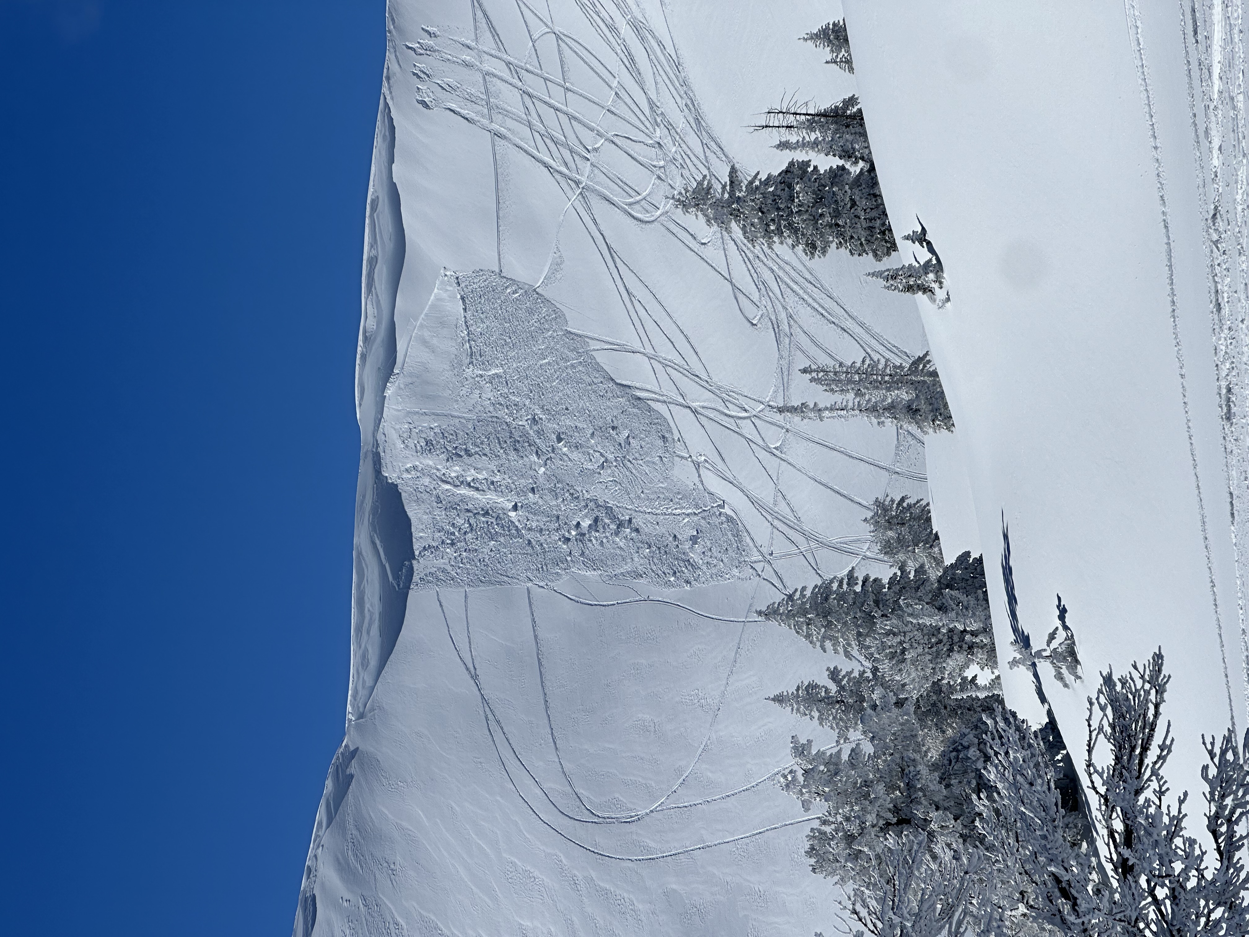
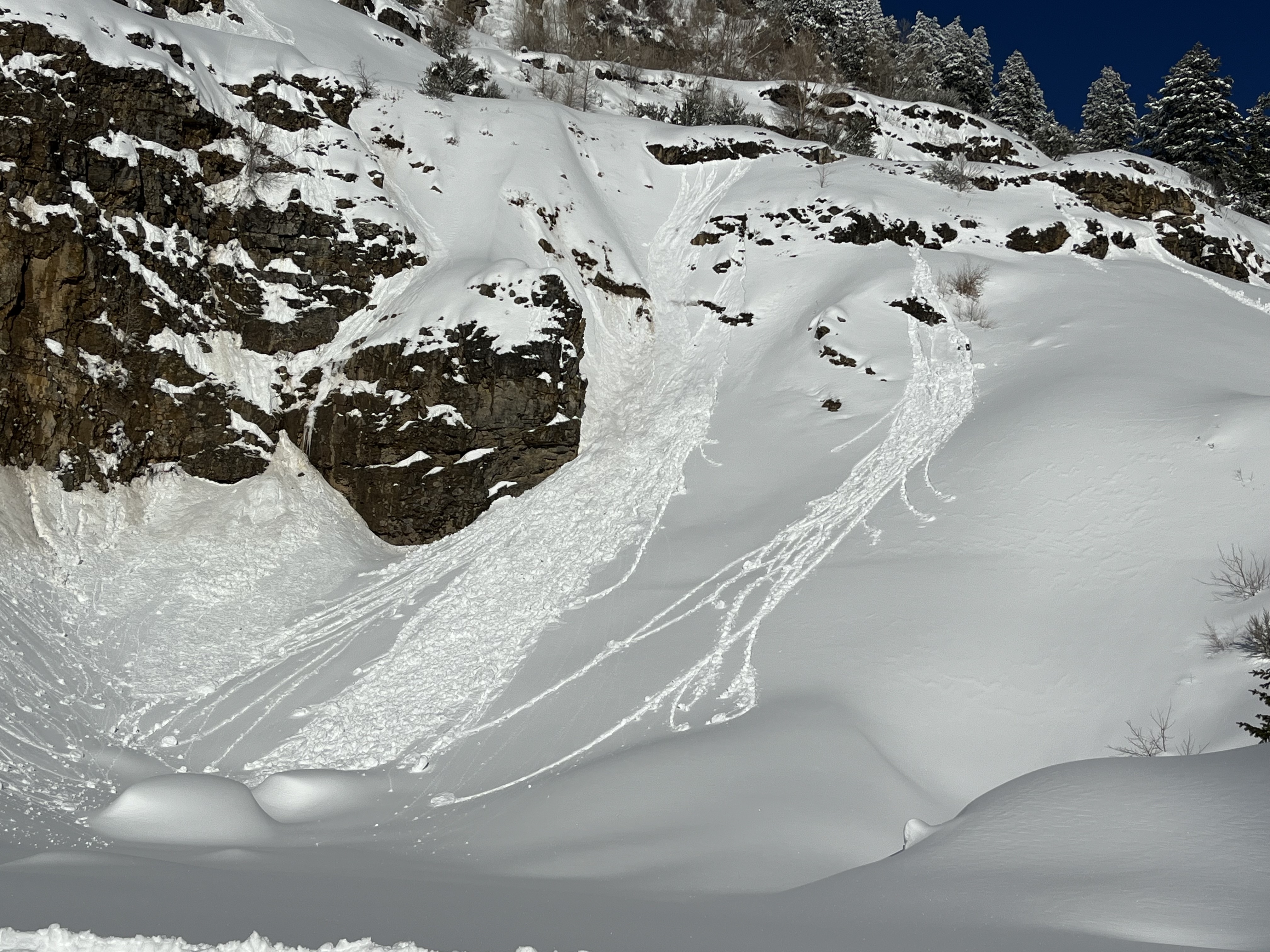
The avalanche danger is MODERATE today, and you could still trigger an avalanche failing on a persistent weak layer buried up to 3 feet deep, especially on previously drifted upper-elevation slopes facing northwest through southeast. Loose wet avalanches are possible during the day's heat on sunny and mid to low-elevation slopes, especially on those that picked up significant new snow accumulations Thursday.
Evaluate the snow and terrain carefully and continue to practice safe travel protocols.
Low
Moderate
Considerable
High
Extreme
Learn how to read the forecast here
Special Avalanche Bulletin
A series of storms in the last week has left a thick blanket of snow at all elevations, creating excellent powder riding conditions while also elevating the backcountry avalanche danger. Don't let the fresh snow and sunshine influence your decision-making - avalanche conditions remain dangerous, people need to make conservative choices, and careful snowpack and terrain analysis are required for backcountry travel. Fortunately, there are great powder riding conditions away from avalanche terrain in the meadows and on safer slopes less than 30° in steepness.
Special Announcements
Help the University of Utah understand risk behavior in the backcountry by participating in a 15-minute survey. The U will compensate up to $30 for your time! Please note: responses will not be confidential but will be handled ethically under IRB guidelines.
Weather and Snow
We finally got a good look around yesterday after a week of snowy and stormy weather. There is snow on the valley floor, and the mountains have snow on all aspects and elevations now. We received reports of excellent powder riding from across the range. While we did not see tons of avalanche activity, we are still approaching steep slopes with great caution. 7" of water in a week is a significant load, and it'll take time for the snowpack to adjust fully. Dave Garcia and I found a few weak layers in the recent storm snow yesterday in Providence Canyon but could not get anything to propagate. But that's how I am approaching steep slopes right now, digging on representative slopes and doing stability tests. There is spatial variability in the new snow depth, and it'll be easier to trigger an avalanche where the slab is thinner. The easy way out is to stick to slopes less than 30 degrees not connected to any steeper terrain, and you can ride to your heart's content without having to dig. There is plenty of fresh snow in the meadows, at lower elevations, and in safer low-angle terrain.

-The Tony Grove Snotel at 8400 feet reports 18° F, with 96 inches of total snow. (111% of normal) It's 14° F at the Card Canyon weather station at 8800 feet with 70 inches of total snow.
Winds are blowing 20-30 mph from the west-southwest at 9700 feet on Logan Peak, and it's 17° F. At 9500 feet on Paris Peak, it's 14° F, with winds blowing 24 to 27 mph from the west-southwest.

Mountain temperatures will be warm again today with an 8500' high of 30° F. We'll see partly sunny skies to start the day, but cloud cover will increase in the afternoon. Winds from the west-southwest will blow about 8-10 mph. Light snow is expected Sunday and into the first part of next week, with sunny skies and a warming trend expected beginning midweek.
We are concerned the nice weather may influence people to make poor terrain choices.

Thank you for reading our forecasts before heading out into the backcountry. We've had four avalanche fatalities this season and do not want anyone else to die in an avalanche.

For more information, visit the UAC weather page here: Weather - Utah Avalanche Center
For Logan-specific weather, go here: Logan Mountain Weather - Utah Avalanche Center
Recent Avalanches
An observer reported very active avalanche conditions in the Bloomington Canyon area, with several natural and intentionally triggered avalanches on Monday and Tuesday, including a large natural that occurred when the party was in the vicinity Tuesday morning. HERE
Yesterday, a cornice fall triggered a soft snow slab on Cornice Ridge. A rider may have stepped off their sled to get a better look but got too far out into the overhanging snow, and the cornice broke, dropping them onto the slope below.
There was also widespread wet activity on solar slopes.
Read about all avalanches and observations in the Logan Zone HERE.
Ad
Avalanche Problem #1
Persistent Weak Layer
Type
Location
Likelihood
Size
Description
Large and dangerous avalanches stepping down into older snow on one of several buried persistent weak layers are possible, especially in areas with shallower snow and poor snow structure. Sugary weak layers exist on slopes facing every direction, not just the northern half of the compass like we saw earlier in the season. One suspect layer is found right on top of a dirty melt-freeze crust from the warm spell at the beginning of February; others consist of crust-facet sandwiches. People could trigger dangerous cornice falls and avalanches of previously drifted snow on many upper and mid-elevation slopes, but the danger is most acute on upper-elevation slopes facing northwest through southeast.
  • Although most prevalent on the lee side of major ridges, stiff slabs of previously wind-drifted snow exist on all aspects in and around terrain features like sub-ridges, gullies, scoops, and cliff bands.
  • Audible collapses (whumpfs) and shooting cracks are sure signs of instability, but these may not be present when avalanches occur.
  • Avalanches failing on a buried persistent weak layer might be triggered remotely (from a distance) or from below steep slopes.
Avalanche Problem #2
Wet Snow
Type
Location
Likelihood
Size
Description
Wet avalanches are possible in sunny terrain and on lower-elevation slopes in the day's heat. People should stay out from under steep slopes as the fresh snow warms and gets sticky or saturated. Roller balls and pinwheels are signs of instability. The easy fix is to move to a cooler or shadier aspect or elevation. This problem may be shortlived today with increasing clouds in the afternoon.
Natural wet avalanches are possible in areas where people may not expect them, like where you might walk the dog, throw a fly, or build a snowman.
Additional Information
General Announcements
-National Forest Winter Recreation Travel Maps show where it's open to ride: UWCNF Logan, Ogden LRD Tony Grove, Franklin Basin CTNF Montpelier
-For all questions on forecasts, education, Know Before You Go, events, online purchases, or fundraising, call 801-365-5522.
-Remember the information you provide could save lives, especially if you see or trigger an avalanche. To report an avalanche or submit an observation from the backcountry, go HERE.
-Receive forecast region-specific text message alerts to receive messages about changing avalanche conditions, watches, and warnings. Sign up and update your preferences HERE.

This forecast is from the U.S.D.A. Forest Service, which is solely responsible for its content. This forecast describes general avalanche conditions, and local variations always occur.