UDOT PLANNED AVALANCHE CLOSURES!!

Forecast for the Provo Area Mountains

Drew Hardesty
Issued by Drew Hardesty on
Tuesday morning, January 7, 2025
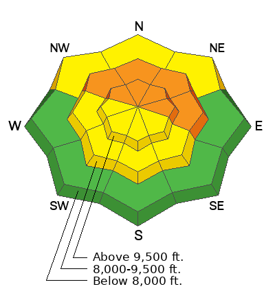
A CONSIDERABLE danger exists on and below steep northwest to east facing terrain at the mid and upper elevations. Here, you can trigger 1-3' thick slab avalanches, even from a distance.
Proper route finding is required. A MODERATE danger exists on all aspects of the mid and upper elevations for triggering a lingering wind or storm slab.
Low
Moderate
Considerable
High
Extreme
Learn how to read the forecast here
Weather and Snow
Skies are mostly cloudy but trending clear. Mountain temperatures are in teens to low 20s. Many anemometers are rimed, but the old lick-the-finger-and-hold-it-aloft trick hints at wind speeds of 10-15mph with gusts to 20mph out of the northeast. The highest ridgelines are likely double that. Amid all the riming, the mountains managed to squeeze a trace to two inches overnight Many observers felt like they were wandering around in the fog.
For today, we'll have partly cloudy skies, temps in the teens and increasing winds from the east northeast. I've often found the models to sandbag (underplay) the windspeeds from the east and northeast, so keep an eye on more blowing and drifting snow than expected.
Another quick hitting storm arrives Wednesday night that should be more wind than snow with another storm on the horizon over the weekend.
Recent Avalanches
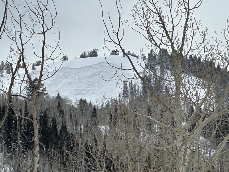
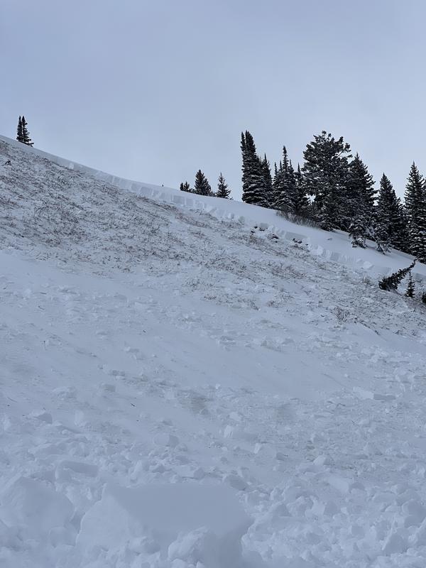
On the Wasatch back near the Ant Knolls and upper Snake Creek on Sunday, a snowmobiler triggered an avalanche on a steep northeast facing slope at 9300' and ripped to the ground. Photos below.
On Saturday, there was a report of an avalanche from just south of the Provo Region in the Mt. Nebo area. Some of the UAC staff were in the Tibble Fork area on Friday and experienced collapsing and cracking in their travels - immediate signs of avalanche conditions.
Ad
Avalanche Problem #1
Persistent Weak Layer
Type
Location
Likelihood
Size
Description
On northwest to east facing slopes at the mid and upper elevations, you'll find a 1-3' thick slab resting uneasily over a sugary persistent weak layer of faceted grains. This set up is dangerous and may be triggered while you are on or beneath the steep slope. These are the type of conditions that cause most of our avalanche accidents and steep terrain on these aspects are to be avoided. Remember that you can trigger these from below.
Additional Information
The accident reports for the Porter Fork and Davenport Hill Accident have been completed. You can read them HERE.
At the Utah Avalanche Center, we strive to learn from every avalanche incident and share insights to help others avoid similar accidents. We have all experienced close calls and understand how easily mistakes can happen. Our goal with these reports is to provide valuable learning opportunities.
General Announcements
This information does not apply to developed ski areas or highways where avalanche control is normally done. This forecast is from the U.S.D.A. Forest Service, which is solely responsible for its content. This forecast describes general avalanche conditions and local variations always occur.