Drew Hardesty
Forecaster
Week in Review: Avalanche Conditions and Snowpack Developments (December 27, 2024 - January 2nd, 2025)
Each week, we look back at the key snow, weather, and avalanche events from the previous week. For archived forecasts, click HERE
The danger roses for the Salt Lake mountains from Friday, December 27th, 2024 through Thursday, January 2nd, 2025:

Overall Summary: This week was one for the books. An Avalanche Watch issued on Thursday, December 26 was upgraded to an Avalanche Warning on Friday morning and lasted through Tuesday (New Year’s Eve). The powerhouse storms finally delivered the knockout punch to produce widespread avalanche activity on our early season PWL of weak, sugary facets. By the end of the week, over 60 large soft and hard slabs 2-4 feet deep and upwards of 1500 feet wide were triggered, commonly from a distance. Unfortunately, two solo backcountry splitboarders lost their lives in separate avalanches, one on Saturday in upper Main Porter Fork of Mill Creek Canyon, and another on Tuesday in the east bowl of Silver Fork below Davenport Hill.
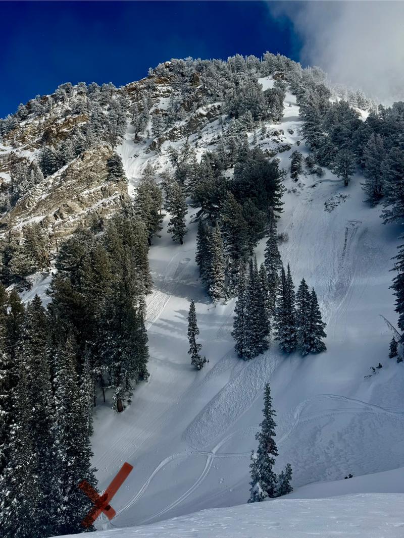
Main Porter Preliminary Accident Report (1st photo - SL County SAR) Original avalanche obscured by recent snow/wind. Avalanches in photo are from explosives to protect rescuers.
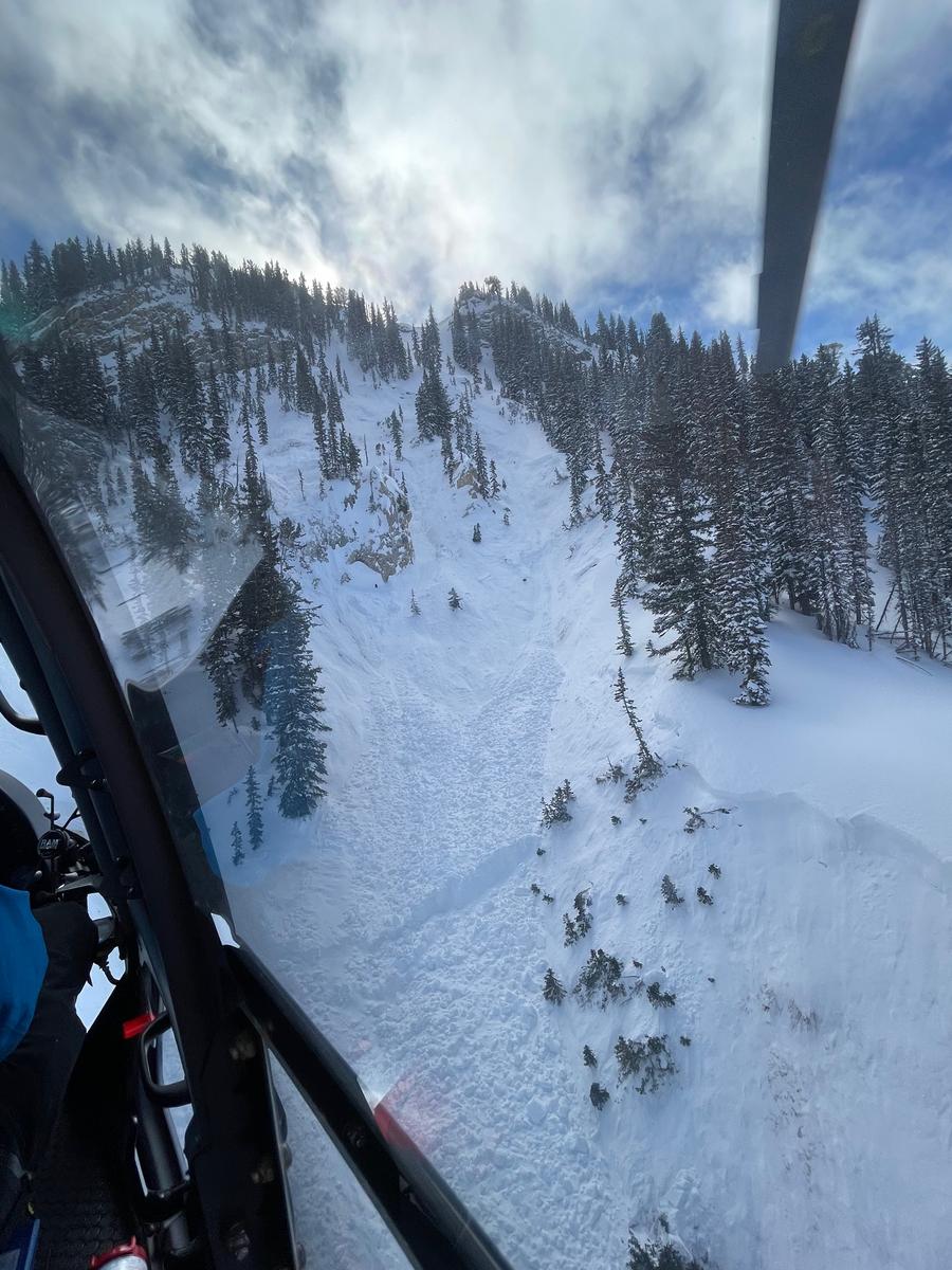
Davenport Hill Preliminary Accident Report (2nd photo - Wasatch Backcountry Rescue) The victim was buried 20 feet deep.


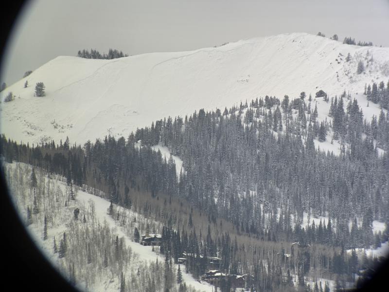
Friday, December 27th: Heavy snowfall and wind. Storm totals reach 10-20” and 1-2.25” SWE by Friday night into Saturday. The avalanche danger rises to HIGH with an Avalanche Warning issued. Pro observer Will Ambler sees that South Monitor had naturally avalanched sometime during the day 1-2 feet deep and 600 feet wide. Weston Deutschlander photo.

Saturday, December 28th: Heavy snowfall and wind continue through the day and into Sunday morning with snow and water reaching 30” of snow and 4.50” SWE. Avalanche danger remains HIGH in the upper-elevation and mid-elevation northerly terrain of the Central Wasatch Mountains, with an Avalanche Warning in effect. On this day, the wheels came off. 21 avalanches failing on the PWL were triggered in the backcountry. Perhaps the most impressive was a remotely triggered avalanche by an avalanche class near Twin Lakes Pass. This avalanche, triggered from the safety of the ridgeline, broke out 3 feet deep and 1500 feet wide, avalanching to the east of the pass. Meanwhile, a lone splitboarder touring with his black lab in Main Porter fails to return to his van in the parking lot. Another skier in the area finds the lonely and frightened dog and shepherds it back to the valley.
Sunday, December 29th: The avalanche danger remains HIGH with the Avalanche Warning firmly in place. Search operations begin for the missing skier. More and more and more avalanches run on this day, with the gold standard again set by an avalanche class that remotely triggers a 2-3’ deep and 1,000 feet wide avalanche in East Bowl of Silver Fork of BCC. Cracking and collapsing remain the rule. Many slides were up to 3 feet deep and over 1,000 feet wide. Ski area operations trigger dozens more.
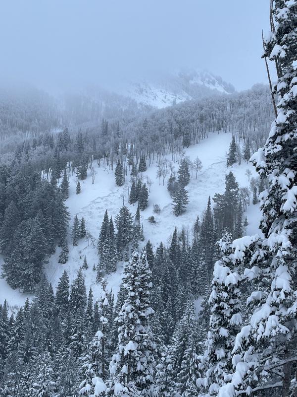
Monday, December 30th: HIGH danger and the Avalanche Warning continues. Search operations continue for the missing skier but it is a bit like searching for a needle in a haystack as there were no witnesses. The storm winds down with storm totals of upwards of 35-50 inches of snow (3.65”-6.0” SWE) for the Park City mountains and the Cottonwoods, respectively. Six more avalanches were reported to the avalanche center, with some releasing in seemingly benign terrain, i.e., Mill D North of BCC. This avalanche is remotely triggered by a party from 200’ away, ripping out a west-facing slope at 9000’. (Jakob photo below) By late afternoon, a skier who noticed an avalanche debris pile below Porter Pass on Sunday returns with a partner to find a beacon signal and uncovers the missing person, a 38-year-old male from Quebec. He skis down and reports his findings to the authorities.

Tuesday, December 31st: The danger remains HIGH, and the Avalanche Warning continues. The day dawns cold but clear. It's good flying weather and recovery operations resume for the avalanche victim in Main Porter. He is extracted via helicopter in the mid-afternoon. During the day, ten significant avalanches failing on the PWL are triggered in the backcountry on generally north through easterly facing aspects at roughly 9500’. One of these unfortunately involves a lone splitboarder who was caught, carried, and buried 20 feet deep in the east bowl of Silver Fork below Davenport Hill. WBR, SLC SAR, and others responded to recover the body of a 54-year-old man from Sandy, Utah. This is our second avalanche fatality of the week. The total number of reported avalanches on the PWL rises to 62. A heat map with the avalanches, starting with forecaster Greg Gagne observing a remotely triggered slide on Rocky Point on Tuesday, December 24th to Thursday morning, Jan 2nd.

Wednesday, January 1st: The overall avalanche danger is rated as CONSIDERABLE. Overcast skies and increasing southwest winds portended the arrival of a warm front, with light precipitation beginning in the early evening hours. Perhaps it was the bad news or the poor weather, but zero avalanches were reported on this day in the backcountry.
Thursday January 2nd: A rising rain/snow line, moderate to strong west to northwest winds, and upward of an inch of snow water equivalent with the warm front Wednesday night ramped the overall danger back to HIGH. Skies started to clear by the early afternoon.


Leave a comment