Nikki Champion
Forecaster
Week in Review: Avalanche Conditions and Snowpack Developments (December 20 - December 26, 2024)
Each week, we look back at the key snowfall, weather, and avalanche events from the previous week. For archived forecasts, visit the Salt Lake Mountains’ past updates.
The danger roses for the Salt Lake mountains from Friday, December 20th through Thursday, December 26th:

Overall Summary:
The week began with a MODERATE danger on mid and upper-elevation slopes, driven by the persistent weak layer. Avalanches in Days Fork, Scotts Peak, and other areas earlier in the week highlighted the instability, even as activity decreased under clear skies and mild conditions.
By Christmas, the MODERATE danger ramped back up on northwest through east-facing slopes, with small snowfall accumulations and diminishing winds. Recent slides near Catherine’s Pass and an accident involving one fully buried snowmobiler who was successfully recovered by his partner in Steep Hollow in the Logan zone emphasized the ongoing instability of the weak snowpack.
By the afternoon of December 26th, the danger rose to CONSIDERABLE on upper-elevation slopes, with heavy snowfall and strong winds forecast to deliver 15 to 30 inches of snow through the weekend. The primary concern moving forward is the weak, faceted snowpack structure that blankets many slopes. Any substantial load moving forward will create very dangerous conditions, and the potential for large, destructive avalanches will increase dramatically.
See Trent's current snowpack update.
December 20th: Avalanche danger was MODERATE on upper and mid-elevation slopes due to a persistent weak layer of faceted snow, especially on recently wind-loaded slopes. Earlier in the week, avalanches in Days Fork and Scotts Peak highlighted this ongoing risk, though decreasing activity was noted as the snowpack settled. Clear skies and warm temperatures persisted, with light winds and a weak storm expected late Sunday, followed by a stronger system around December 25th.
December 21st: Avalanche danger remained MODERATE on mid and upper-elevation slopes facing northwest through east and upper-elevation west-facing terrain. Explosive-triggered slides near Alta, both size two, emphasized the instability of buried weak layers.
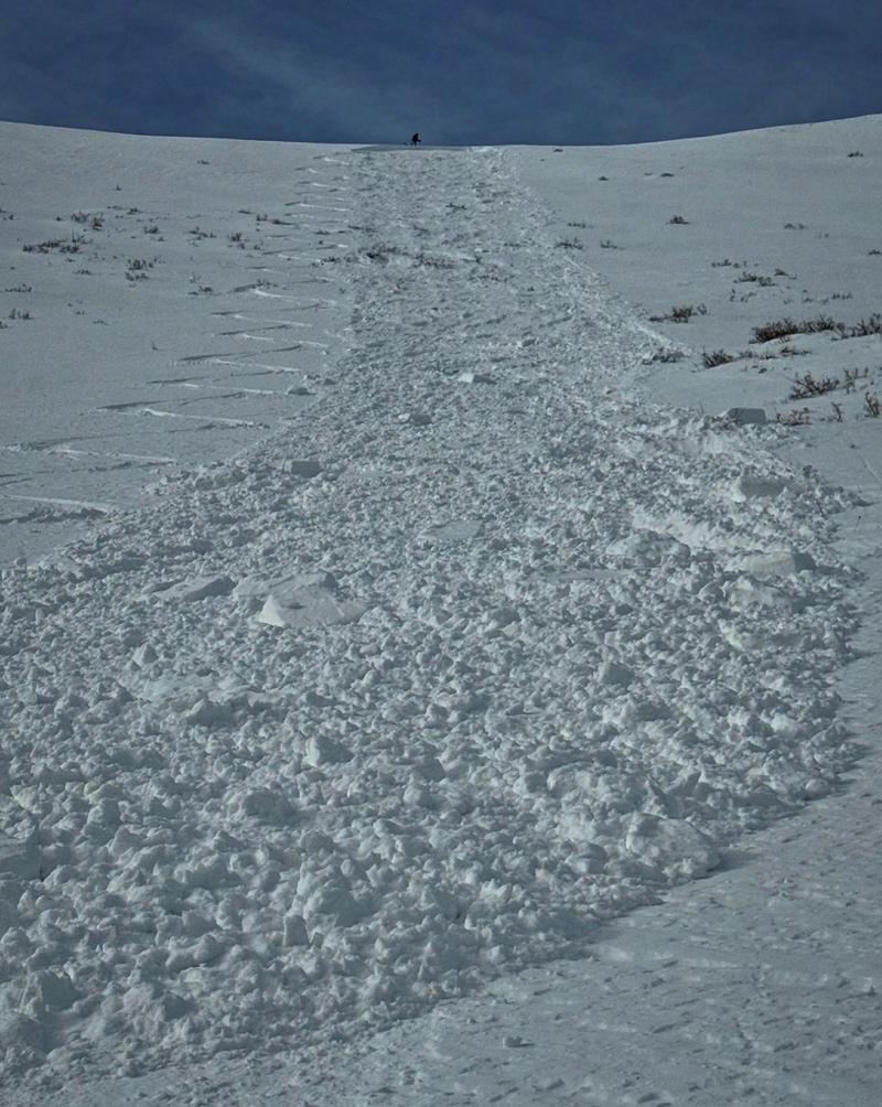
December 22nd: MODERATE avalanche danger persisted on mid and upper-elevation slopes facing northwest through east, as well as upper-elevation west-facing terrain. Two avalanches were reported on Saturday: one near South Monitor and another along the Park City Ridgeline during control work, both failing on weak-faceted snow. Light snowfall of 2–6 inches was forecast through Monday, with an active winter weather pattern anticipated starting on Christmas.
Photo from the South Monitor skier triggered avalanche - Mark White

December 23rd: Avalanche danger dropped slightly as the MODERATE was shrunk to the upper-elevation slopes facing west, north, and east. Gusty west-to-northwest winds reached up to 55 mph. A weak system brought light snow of 0.5 to 2 inches by evening, followed by high-pressure building overnight. No new avalanches were reported, though earlier slides from Saturday continued to highlight the persistent weak layer above 9,800 feet.
December 24th: The avalanche danger was primarily LOW by this point, with small pockets of MODERATE danger on upper-elevation northwest through east aspects, where triggering avalanches 1 to 3 feet deep on a weak layer remained possible. Southwest winds increased to 35 to 45 mph ahead of a storm delivering 4 to 8 inches of snow by Christmas Day. No avalanches were reported, with the last observed activity occurring on December 21st.
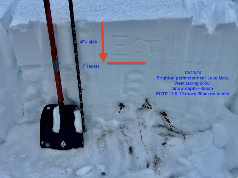
Photo of Drew Hardesty's snowpit below highlighting our current weak structure

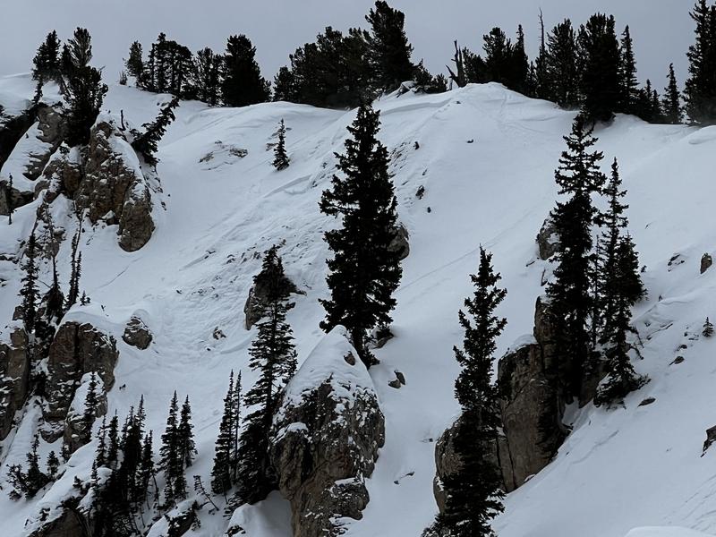
December 25th: The avalanche danger rose back to MODERATE on upper-elevation west through northeast slopes due to 2 to 3 inches of fresh snow and diminishing winds. Temperatures stayed in the low 20s°F, and more snow was forecast, with up to 2 feet expected by New Year’s. Recent activity included a skier-triggered slide near Catherine’s Pass and a snowmobile-triggered 500-foot-wide avalanche in the Logan area mountains, where a full burial occurred, but no major injuries were reported.
Photo of the skier-triggered avalanche near Catherine's Pass. Greg Gagne.

December 26th: An Avalanche Watch was issued for the mountains of northern and central Utah and southeastern Idaho. Avalanche danger increased to CONSIDERABLE on upper-elevation northwest through east-facing slopes as strong winds and heavy snowfall overloaded a weak snowpack. A winter storm warning predicted 15 to 30 inches of snow by Monday, creating dangerous conditions. While no new avalanches were reported on December 25, the combination of persistent weak layers and significant snowfall heightened the risk of triggering avalanches on steep slopes.


Leave a comment