
Drew Hardesty
Forecaster
Week in Review (December 13 - December 19, 2024)
Each Friday, we look back at the key snow, weather, and avalanche events from the previous week.
For archived forecasts, click HERE.
The danger roses for the Salt Lake mountains from Friday, December 13th through Thursday, December 19th:

Overall Summary:
After a long period of high and dry, storms raced across northern Utah over the weekend into the early part of the week. The Friday storm overproduced while the Sunday storm underproduced. Strong southwesterly winds, sandwiched between the two storms, unfortunately verified. All in all, however, many areas of the Salt Lake, Ogden and Provo mountains totaled about a foot of new snow and about an inch of snow water equivalent (SWE). The additional snow and wind were enough to overload our early season faceted grains in some terrain as skier-triggered wind slabs failing on the faceted grains started in earnest on Sunday. A CONSIDERABLE danger was forecast for the weekend and persisted through early week.
Friday December 13th: The danger rose to MODERATE with a forecast of a trace to 3" expected. This storm produced up to a foot fo new snow in upper LCC with 0.55" SWE. Ski areas found manageable ski cutting in the new snow with some smaller natural activity noted in terrain along the 11,000' level. One small pocket near the Sun Dial is triggered by hikers at 9500' on a north facing aspect, just 6" deep and 10' wide. A very small pocket, but it's clear that the persistent weak layer of faceted grains is showing its cards.
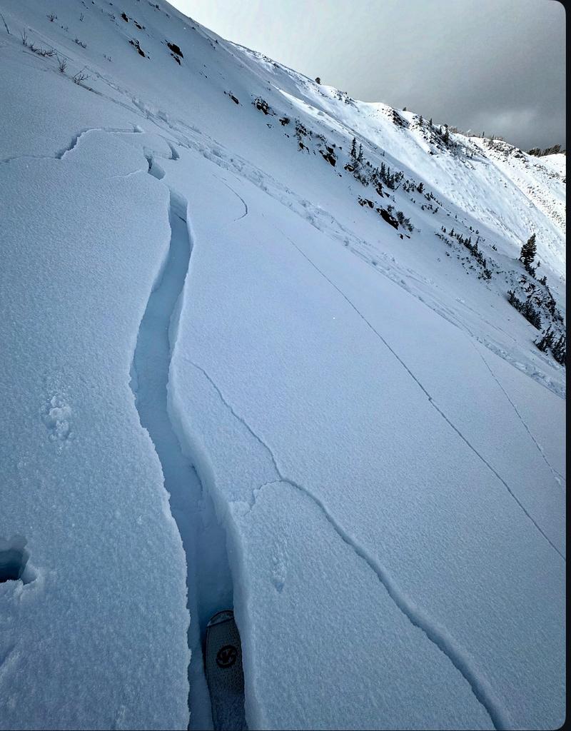

Saturday December 14th: A Special Avalanche Bulletin is issued to warn of a rising avalanche danger across northern Utah as the danger rises to CONSIDERABLE. Strong winds from the southwest precede the next forecast significant storm for the following day. Many west and southwest facing slopes are stripped and eroded with wind slabs forming in the lee, north-facing terrain. Some natural avalanches are noted in the alpine of upper LCC. Few people are out in the backcountry. Note Dave Kelly and Nat Grainger's outing on Gobbler's below.
Sunday December 15th: The storm is a bust with only 3-5" of new snow reported with 0.3--0.45" snow water equivalent. Northwest winds continued to blow in the moderate range post frontal and drifting is again observed. Cloud cover has turned partly cloudy and more people can get out and about to check on conditions. Natural avalanches failing 1-2 feet deep, running on the facets are noted in Banana Days (9700' Northeast facing, 2' deep and 70' wide), while human triggered avalanches are noted in the following areas: (as always, you can find these areas on the Wasatch Backcountry Skiing website, paper map, or app)
- Silver Fork Headwall - 9800' North facing, 12" deep and 40' wide, cornice drop triggered a shallow wind slab avalanche in the new snow
- Alexander Basin - 9400' East facing, 12" deep and 40' wide, cornice drop triggered a shallow soft slab that gouged into the old snow
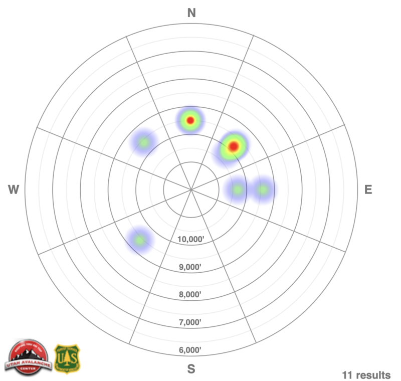
- Grizzly Gulch- 9400' "Southwest" facing, but presented as North facing (very sheltered behind trees in the gulch) 16" deep and 100' wide, skier intentionally triggered
- Cardiff Peak - 9800' North facing, 16" deep and 40' wide, snowboarder unintentionally triggered, nearly caught and carried
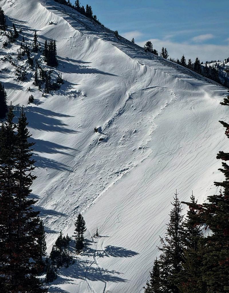
- West Monitor - 9500' North facing 15" deep 75' wide, remotely triggered from 200' away (Mark White photo below)

Monday December 16th: Skies are partly to mostly cloudy with no precipitation. We heard of only one avalanche from the backcountry: a sizeable remote trigger in Wolverine Cirque. From the reporting party: The initial avalanche was a small windslab, triggered remotely by our party from the ridge. The initial slab was 2.5' deep and no more than 10' wide. It failed at the ground, entraining all available snow in the couloir. It triggered a larger avalanche on the apron below and ran full track. Both avalanches appear to have failed on the same layer of weak faceted grains at the base of the snowpack, demonstrating a capability for large, full-depth avalanches to be triggered remotely from a distance, and/or by smaller avalanches which may be more sensitive to human trigger. Zack Little photo below:

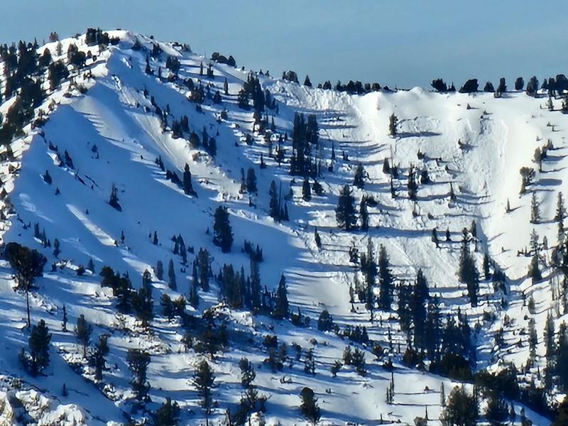
Tuesday December 17th: A couple inches of graupel smooths out old ruts and improves skiing and riding conditions. Ski areas report touchy conditions with a few remotely triggered slides in unopened and uncompacted terrain. In Days Fork, a touring party intentionally triggers a wind slab failing on old faceted snow in Main Days at 10,500'. By "stomping the top" of the starting zone from the subridge, the avalanche broke out 2' deep and 100' wide on the northeast aspect which then dominoed a number of sympathetic releases along the terrain to the north. The overall width was estimated at 800' wide. (photo from afar by Joey Manship - not part of the party).

Similarly, what also looked to be a close call with two tracks in and two tracks out was a skier triggered avalanche on a steep wind loaded portion of Scott Peak along the PC ridgeline. This also looks to have failed on our early season PWL. (Northeast facing at 9800')

Wednesday December 18th: Temperatures warm but the winds remain elevated along the ridgelines. Ski area teams continue to trigger pockets of hard wind slab with explosives. Observers report a "collapse-athon" while breaking trail in upper White Pine of LCC.
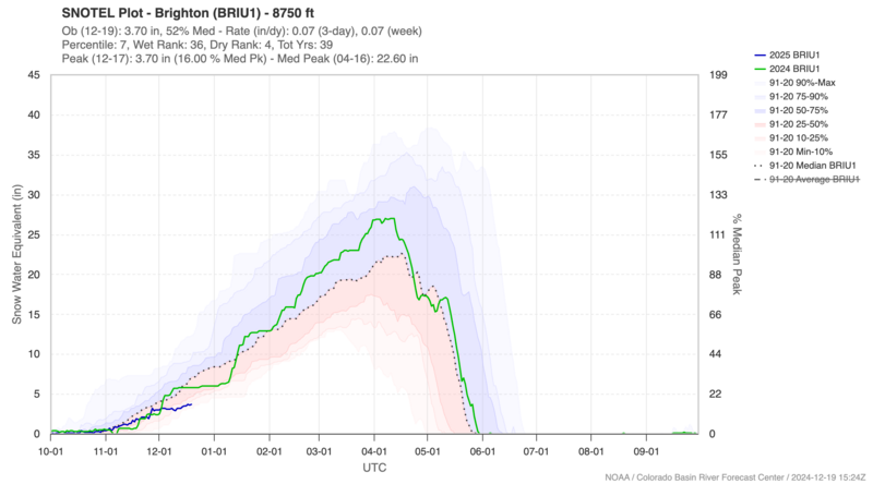
Thursday December 19th: A weak ridge of high pressure builds with mountain temperatures dramatically warming into the low to mid-40s. The Brighton snotel site (8750') tells the tale of the dry winter: 52% of 'normal'.

Heat Map of Avalanches for the Week failing on our PWL (note the southwest aspect ... an outlier in Grizzly Gulch that is heavily shaded and sheltered and presents as north facing...)


Leave a comment