Check out our Holiday Auction - Sign Up for the Utah Snow and Avalanche Workshop (USAW)

Forecast for the Skyline Area Mountains

Brett Kobernik
Issued by Brett Kobernik on
Wednesday morning, November 27, 2024
The overall avalanche danger is currently CONSIDERABLE.
15 to 24 inches of new medium density snow has fallen on top of older sugary weak snow creating an unstable situation.
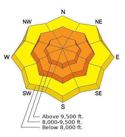
Human triggered avalanches are likely today if you are getting onto steep slopes above 8000 feet in elevation.
Low
Moderate
Considerable
High
Extreme
Learn how to read the forecast here
Weather and Snow
Current Conditions: The storm is coming to an end with some light snowfall still this morning. It left 15" of new snow at the top of Fairview Canyon, 24" in Ephraim Canyon, and 22" in 12 mile. The first half of the storm produced higher density snow but temperatures cooled into the teens overnight bringing low density powder. There was not a whole lot of wind wind this storm. Unfortunately there's not enough snow to really start charging on skis or snowmobiles. Total depths range from 2 to 3 feet. If we had a decent base, today would be an epic powder day. It can still be enjoyable but you'll need to poke around carefully.
Mountain Weather: Skies should slowly start to break today. Temperatures should creep up to around 20˚F. Moderate speed northwest wind should slow and shift a bit more northerly. A massive ridge of high pressure will build in over the area leaving us high and dry until mid December.
Ad
Avalanche Problem #1
Persistent Weak Layer
Type
Location
Likelihood
Size
Description
Here's the deal. There was about a foot of old snow that fell over the last month. As it sat around, it became weak and sugary. We just stacked up a thick layer on top of it. It's like trying to set a cement block on top of potato chips. The older weak snow is going to fail. On Tuesday, my snow stability tests were not alarming but definitely pointed to the unstable structure failing into the weak sugary snow. My thought is that you won't see any obvious signs of danger out there today like recent avalanches. Pay attention for any collapsing (whoomping) of the snow beneath you. Make no doubt, there is weak snow lurking below, and that alone is enough to make me avoid my favorite steeper terrain.
General Announcements
This forecast is from the U.S.D.A. Forest Service, which is solely responsible for its content. This forecast describes general avalanche conditions and local variations always occur.