Sign Up for the Utah Snow and Avalanche Workshop (USAW) on December 7th!

Forecast for the Ogden Area Mountains

Drew Hardesty
Issued by Drew Hardesty on
Monday morning, March 18, 2024
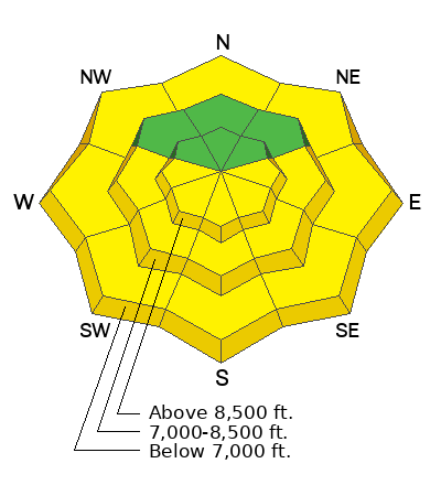
The avalanche danger will again rise to MODERATE for wet avalanches on all steep solar aspects and some lower elevation polar aspects. Don't overstay your welcome on (or below) terrain once the snow becomes wet, unsupportable, and unstable.
Cornice-fall and roof-alanches should be on your radar this week.
Low
Moderate
Considerable
High
Extreme
Learn how to read the forecast here
Special Announcements
Support the UAC website backend platform to ensure the ongoing security of the website and the data stored on the site rebuild by donating to our spring campaign. Save lives by making a donation today!
The Utah Avalanche Center is hosting The Banff Film Festival on Thursday, March 21, and Friday, March 22 in Moab.
Weather and Snow
If there's a silver lining to the east wind, it's that the east wind carries with it no dust layer or anything else blowing in from the west desert or the once Great Salt Lake. Look at the weather map below. The storm parked over Arizona is, yes, the same storm that arrived on our doorstep last Tuesday/Wednesday. This meddlesome cyclone has essentially been spinning its wheels over Arizona, kicking 2-4' of snow into parts of southern Colorado and the Grand Canyon state while we've been left holding the bag of strong east wind.
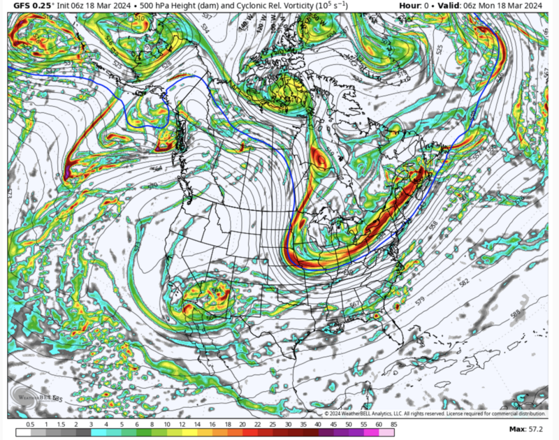
Currently, skies are mostly clear, temps are in the low 30s, and winds remain from the east, blowing 15-20mph. Along the highest ridgelines, winds are blowing 25-30mph with gusts to 40.
For today, the last day of winter, we'll see mostly sunny skies, diminishing winds, and temps again skyrocketing into the upper 30s to upper 40s. It'll be warm and sunny for most of the week. A weak brush-by storm passes to the north on Thursday. An active weather pattern returns late weekend. In the meantime, enjoy all the glory that the Wasatch has to offer.
Recent Avalanches
Yesterday, there were reports of wet loose snow avalanches on solar aspects in the afternoon hours.
Ad
Avalanche Problem #1
Wet Snow
Type
Location
Likelihood
Size
Description
Expect to see wet loose avalanche activity on solar aspects with daytime warming. This will be most evident in areas out of the wind zone and in steep rocky gully features. Roller balls, dripping water off of rocks, and your boots or skis sinking into the surface snow are signs it's time to move to higher elevation terrain. This wet snow problem is most pronounced on steep terrain facing east-south-west but not to be discounted in lower elevation north facing terrain.
The best way to avoid this problem is to be off of sunny slopes before they start to take too much heat.
Avalanche Problem #2
Wind Drifted Snow
Type
Location
Likelihood
Size
Description
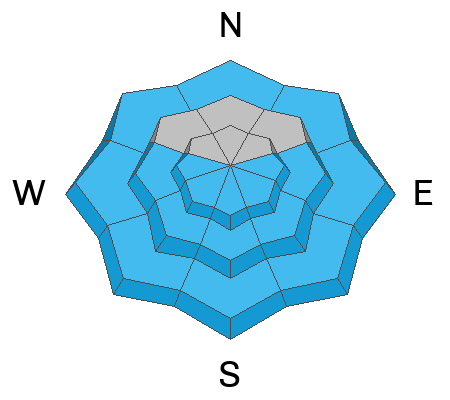
There will be isolated areas where you may find soft slabs of wind-drifted snow 1'-3' deep. These will be most pronounced on leeward-facing slopes; but sporadic winds have loaded many aspects and elevations and I wouldn't discount finding an area of wind-drifted snow in mid-elevation terrain.
Look for and avoid signs of wind-drifted snow such as texture and pillow-shaped features. Approach steep terrain features that have accumulated drifting snow cautiously.
Limit your exposure to ridgelines near cornices and slopes below them. A cornice fall could trigger a slab of wind-drifted snow below and there was a report of a cornice triggered avalanche in Silver Fork on Friday.
General Announcements
This information does not apply to developed ski areas or highways where avalanche control is normally done. This forecast is from the U.S.D.A. Forest Service, which is solely responsible for its content. This forecast describes general avalanche conditions and local variations always occur.