Observer Name
EL/Ben F/Matt B/Matt P
Observation Date
Saturday, February 10, 2024
Avalanche Date
Saturday, February 10, 2024
Region
Salt Lake » Big Cottonwood Canyon » Cardiff Fork » Cardiac Ridge
Location Name or Route
Cardiac Ridge
Elevation
10,800'
Aspect
East
Trigger
Skier
Trigger: additional info
Unintentionally Triggered
Avalanche Type
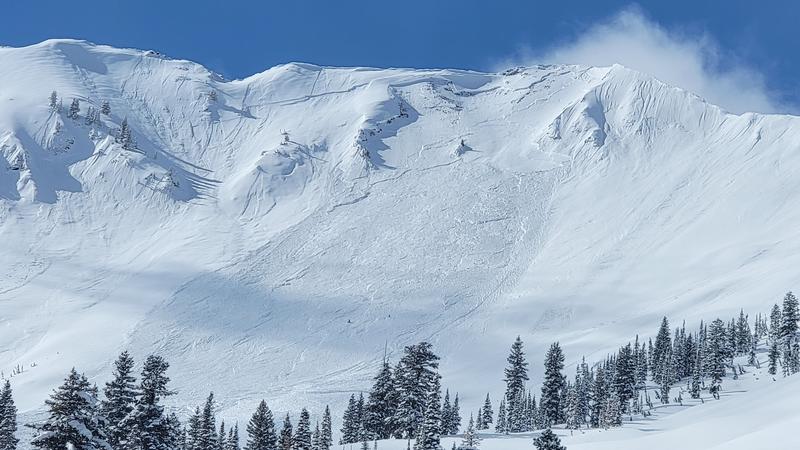
Hard Slab
Avalanche Problem
Persistent Weak Layer
Weak Layer
Facets
Depth
3.5'
Width
350'
Vertical
1,000'
Caught
1
Carried
1
Comments
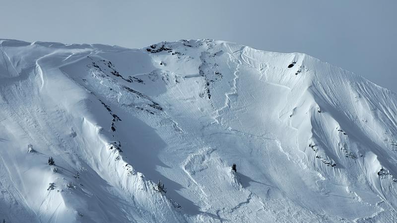
Forecaster Note: Multiple observations submitted. Combined into one observation. Some details edited for accuracy. An heli-operation skier triggered avalanche - caught and carried with airbag deployment, skier ended up on surface with 1 lost ski. No injuries.
EL:
EL:
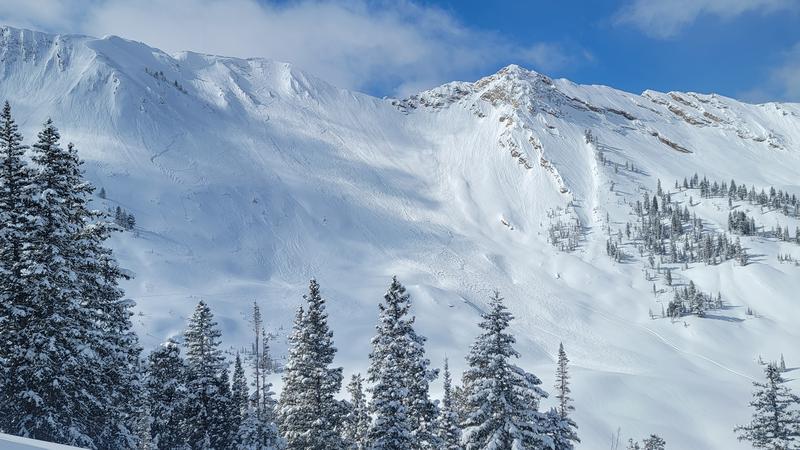
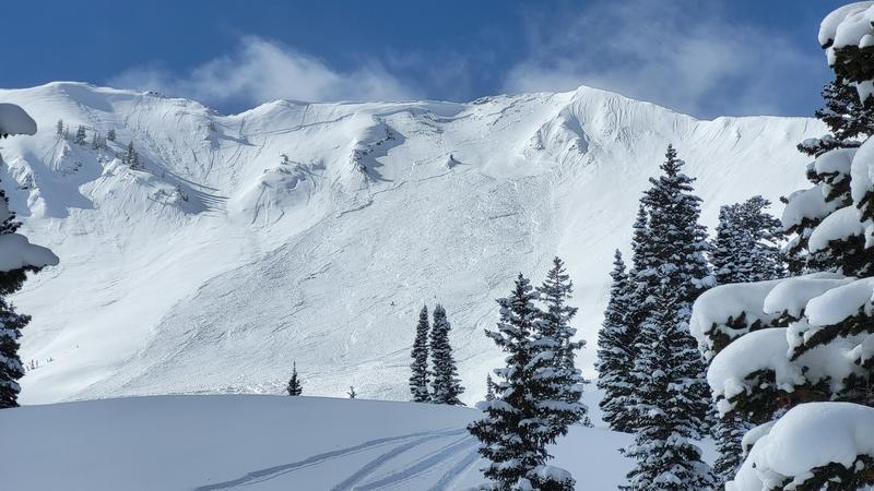
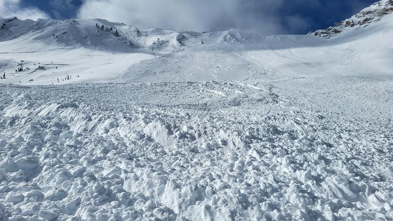
Noticed this slide off Cardiac Ridge while skinning up powerline around noon. It wasn't there when we skied down power outage around 830am. We saw what may have been tracks at the top right of the crown, and three tracks coming out from it down towards the bottom, but didn't see anyone. The slide ran all the way down to the flat terrain below (estimated around 9400'). Took our best guess at estimating the size.

Comments
Matt B:
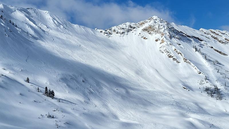
Went up Cardiff pass from Alta this morning, noticed natural activity on Cardiac Ridge on the way to Ivory area. While lapping Ivory, saw the toe of debris from what looked like a large slide below Cardiac Ridge. While skinning back up towards Powerline, passed over the debris pile, scanning for anyone that might have been caught. As the slide started at the ridge line, it was hard to tell if it was human caused or if anyone was involved. Did pick up signals but two passes of the debris pile across, up and down generated no signal distance reduction, telling me the pings were likely unrelated to the slide and my beacon's distance reading was maxed out. Partner and I determined they were likely from a party well below the debris pile and left.
Comments
Ben F:
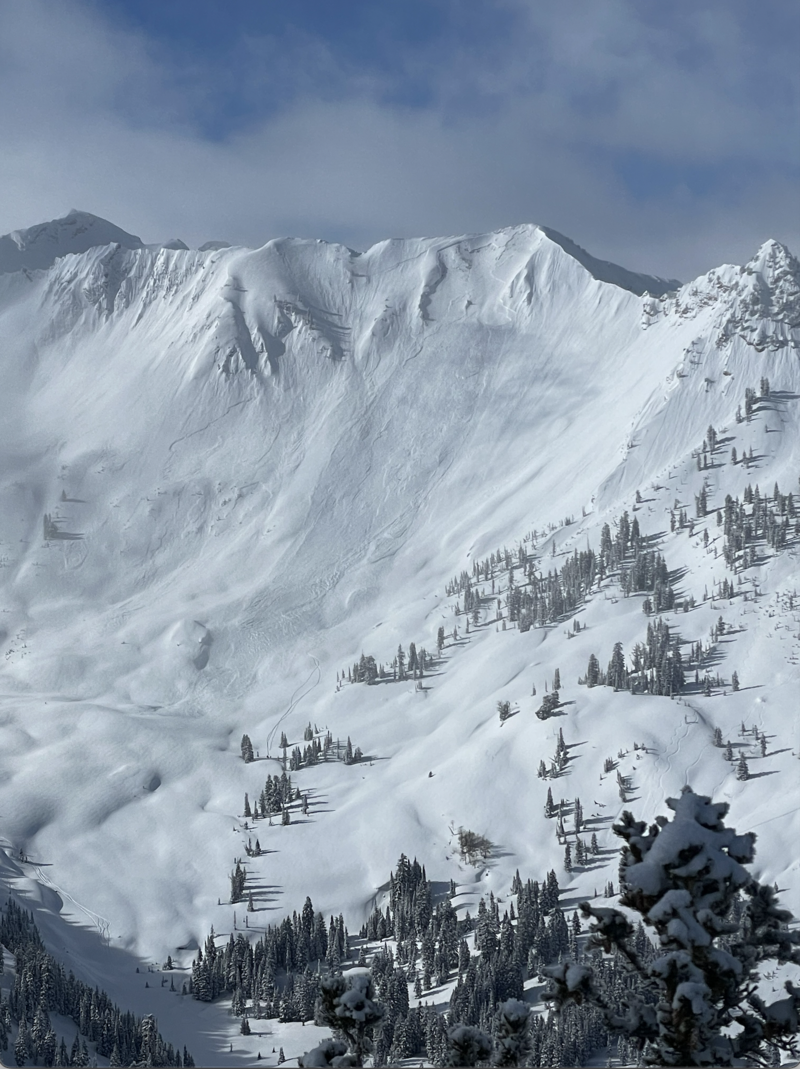
Photo taken at 10:43am from top of Chicken Shit ridge
Comments
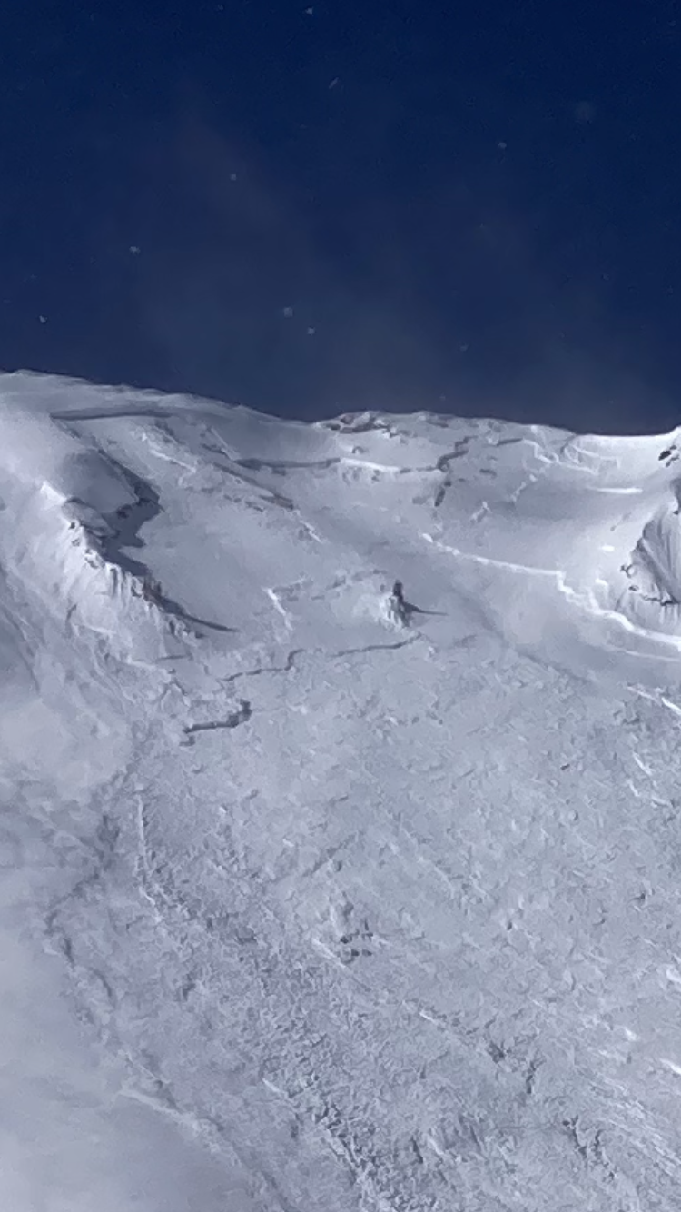
Matt P photo from LSB Zone
Coordinates


