Forecast for the Salt Lake Area Mountains

Drew Hardesty
Issued by Drew Hardesty on
Monday morning, December 2, 2019
The danger is CONSIDERABLE on many mid and upper elevation west to north to southeast facing slopes. While these monster avalanches may be slightly less sensitive, they are no less deadly. They may also be triggered from a distance or below. Aspect and slope angle are your trump card: choose terrain that either harbored no old snow or stick to low angle terrain with nothing steeper above.
The amplified winds have also pushed the danger for wind drifts on many lee slopes and should be avoided in steep terrain today.
Low
Moderate
Considerable
High
Extreme
Learn how to read the forecast here
Special Announcements
The First Annual Statewide Avalanche Awareness Week is December 2-7 and kickoff is tonight at TF Brewing near downtown SLC. Check out the schedule here.
Drew Hardesty released the first UAC podcast of the season " Early Season Essentials with Program Director Bo Torrey" check it out HERE.

The Supreme area of Alta ski area is now closed to the public as the ski patrol gets this terrain ready for the season.
Weather and Snow
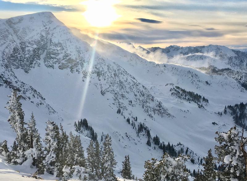
We'll remember this storm.
Prior to the onslaught, we were on track to be the driest November on record (since 1945) at the Alta Guard station. Good friend and Keeper of the Ancient Scrolls Mark Saurer's snow numbers for November are 58” (4.53” SWE/Snow Water Equivalent) and year to date is 88” (SWE-7.32”). 1976 had the driest November of 13.6". (More Info)
Total snow since Monday the 25th is as follows:
Wasatch Mountains: 50-70" snow (3.5 - 4.34" h20)
Park City Ridgline: 30-40" snow (2.5 - 3.0" h20)
Ogden Mountains: 40-50" snow (4.0 - 4.8" h20)
Provo Mountains: 24-33" snow (1.6 - 2.1" h20)

Skies are mostly cloudy ahead of a relatively messy weather week - no bluebird, no blockbuster, oh well.
Temperatures have climbed out of the icebox and are now in the mid to upper 20s.
Southerly winds played the spoiler yesterday afternoon and into the overnight hours, blowing 25-30mph with hourly averages in the 40s and 50s along the highest elevations. (pc:Grainger) Direct sun, too, had its way with the southerly aspects and will be crusted this morning. Still, excellent riding conditions today will still be found in the mid-elevation sun and wind sheltered slopes.

For today, expect mostly cloudy to overcast skies. A trace to an inch is possible. Mountain temps will be in the upper 20s; winds moderate from the southwest. A couple inches of snow possible mid-week and again over the weekend.
Recent Avalanches
Ski area control teams in the Cottonwoods and along the PC ridgeline continue to trigger large and dangerous avalanches in mid and upper elevation shady slopes.
In the backcountry, however, yesterday was the first day of no reported avalanches since Wednesday (and that list is too long to mention. You can sift through them HERE.) These avalanches have best been described as "eye-opening" and "terrifying".
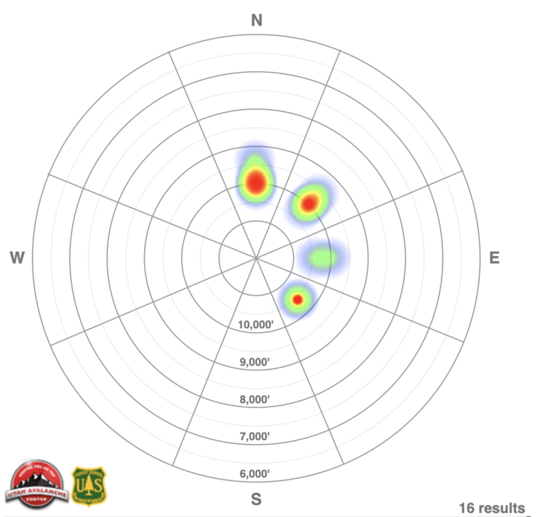
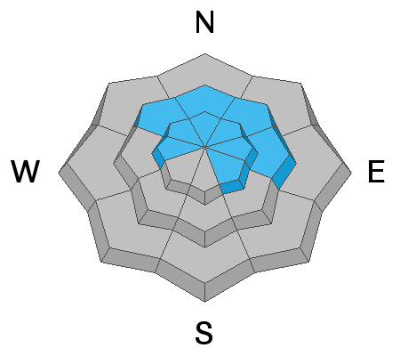
The avalanche heat map below conveys the reported avalanche activity on an aspect/elevation rose that somewhat mirrors our danger rose of the past week. You'll see that most of the activity involved upper elevation north through east facing slopes...terrain that held old, weak faceted snow from October and November. CAUTION! - one should not consider 'blank' areas to necessarily be safe...and there is always a bias in reporting.
Ad
Avalanche Problem #1
Persistent Weak Layer
Type
Location
Likelihood
Size
Description
Steep shady slopes are OFF.
Booming collapses and snow tests yesterday provide evidence of what we already know - dangerous avalanche conditions continue to persist on many mid and upper elevation west to north to southeast facing slopes. The use of the word persist is not without intention. Patience is required while waiting for the snowpack to adjust. It may be awhile.
Now that the sunny aspects are sun damaged, the only reasonable choice is to choose low angle sun-sheltered terrain that is not beneath anything steep. This last point is key: in shady terrain, know that our body weight is able to collapse the snow structure and allow us to trigger avalanches from the flats below the steeps.
Avalanche Problem #2
Wind Drifted Snow
Type
Location
Likelihood
Size
Description
Both sensitive and stubborn wind drifts may be found in the mid and upper elevations. They'll be predominantly found on steep west to north to east facing slopes, but intense wind speeds coupled with terrain channeling often conspire to drift snow in unusual areas. Rounded and scalloped snow should be avoided. Cornices, too, are growing and ridgelines should be approached with caution.
Additional Information
The Avalanche has expired and the danger is no longer HIGH. But it may be more dangerous.
Most of our avalanche accidents and fatalities occur during CONSIDERABLE danger.
Why? Often, it's because the signs of instability are not as evident as they were only a day or two before. Or we see someone else get away with a line where the line between lucky unlucky is grey. Or that the lure of the powder is too much. Now is a time for reckoning.
General Announcements
This information does not apply to developed ski areas or highways where avalanche control is normally done. This forecast is from the U.S.D.A. Forest Service, which is solely responsible for its content. This forecast describes general avalanche conditions and local variations always occur.
Remember your information can save lives. If you see anything we should know about, please help us out by submitting snow and avalanche conditions. You can also call us at 801-524-5304, email by clicking HERE, or include #utavy in your tweet or Instagram.
To get help in an emergency (to request a rescue) in the Wasatch, call 911. Be prepared to give your GPS coordinates or the run name. Dispatchers have a copy of the Wasatch Backcountry Ski map.
Backcountry Emergencies. It outlines your step-by-step method in the event of a winter backcountry incident.
If you trigger an avalanche in the backcountry, but no one is hurt and you do not need assistance, please notify the nearest ski area dispatch to avoid a needless response by rescue teams. Thanks.
  • Salt Lake and Park City – Alta Central (801-742-2033), Canyons Resort/PCMR Dispatch (435-615-1911)
  • Ogden - Snowbasin Resort Dispatch (801-620-1017), Powder Mountain Dispatch (801-745-3772 x 123)
  • Provo - Sundance Dispatch (801-223-4150)