The dominant weather pattern will be a high pressure system for the foreseeable future, with this will come scattered thin clouds and mild temperatures. The weekend weather system looks mild and fairly weak, with no real threat of precipitation.
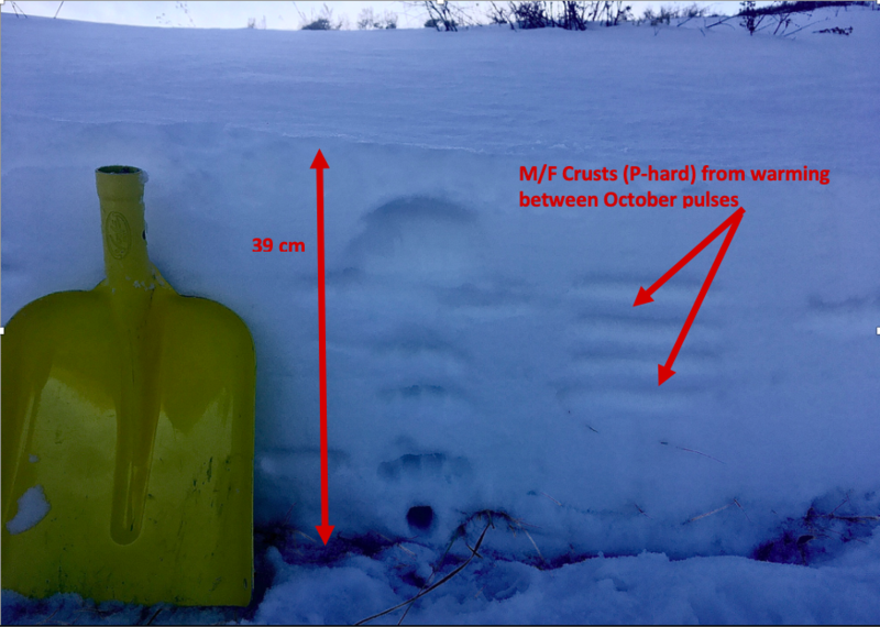
Our snowpack is dwindling. Sunny slopes are losing snow and becoming bare while upper elevation shady slopes are retaining snow. There is to 1-2 feet in protected areas of the upper Cottonwoods, and 6-12 inches on the Park City ridgeline. Old snow distribution is going to be very important moving into the next storm system, so be conscious of where coverage is as it forming a weak layer at the ground. Take photos, and submit observations.
Strong Sunday into Monday winds could have led to wind drifted snow sitting on unconsolidated snow. Look for and avoid this wind drifted snow on steep slopes.
PC:Grainger - Murdock Peak - Look at full observation
HERE.
Here are a few things to remember:
- Hitting rocks and stumps is a real danger. Don't end your season before it starts with an injury from hitting one of these obstacles.
- Avalanches are a real possibility. It doesn't matter if you are hiking, hunting, skiing, etc., be prepared with rescue gear and a partner.
- The Tony Grove Road is not maintained for wheeled vehicles in the winter, and it is snowpacked, narrow, and icy in places.
- Hikers, cross country skiers, snow bikers, dogs, sleds, and 4x4s share the road this time of year, so be nice and keep your speed down around others...