AVALANCHE WARNING!! Tap for info

Forecast for the Uintas Area Mountains

Andrew Nassetta
Issued by Andrew Nassetta on
Sunday morning, February 16, 2025
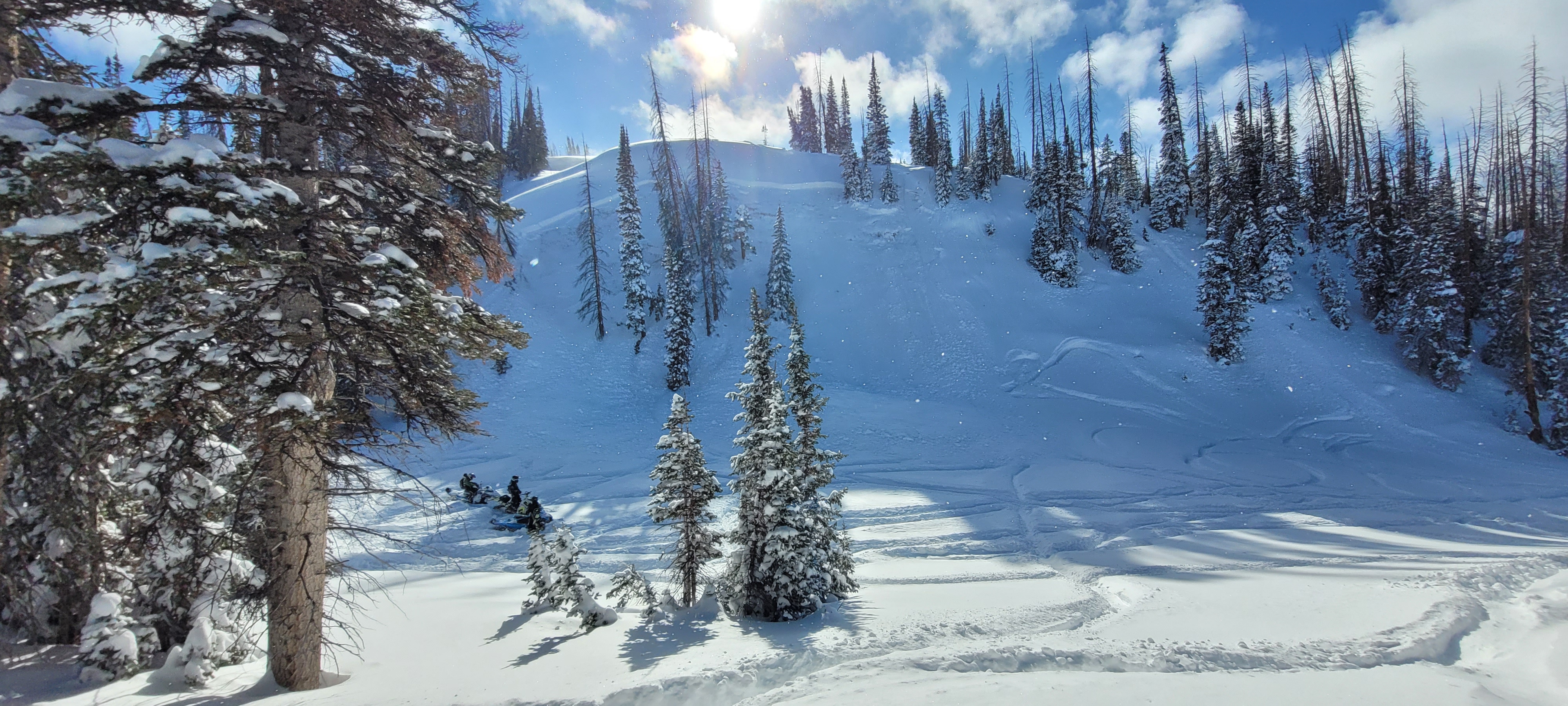
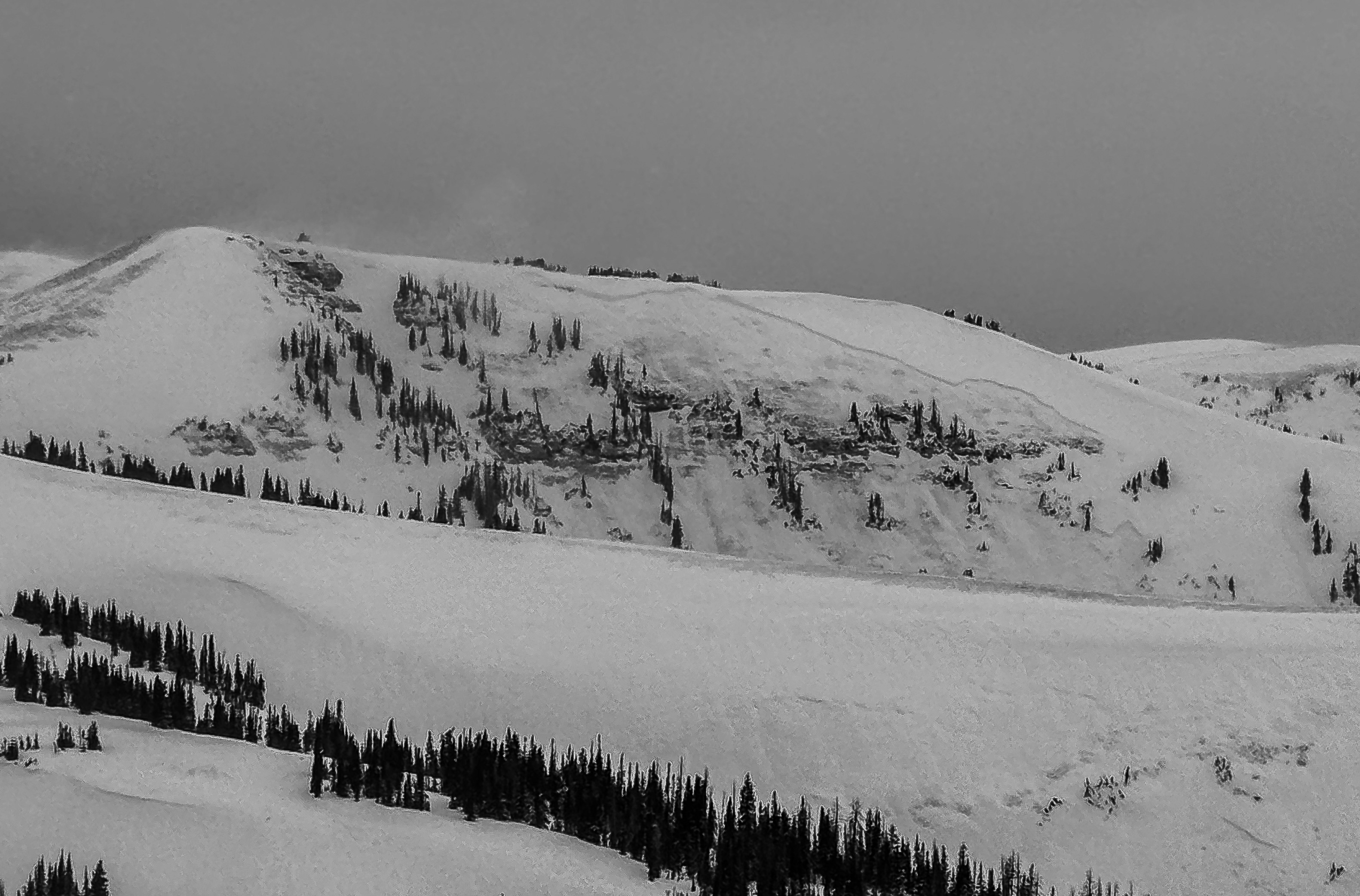
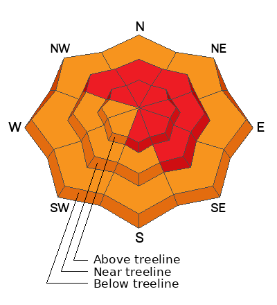
The avalanche danger is rated HIGH today, and human-triggered avalanche are VERY LIKELY. Avalanches failing 2-6' deep and breaking up to a 1,000' wide are occuring naturally and triggered remotely by skiers and riders from a distance. Remember, it is not just the big, bad, in your face avalanche terrain today. Leaving the trailheads, pay attention to benign steep slopes that we like to ride like road cuts, creek beds, and gully walls -- These are places where new snow has stacked up and a small slide could catch us off guard burying us deeply in a nasty, consequential place.
Today is no joke. I am avoiding all slopes approaching and greater than 30° with no steep slopes above me. I'm meadow skipping, breaking out the skate skis, or wiggling away in greener pastures that have no avalanche hazard.
Low
Moderate
Considerable
High
Extreme
Learn how to read the forecast here
Avalanche Warning
What- The avalanche danger for the warning area is HIGH today and may rise to EXTREME in some areas this weekend.
When- In effect from 6:00 AM MST this morning to 6:00 AM MST Monday
Where- For all the mountains of Utah and Southeast Idaho, including the Wasatch Range, Bear River Range, Uinta Mountains, Wasatch Plateau, Manti Skyline, the La Sal Mountains, the Tushar Range....
Impacts- Recent heavy snow and drifting by strong winds have created widespread areas of unstable snow and very dangerous avalanche conditions at all elevations. Natural and human-triggered avalanches are likely. People should avoid travel in all avalanche terrain and keep out of avalanche runouts. This means you should stay off of and out from under slopes steeper than 30 degrees.
Weather and Snow
Nowcast
We have finally reached a break in the action as additional snowfall stacked in places throughout the day yesterday. Rough, total numbers for the storm are Mirror Lake Corridor at 30" and 2.9" SWE, Currant Creek 25"/2.5" SWE, and the North Slope closer to 23"/2.2" SWE. Temperatures are hovering in the teens from trailheads to high peaks. Winds are steady from the west at 20-30 MPH, with gusts nearing 40.
Forecast
A quick lull this morning is short-lived as light snow showers and increasing winds usher in another wave of snow that should hit this afternoon into the evening. Expect temperatures to stay steady in the teens, and winds to continue to increase throughout the day around 20-30 MPH with stronger gusts on the high peaks and ridges.
Futurecast
Expect stormy conditions for the next couple days, with the heaviest precipitation early tomorrow morning into the start of the business day. Things settle out for a few days and return to active later in the week, with crosshairs on Thursday.
Recent Avalanches
Our PWL is the main focus, and a crew near Currant Creek sent in the perfect example of a more benign slope that could sneak up on you. While setting up shop for a jump site this crew triggered was warned by local wisdom of the hazard, triggerend remotely, and quickly re-evalutated their plans. Get up to speed by checking out obs, avalanches and trip reports from across the range and beyond, here!
A northeast slope at 9,800' near Currant Creek where the crew intended on having their landing zone.
Ad
Avalanche Problem #1
Persistent Weak Layer
Type
Location
Likelihood
Size
Description
Since Thursday, 2-3' of snow and 2"+ of SWE has piled on our snowpack reactivating layers buried mid-pack and near the ground on northwest through southeast slopes. Over the past few days riders remotely triggered slides from above, below and observed large natural avalanches like the one below. Failing 2-6' deep and breaking wide, these are unsurvivable avalanches and the conditions are ripe for triggering one of these monsters. There is no threading the needle today, and it is crucial to avoid any avalanche terrain where this problem lives.
A large destructive avalanche at 10,400' on a northeast slope that occured naturally, and gouged to the ground near Chalk Creek.
Avalanche Problem #2
Wind Drifted Snow
Type
Location
Likelihood
Size
Description
The wind's are helping to drive the hazard elsewhere, and wind-drifted snow will be found at all mid and upper-elevations across the range. There is so much snow available for transport and steady winds from the west and northwest that I would expect sensitive soft slabs in most places up high. Keep your eyes peeled for fat rounded pillows, cornices, and places where the snow looks affected and textured. Today's drifts will break 1-3' deep and are far from manageable. Remember, any avalanche triggered today could step-down or fail into weak, faceted snow buried deeper in the pack.
General Announcements
We are always looking for snow and avalanche observations or just general riding conditions. In the meantime reach out to us with questions, concerns, or if you see anything in your travels! Contact us directly through the info below:
This forecast is from the U.S.D.A. Forest Service, which is solely responsible for its content. This forecast describes general avalanche conditions and local variations always occur. This forecast was issued on Sunday, February 16th at 05:00 AM and expires 24 hours after it was issued.