Forecast for the Skyline Area Mountains

Brett Kobernik
Issued by Brett Kobernik on
Thursday morning, March 30, 2023
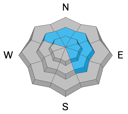
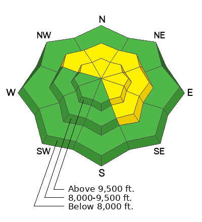
The overall danger rating on the Skyline is MODERATE.
There may be areas where the new snow is unstable, especially where the wind has drifted the new snow.
The most likely places to find trouble will be in the higher elevation northwest through southeast facing steep slopes with recent deposits of wind drifted snow.
Avoid the windy terrain and you'll avoid avalanche danger.
Low
Moderate
Considerable
High
Extreme
Learn how to read the forecast here
Weather and Snow
Current Conditions: The first part of the storm moved in overnight and left 4 inches of new snow in most upper elevation locations. Temperatures got into the mid 30s on Wednesday and dropped down to around 20˚F overnight. Southerly wind is a bit breezy along the higher terrain. It's in the moderate speed range in other areas.

Mountain Weather: The storm system will continue to move through today and into Friday. We'll have periods of snow later today and tonight which should bring another 4 to 8 inches. The wind from the southwest will slow down for a while this morning then switch more west northwest and increase in speed this afternoon. It looks like the wind could get pretty strong tonight and through Friday. High temperatures will get into the mid 20s today. We'll have a break in the weather for the weekend then another storm system shaping up for early in the week.
Ad
Avalanche Problem #1
New Snow
Type
Location
Likelihood
Size
Description
You'll want to pay attention to the new snow today to see if it's at all sensitive. Watch for cracking within the new snow. Make slope cuts on small steep test slopes to try and initiate any cracking. This will help you determine if the new snow is stable. I suspect the new snow itself should be stable. The places you could find trouble will be where the wind has drifted it. These are the usual places in the upper elevations right along and below the ridelines on very steep northwest through southeast facing slopes.
General Announcements
This forecast is from the U.S.D.A. Forest Service, which is solely responsible for its content. This forecast describes general avalanche conditions and local variations always occur.