Check out our Holiday Auction - Sign Up for the Utah Snow and Avalanche Workshop (USAW)

Forecast for the Skyline Area Mountains

Brett Kobernik
Issued by Brett Kobernik on
Saturday morning, March 2, 2024
The avalanche danger rating for the Skyline is MODERATE today but the danger will be increasing as a windy storm moves through later today and Sunday.
There are scattered areas where a person could trigger a recently formed wind drift or wind slab. Triggering one of these today is possible but not all that likely.
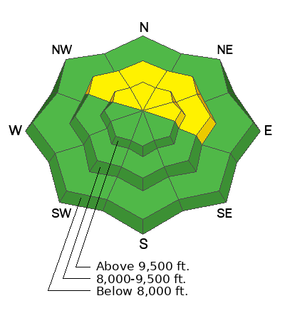
The most likely spot to find trouble is on very steep upper elevation terrain that faces northwest through east, especially just below ridgelines.
With clouds and strong wind during the day today it is unlikely that people will be traveling in these areas that are the most dangerous.
Low
Moderate
Considerable
High
Extreme
Learn how to read the forecast here
Weather and Snow
Current Conditions: The wind has been increasing from the southwest and is moderate to strong in speed now. Temperatures made it up to around 40˚F on Friday and are just below freezing this morning. The snow surface became damp at almost all locations except for the higher more north facing terrain.
Mountain Weather: It's going to be windy today. The flow is from the southwest. Temperatures won't warm all that much today. We should see snowfall start this afternoon and continue into tonight. Another round of snow will move through starting Sunday morning. I'm anticipating about a foot of snow by the end of the storm late Sunday although it's possible we could see more.
Recent Avalanches
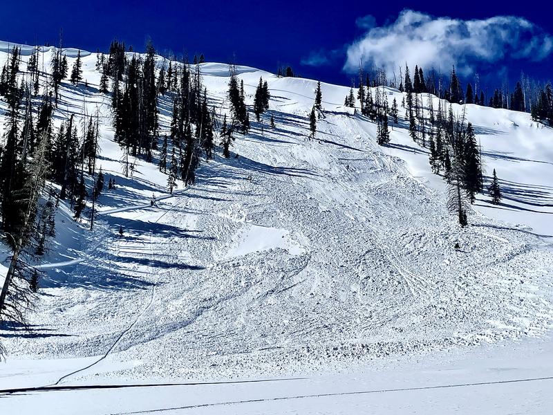
This is old news now but I stumbled across this fairly large natural avalanche that released during the strong wind earlier this week. What is notable about this slide is that as it slid, it "stepped down" and broke into layers of snow from mid February. With strong wind and more snow anticipated, we could see activity like this on Sunday. MORE DETAILS HERE
Ad
Avalanche Problem #1
Wind Drifted Snow
Type
Location
Likelihood
Size
Description
With all the recent wind and warm temperatures there isn't much loose snow available for the wind to transport and form drifts today. That said, it seems like when the wind gets strong, it always finds some snow to blow around. Look for and avoid any fresh drifts that are forming on steep slopes today. There may be enough new snow blowing around later in the day to make things dangerous.
General Announcements
This forecast is from the U.S.D.A. Forest Service, which is solely responsible for its content. This forecast describes general avalanche conditions and local variations always occur.