Check out our Holiday Auction - Sign Up for the Utah Snow and Avalanche Workshop (USAW)

Forecast for the Skyline Area Mountains

Brett Kobernik
Issued by Brett Kobernik on
Thursday morning, February 29, 2024
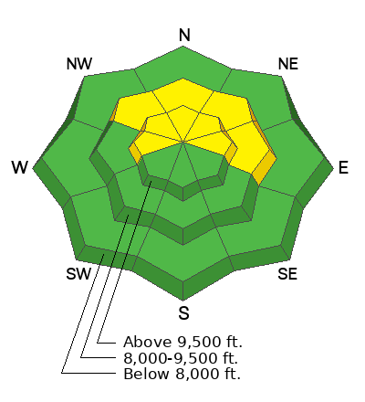
The avalanche danger rating for the Skyline is MODERATE today.
Fresh drifts and slabs of snow that formed during the very windy storm seem welded in place now but there's a chance a person could still trigger one today.
Continue to avoid being on or below cornices.
Low
Moderate
Considerable
High
Extreme
Learn how to read the forecast here
Weather and Snow
Current Conditions: The wind damaged the riding conditions in many areas but on Wednesday I actually found more areas with good riding than I was expecting. The wind was light and temperatures got up to around 30˚F. Overnight temperatures were in the mid 20s and the wind is still light.
Mountain Weather: We'll have sun and high temperatures into the mid 30s with light wind gradually increasing a bit as the day goes on. Friday looks similar with some clouds moving in though. There will be more clouds on Saturday. A fairly decent storm system will move through Saturday night into Sunday which looks like it could bring 6 to 10 inches of new snow.
Recent Avalanches
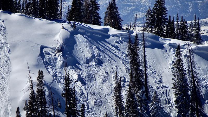
I was able to confirm that there was some natural avalanche activity during the storm on Tuesday. The avalanches I saw were mainly on northeast facing very steep slopes. Wind loading was the obvious cause. They were around a foot deep.
Ad
Avalanche Problem #1
Wind Drifted Snow
Type
Location
Likelihood
Size
Description
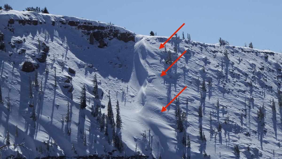
I found all of the fresh drifts and slabs to be quite stubborn on Tuesday. I was not able to get any to crack out while I was hitting test slopes with my machine. I didn't get into the most radical terrain but things seem mostly stable now. I would still avoid the steepest slopes where there are recently formed drifts. The most dangerous areas are upper elevation north through east facing steep slopes. Avoid drifts on all aspects though. The photo below is of a crossloaded terrain feature on a northwest facing slope. This is the type of stuff to look out for today.
General Announcements
This forecast is from the U.S.D.A. Forest Service, which is solely responsible for its content. This forecast describes general avalanche conditions and local variations always occur.