Current Conditions: Warm weather has continued over the last 24 hours. Temperatures have been in the upper 20s to low 30s. Most stations are at about 30˚F this morning. This made the snow surface damp up to around 8200' on Sunday. Above that elevation the snow remains cold. The wind has been from the northwest in the light to moderate speed categories. Riding conditions are not great in many places right now due to recent wind forming drifts and various crusts all over the place in the higher terrain.
Mountain Weather: Today will be the warmest day with temperatures well into the mid 30s with mostly cloudy skies. The wind shifts direction and will be from the southwest with fairly light speeds this morning and gradually increasing through Tuesday. Temperatures on Tuesday remain pretty warm with moderate to strong wind from the southwest. A decent looking storm moves in Tuesday through Wednesday. My initial thoughts are we should see a foot of snow out of it by late Wednesday. Lingering periods of snow remain through the rest of the week and then another pretty decent looking storm moves in for the weekend.
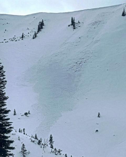
This is somewhat old news now but still relevant to our current snowpack structure. I found an avalanche that released naturally during the strong northwest wind event on Thursday. (Pleasant Creek,
DETAILS HERE) The wind drifted snow until it overloaded the slope. What caught my attention is that the avalanche broke into the November weak layer of loose faceted snow.