Yesterday: Cloudy skies and snow showers kept things from heating up too much. Across most elevations high temperatures were in the low 30s F. Winds were light. A few inches of snow accumulated yesterday morning followed by another inch or so in the afternoon.
This morning: Mostly clear skies allowed temperatures to drop into the mid to upper teens F. Westerly winds this morning are averaging 5-10 mph with 20 mph gusts at the highest elevations. A band of precipitation moved over Salt Lake City at about 3 a.m. and dropped 2 inches of snow in the mountains.
Today: Clouds should dissipate this morning and there should be more and more sunshine appearing through the day. Temperatures should warm more than yesterday and easily climb into the low 30s to low 40s F depending on elevation. A brief ridge of high pressure will build today, but a series of storms is headed our way starting tomorrow with strong southwest winds.
With cloudy skies and relatively cold weather for this time of year, most slopes have great powder this morning but that should change as the sun heats up many slopes today. Notherly facing slopes should have great powder all day.
There have been a few avalanches within the new snow. Yesterday ski patrols in the Cottonwood Canyons were still able to trigger a few soft slabs in the new snow up to 30 inches deep. There were three avalanches reported in the backcountry.
- One occurred on Mt Superior (about 6 inches deep).
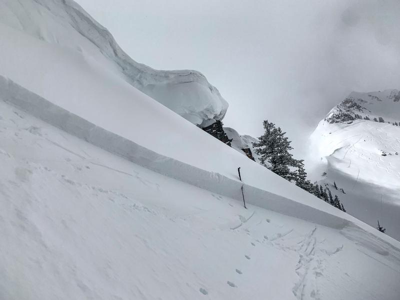
- Another nearby on Cardiff Peak (about 18 inches deep) - photo below by M. White.
- Another in the Y Couloir (possibly a dry, loose snow slide or sluff).
All of these slides appear to be breaking within the new snow where slightly denser snow is resting on softer snow.
Be sure to read our Week in Review as you make plans for today and this weekend. 


