Sign Up for the Utah Snow and Avalanche Workshop (USAW) on December 7th!

Forecast for the Salt Lake Area Mountains

Nikki Champion
Issued by Nikki Champion on
Thursday morning, April 11, 2024
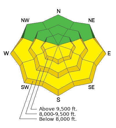
The overall avalanche danger is LOW this morning but could rise to MODERATE on the southern end of the compass as the day warms up.
Pay attention to changing conditions and avoid being on steep solar aspects if the snow has become wet and unsupportable. Steer clear of being on or under large overhanging cornices, which may break back further than expected and may also trigger an avalanche below.
Low
Moderate
Considerable
High
Extreme
Learn how to read the forecast here
Weather and Snow
This morning, under clear skies, trailhead temperatures are in the mid-30s °F, while the highest peaks are in the upper 20s °F. Last night marks another evening, that some trailhead temperatures did not drop below freezing. Winds at the mid-elevation ridgelines are westerly blowing at low double-digit speeds, with gusts near 20 MPH. At the highest ridgelines, winds are gusting near 35 MPH.
Today should be a beautiful day in the mountains with warm temperatures and sunny skies. Temperatures should climb into the mid-40s to low 50s °F, with winds blowing from the west at 5-10 MPH, gusting to 20 MPH at the mid-elevation ridgelines. At the highest ridgelines, winds may gust up to 30 MPH.
Outlook: High pressure continues through the remainder of the week, with the highest temps expected tomorrow. The low pressure system may bring some precipitation late Sunday night into Monday, with uncertain impact from a colder trough expected early next week.

You can still find lingering good-settled powder in shady upper and mid-elevation terrain, though the cold compass continues to shrink. Sunny slopes will have a decent crust this morning and become damp as the day warms up.
Recent Avalanches
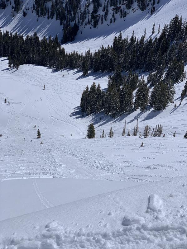
Yesterday was generally quiet in the backcountry, with one report of a small skier-triggered wet snow avalanche along the Park City Ridgeline. This avalanche occurred on an east aspect near 10,000 feet, breaking 4 inches deep and 15 feet wide. Ski resorts reported a warming snow surface by the afternoon.
Small skier triggered avalanche near the Dutch Draw Zone.
Ad
Avalanche Problem #1
Wet Snow
Type
Location
Likelihood
Size
Description
The cooler overnight temperatures could keep the wet snow at bay today, but with such strong sunshine and temperatures climbing into the low 50s F, there is still the potential to trigger wet-loose and shallow wet slab avalanches on steep, sunny slopes by the afternoon.
Wet snow is the easiest avalanche problem to avoid; simply move to shady slopes once the snow surface becomes wet. Signs that the snow surface is becoming wet include rollerballs, pinwheels, and the snow no longer being supportable. Remember, even a small avalanche can have a detrimental outcome in consequential terrain. Watch for terrain traps.
Avalanche Problem #2
Normal Caution
Type
Location
Likelihood
Size
Description
The snowpack is generally stable and natural and human-triggered avalanches are unlikely. In isolated areas, you may encounter:
  • Stubborn pockets of wind drifted snow along exposed ridges and in open terrain at the upper elevations. The moderate to strong northwesterly winds from yesterday could have transported any soft snow onto leeward aspects that may be sensitive to a rider today. Rounded pillows of new snow that crack or collapse on approach are sure signs that the wind-drifts should be approached with caution.
  • Cornices and roof-avalanches present a real danger today as well. Give both a wide berth.

Remember safe travel techniques: Only expose one person at a time when crossing steep slopes. Make sure everyone in your party has a beacon, shovel, and probe and knows how to use them.
General Announcements
This information does not apply to developed ski areas or highways where avalanche control is normally done. This forecast is from the U.S.D.A. Forest Service, which is solely responsible for its content. This forecast describes general avalanche conditions and local variations always occur.