Forecast for the Salt Lake Area Mountains

Drew Hardesty
Issued by Drew Hardesty on
Thursday morning, February 13, 2025
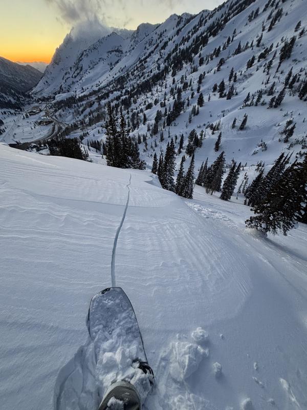
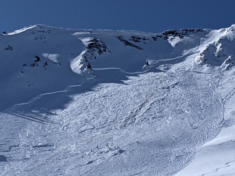
This morning, we have a MODERATE avalanche danger on many steep slopes for triggering existing and developing soft and hard slabs of wind drifted snow. These drifts will be most pronounced on northwest to north to southeast facing slopes of the mid and upper elevations. In localized west to north to easterly facing terrain, these may also step down into older faceted snow near the ground.
HEADS UP! The danger may reach CONSIDERABLE in some areas by the afternoon and likely HIGH danger overnight.
Low
Moderate
Considerable
High
Extreme
Learn how to read the forecast here
Avalanche Watch
What
The avalanche danger for the warning area is expected to rise to HIGH overnight and into the weekend.
When
Very dangerous avalanche conditions will develop tonight and last through the weekend. (The Watch is in effect from 6am MST this morning to 6pm MST Saturday.)
Where
For the mountains of Northern and Central Utah and Southeast Idaho including the Wasatch Range...Bear River Range....the Uinta Mountains...and the Manti-Skyline Plateau.
Impacts
Expected heavy snowfall and strong winds will lead to widespread and very dangerous avalanche conditions. Both human triggered and natural avalanches are likely. Stay off of and out from under slopes steeper than 30 degrees.
Special Announcements
  • A preliminary report on Saturday’s avalanche fatality in the East Bowl of Silver Fork can be found [HERE]. We hope to have the full report out very soon.
  • The full report on the February 3rd avalanche fatality on Monte Cristo (Ogden Mountains) is published [HERE].
  • The accident report detailing the full and partial burial close call in Dutch Draw (Park City ridgeline) from Saturday is available [HERE].
Weather and Snow
Skies are partly cloudy.
Mountain temperatures have well rebounded from yesterday's icebox and are in the upper single digits. (Wind chill at 11,000' yesterday dropped to -46°F). Winds have backed to the west-southwest and are blowing moderate to strong along the ridgelines.
Our partners at the National Weather Service have issued a Winter Storm Warning for most of the mountainous terrain across the state through at least the early part of the weekend. In their discussion, they write, "One of the most significant
mountain snow storms of the season
is on tap for the short term forecast period...with many locations measuring in feet or even a yard stick by sunset on Saturday." I couldn't agree more.
Snowfall should begin by midday and last through late Saturday where we'll measure the snowfall in feet and not inches. The storm should provide a fairly even blanket across northern Utah with the northern, central and southern Wasatch all seeing their fair share. Winds will steadily increase to strong from the southwest today and temperatures will rise into the mid-20s. The bulk of the precipitation will come in on a southwest to westerly flow, aided by a moisture tap from the Pacific. Colder temps follow for Saturday. Active weather continues for late weekend into early next week.
Happy Valentine's Day.
Recent Avalanches
No new avalanches were reported from the backcountry yesterday, but ski area avalanche teams reported finding shallow soft and hard slabs of wind blown snow in standard leeward terrain. Some sluffing of the low density snow was also noted.
Ad
Avalanche Problem #1
Wind Drifted Snow
Type
Location
Likelihood
Size
Description
The moderate to strong winds will continue to transport the existing and falling snow into unstable slabs in lee terrain...and these will get bigger and more sensitive by the afternoon. These will be particularly sensitive as they will break on very low density and/or recrystallized snow on the surface. These soft slabs (and occasional hard slabs) may be triggered at a distance. Cracking and collapsing are telltale signs of unstable snow (Hathcock photo from yesterday). Note that the locator rose shows where you are most likely to find these unstable wind slabs but be warned that weak, low density snow exists on the surface of many aspects (even some solar aspects) and strong, swirling winds have a habit of loading and crossloading snow onto many aspects. Cornices will also become increasingly tender with the new snow and wind.
TREND: Rapidly increasing.
Avalanche Problem #2
Persistent Weak Layer
Type
Location
Likelihood
Size
Description
Two buried weak layers of faceted snow in the snowpack continue to be triggered by skiers and riders with the most recent avalanches occurring on Monday. These were both very close calls involving very experienced backcountry skiers.
  • The upper weak layer is buried around 1–2 feet deep, formed during the cold weather at the end of January.
  • The lower layer, near the ground, formed in November/December and has caused many large avalanches. This layer is most likely to be triggered in steep, thin snowpack areas, and repeater slopes—places that have previously avalanched. This layer continues to avalanche, continues to reload, and continues to be an issue. Avalanches up to 1–3+ feet deep remain possible. Dindy photo of Monday's slide off the Cardiac Ridge below.
These weak layers are primarily found on north-facing slopes, with some east and west-facing pockets at mid and upper elevations. These are tricky, dangerous layers that demand extra caution. Significant spatial variability exists—snow pits may not reflect conditions on similar aspects and elevations.
TREND: Increasing
General Announcements
This information does not apply to developed ski areas or highways where avalanche control is normally done. This forecast is from the U.S.D.A. Forest Service, which is solely responsible for its content. This forecast describes general avalanche conditions and local variations always occur.