UDOT PLANNED AVALANCHE CLOSURES!!

Forecast for the Salt Lake Area Mountains

Dave Kelly
Issued by Dave Kelly on
Sunday morning, December 8, 2024
The avalanche danger is LOW. With increased wind speeds last night and continuing through the day, evaluate snow and terrain carefully in locations where wind transported snow could accumulate and create wind slabs near ridgelines that may fail on a buried layer of facets. Stay away from thinner areas where you may find buried objects just under the snow surface.
Low
Moderate
Considerable
High
Extreme
Learn how to read the forecast here
Special Announcements
The 17th Annual Utah Snow and Avalanche Workshop (USAW) was held last night at the University of Utah. Thanks to all the amazing speakers and full house of attendees for making it such a great event.
Weather and Snow
Skies are partly cloudy with inverted temperatures in the 20's °F at the trailheads and in the low 30's °F at the upper elevations. Winds are blowing from the west 20 gusting to 30 MPH at the 9,000' ridgelines and from the northwest in the mid 40's gusting to the low 50's MPH at the 11,000' ridgelines.
Today, look for increasing clouds. Temperatures will be 29-35 °F and dropping during the day with westerly winds blowing 10 gusting to 20 MPH at the 9,000' ridgelines and blowing from the west-northwest 40 gusting to 50 MPH at the 11,000' ridgelines. The freezing level will start around 10,000' and slowly drop throughout the day.

There is a chance of snow on the horizon and we can look for 1"-3" of new snow and .05"-.20" of water by tomorrow morning.
Recent Avalanches
There has been no recent avalanche activity. Check out all recent observations HERE.
Ad
Avalanche Problem #1
Persistent Weak Layer
Type
Location
Likelihood
Size
Description
The persistent weak layer (PWL) making up most of the snowpack on the north side of the compass continues to lose strength. As we get new snow or wind, this structure is not going to be able to support much weight and will start to collapse. Take a look around and make note of what slopes, aspects, and elevations are and are not holding snow so you'll have an idea of locations to avoid once we get our next storm.
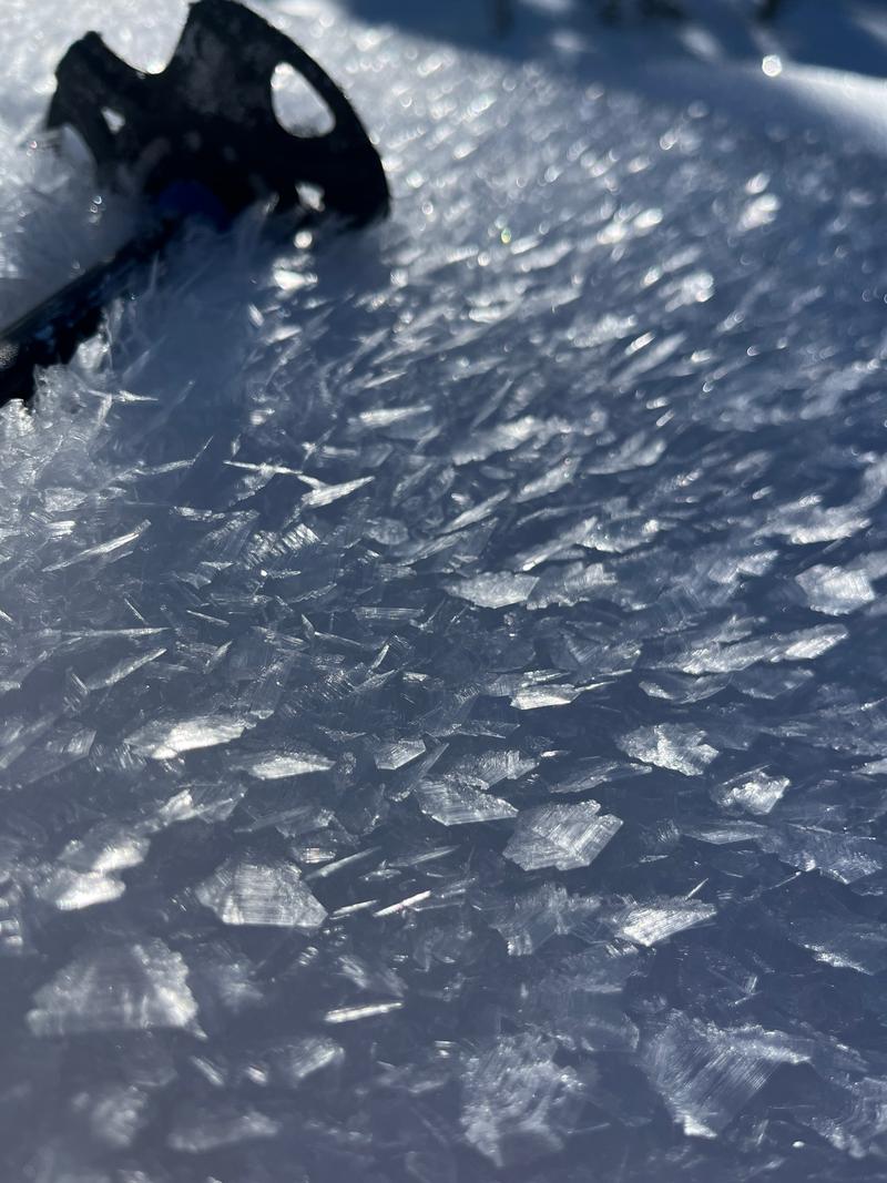
Weak snow is also forming on the surface and you can learn more about surface hoar HERE. The question is whether or not the warmer temperatures and wind will destroy this surface weakness before it snows?
Photo of Surface Hoar from a north facing meadow in White Pine (J.Kelly)
Additional Information
Nikki Champion did a great write up of the last week's weather and avalanche activity and you can find the Forecaster Week in Review HERE.

While you're waiting for more snow, dive deeper into avalanche philosophy with Drew Hardesty HERE and HERE.
General Announcements
This information does not apply to developed ski areas or highways where avalanche control is normally done. This forecast is from the U.S.D.A. Forest Service, which is solely responsible for its content. This forecast describes general avalanche conditions and local variations always occur.