Forecast for the Salt Lake Area Mountains

Evelyn Lees
Issued by Evelyn Lees on
Thursday morning, December 27, 2018
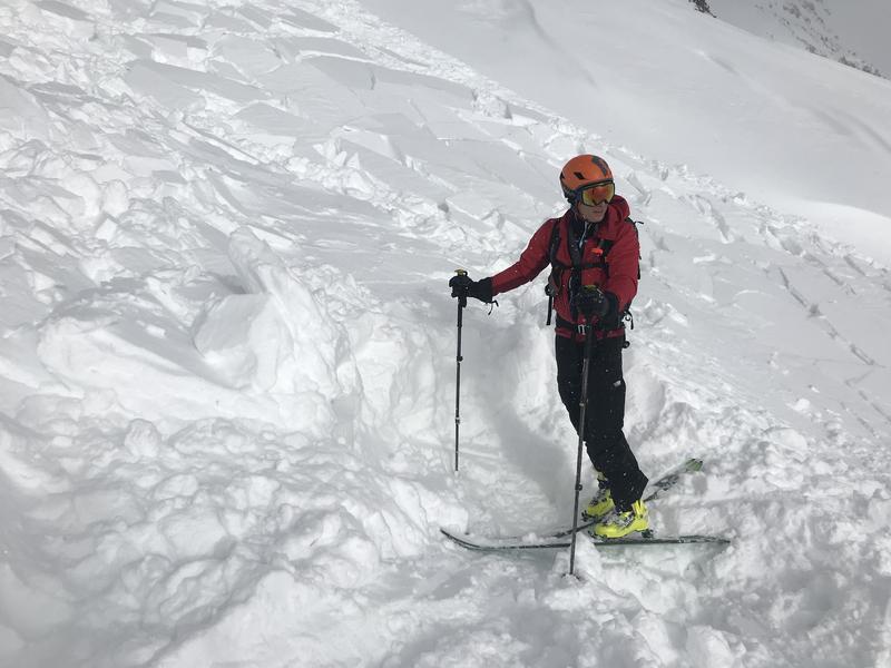
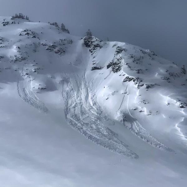
The avalanche danger is MODERATE on all steep upper elevation slopes, where sensitive wind drifts, sluffs and new snow soft slabs can be triggered.
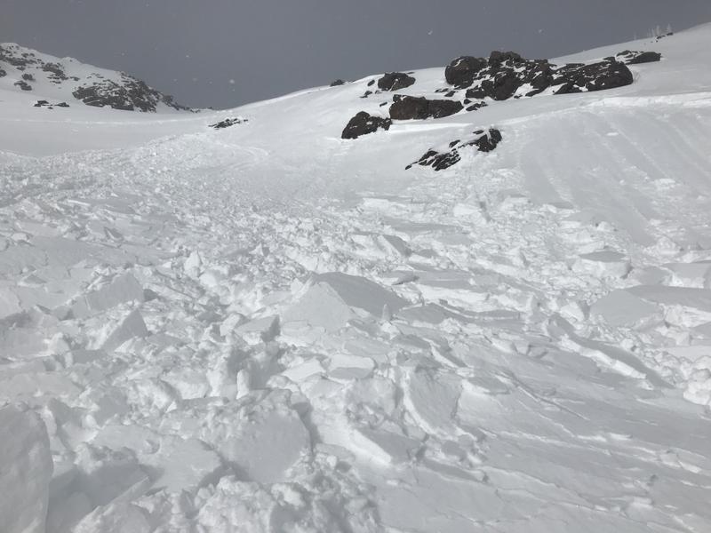
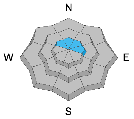
There is also a MODERATE danger for triggering a deeper slide failing on facets near the ground. The most likely place would be an upper elevation slope facing northwest through north through easterly, with a shallow or rocky snowpack.
Travel one at a time in steep terrain, keep your partner in sight and be in position to get to them quickly should there be an avalanche.
Low
Moderate
Considerable
High
Extreme
Learn how to read the forecast here
Special Announcements
The new UAC IOS mobile app is now available on the app store. Check out the new "My Weather" feature.
Weather and Snow
Yesterday’s magical clouds and sun added visuals to one of the best powder days of the year. While today is much colder with cloudy skies, the powder is still there on all aspects, with a small refill on the way. Light snow should fall for most of the day, with accumulations of 2 to 5” of low density fluff expected. Temperatures this morning are in the single digits from the peaks to the canyon bottoms and will only warm into the teens today. The northwesterly winds are forecast to remain light, averaging 5 - 15 mph, though speeds across the highest peaks could average to 20 mph.
Recent Avalanches
A close call yesterday, with a good ending. A party triggered a wind slab on a SE facing slope at 10,500', with one person carried and buried with only their hand sticking out. The group got to and cleared their face in 30-60 seconds, and they were uninjured. It occurred on east pass by Red Baldy, coming back from the American Fork side into Little Cottonwood. They wrote up a very thoughtful and introspective report. (photos below: burial spot, looking up at the crown from the burial spot.) Also of note, they had an avalanche airbag malfunction.
There were also reports of both natural and skier triggered shallow, new snow sluffs and a few soft slabs, with a larger natural sluff hitting ice climbers in "Hogum right".
Ad
Avalanche Problem #1
Wind Drifted Snow
Type
Location
Likelihood
Size
Description
There is so much low density snow available for transport, I’m just holding my breath that the winds don’t pick up. If wind speeds increase and the snow starts to move where you are or you see plumes above you off the peaks, sensitive drifts are forming and instantly increasing the avalanche danger. And you’ll need to instantly change your travel plans. My greatest concern is the highest peaks and ridgelines, where speeds reached 15 to 20 mph for a few hours last night. Winds could pick up to those speeds again today, easily transporting the low density snow. Avoid travel on and below steep slopes with new wind drifted snow.
There are also a few older, denser wind drifts hidden beneath the snow snow, on a variety of aspects and around terrain features like the lee sides of ridge crests, gully walls, sub ridges and breakovers.
Avalanche Problem #2
Persistent Weak Layer
Type
Location
Likelihood
Size
Description
The small storms are adding up, with the upper elevations having over two feet of snow since the 20th. There have been 2 skier triggered slab avalanches in the last 5 days breaking near ground on weak, sugary faceted snow - in South Monitor and in Days Draw. Both slopes had a shallow snowpack because they avalanched earlier this winter (know as “repeaters”). This weak faceted snow layer is most widespread on upper elevation northwest through north through easterly facing terrain. Your are most likely to trigger a slide on this weak persistent layer on slopes with a shallow snow pack, less than about a meter deep, including “repeater” slopes in the core Cottonwoods zone, upper-elevation alpine terrain that was wind-scoured, as well as traditionally thinner snowpack areas such as the Park City ridge line and Millcreek Canyon.
Avalanche Problem #3
New Snow
Type
Location
Likelihood
Size
Description
The low density snow will continue to sluff today, especially during any periods of heavy snowfall. Even in wind sheltered areas, there could be natural sluffs after a few hours of heavy snowfall. Small sluffs can be serious if they take you into trees, off a cliff or for a long ride, so choose your terrain carefully and use slope cuts to minimize the chance of going for a ride.
Loose snow sluffs Mark White photo
General Announcements
This information does not apply to developed ski areas or highways where avalanche control is normally done. This forecast is from the U.S.D.A. Forest Service, which is solely responsible for its content. This forecast describes general avalanche conditions and local variations always occur.