UDOT PLANNED AVALANCHE CLOSURES!!

Forecast for the Salt Lake Area Mountains

Mark Staples
Issued by Mark Staples on
Thursday morning, December 24, 2020
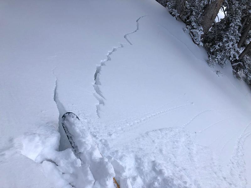
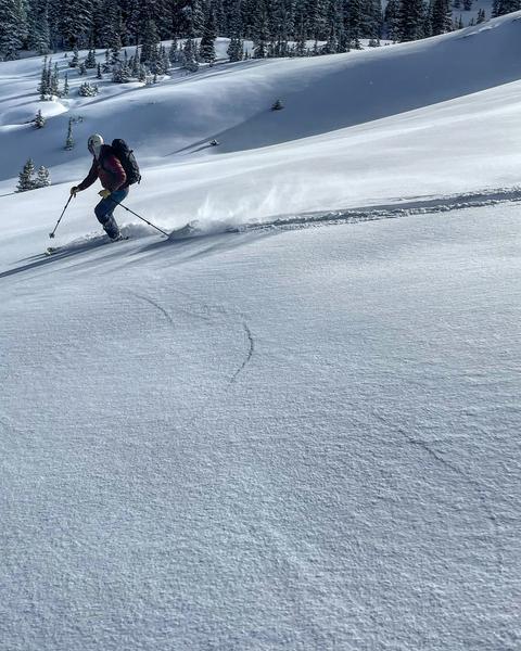
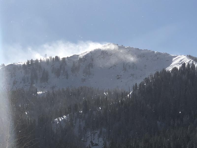
Today there is a CONSIDERABLE avalanche danger at mid and upper elevations. There is a persistent weak layer of old faceted snow underneath snow from the last two storms that will fracture and produce avalanches. There are also fresh slabs of wind drifted snow that will avalanche. The simple solution is to avoid avalanche terrain and ride slopes less than 30 degrees in steepness.
Below 8,000', there is a LOW avalanche danger simply because there isn't enough snow.
Low
Moderate
Considerable
High
Extreme
Learn how to read the forecast here
Special Announcements
Thanks to the generous support of our local resorts, Ski Utah, and Backcountry, discount lift tickets are now available.
Support the UAC while you ski at the resorts this season. Tickets are available here.
Weather and Snow
Tuesday's storm delivered 7-12 inches of snow (0.4-0.8 inches of water). Very strong winds blew Tuesday evening at the start of the storm and generally eased by yesterday morning although they were still transporting snow in some areas.
This morning temperatures are mostly in the mid teens F with some trailhead temperatures in the single digits F. Ridgetop winds are blowing 10-15 mph and gusting 20-30 mph from the northwest.
Today will have clear sunny skies under a ridge of high pressure. Winds will slowly ease through the day and temperatures will warm to near freezing.
The snowpack is about 2 feet deep in many places although it is closer to 3 feet deep in the upper Cottonwoods. Snowfall Tuesday night made a huge difference in riding conditions although an ice crust from warm temperatures and a rime event on Sunday can be found under the new snow. Expect the snow on south facing slopes to get a little damp this afternoon.
Recent Avalanches
Yesterday in upper Dry Fork ski guides reported a remotely triggered avalanche by another party that was 2-3 feet deep and 150 feet wide on a ENE aspect near 10,000 feet (no photo).
Local ski areas triggered a few more slides that broke into old facets.
Otherwise many groups yesterday reported collapsing and cracking which should be treated the same as triggering an avalanche. The difference is that they were not in terrain steep enough to slide.
Photo (J. Mletschnig) of a shooting crack in Cardiff Fork yesterday.
Ad
Avalanche Problem #1
Persistent Weak Layer
Type
Location
Likelihood
Size
Description
A persistent weak layer (PWL) of faceted snow exists in the bottom foot of the snowpack on most slopes except ones facing south. Snow from yesterday's storm (7-12"), Tuesday's winds, and last Thursday's storm (8-17") has built a slab on top of that weak faceted snow. Trent explains this setup in a video from Tuesday. This PWL is widespread and easy to find on any slope on the northern half of the compass, but it can be found in pockets on SW and SE facing slopes as well.
We know this snowpack structure is unstable because of avalanche activity that occurred prior to Tuedays's storm and reports of collapsing and cracking yesterday. A good example can be seen in the photo below where the snowpack was collapsing and cracking as a skier in Cardiff Fork descended a low angle slope (photo below). Had they been on a steeper slope, they would have triggered an avalanche. Additionally, the remotely triggered avalanche reported in Dry Fork yesterday is another red flag because that means a person triggered it by simply walking near a slope without getting on it.
The bottom line is that triggering an avalanche on this layer is likely, and I would avoid avalanche terrain today, tomorrow, the next day, and for weeks to come.
Photo by M. White from Cardiff Fork.
Avalanche Problem #2
Wind Drifted Snow
Type
Location
Likelihood
Size
Description
Very strong winds blew Tuesday afternoon and evening (80 mph gusts at 11,000 ft). In many places yesterday, winds calmed and the new snow made it hard to see evidence of these winds. In other places like the Park City ridgeline, winds continued transporting snow yesterday. This morning's uptick in northerly winds should keep transporting snow.
Freshly formed slabs of wind drifted snow should still be able to produce an avalanche today. They will also add weight and stress to a buried PWL (see discussion above) and cause avalanches to break wider and farther because winds are very good at forming stiff, cohesive slabs of snow.
Photo of winds transporting snow along the Park City ridgeline yesterday (G. Gagne).
General Announcements
Please visit this website with information about Responsible Winter Recreation by the Utah Office of Outdoor Recreation.

This information does not apply to developed ski areas or highways where avalanche control is normally done. This forecast is from the U.S.D.A. Forest Service, which is solely responsible for its content. This forecast describes general avalanche conditions and local variations always occur.