Forecast for the Salt Lake Area Mountains

Issued by Dave Kelly on
Thursday morning, December 14, 2023
Thursday morning, December 14, 2023
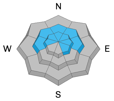
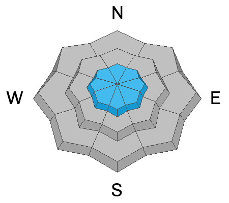
The avalanche danger is MODERATE on slopes over 30° in mid and upper west-north-east elevation and upper elevation southeast facing terrain. Areas with a thinner snowpack are where it would be possible to trigger an avalanche 1-3' deep failing into the older faceted snow. The avalanche danger is LOW at lower elevations and in mid-elevation southerly facing terrain.
Yesterday's strong winds transported loose surface snow into stiff wind-slabs. This problem will be easy to see; look for and avoid smooth, pillowy, or rounded piles of snow. Today, I will be staying away from steeper terrain (over 30°) with wind loading as an avalanche involving wind slabs on top of a PWL would be dangerous.

Low
Moderate
Considerable
High
Extreme
Learn how to read the forecast here