UDOT will be performing control work above the Alta bypass road around 7 am with a brief closure expected at that time.
The new UAC IOS mobile app is now available on the app store. Check out the new "My Weather" feature.
Check out the new free online avalanche course series developed by the Utah Avalanche Center. This is a great way to refresh your skills or prepare you for a Backcountry 101 or Level 1 class.
A sharp cold front entered the Salt Lake mountains mid-morning yesterday, accompanied with strong winds and heavy precipitation throughout the afternoon, with snowfall rates of 1-2" per hour at times. Moderate to strong west/northwest winds persisted well into the evening hours, with gusts exceeding 90 mph at 11,000'. Even at the friendlier elevation band between 9000' and 10,500' winds were gusting into the 40's and 50's mph.
The all-important snowfall totals range from 6" to 13" with 0.5 - 1.0" of water, with upper Little Cottonwood coming out on the higher end.
Winds have backed off considerably since Wednesday afternoon, and are currently northwesterly and generally light, with 10,500' stations gusting in the teens. At 11,000' winds are gusting into the 30's mph. Mountain temperatures this morning are in the single digits.
Mountain temperatures will rise into the 20's at the mid elevations, and teens at upper elevations. Winds will be northwest/west and generally light, although upper-elevation ridgelines may gust into the 20's mph. Skies will be mostly sunny with a few passing clouds. Enjoy the fresh snow while it lasts as there does not appear to be any significant weather for at least the next 7 days.
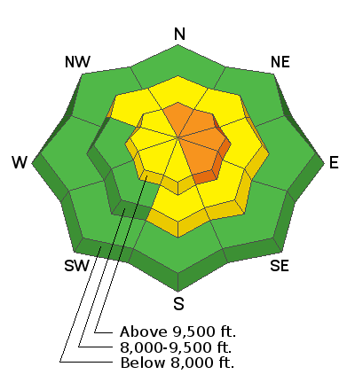
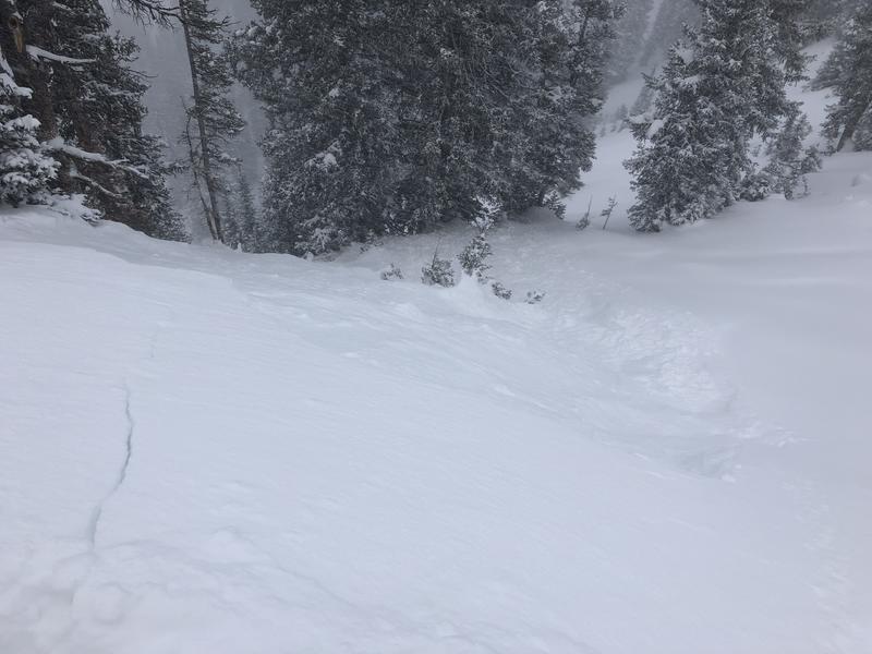
Few people getting out and very poor visibility limited field observations from Wednesday, but there were reports of cracking in the new snow during periods of heavy precipitation intensity, especially in wind-loaded areas.Yesterday I was able to easily pry out a few soft slab avalanches from safer ridgelines and test slopes (photo below), and there were also reports of a few natural avalanches on upper elevation northerly aspects later yesterday afternoon. Reported avalanche activity was running in density inversions within the storm snow, or at the interface of the old snow surface.


