Forecast for the Provo Area Mountains

Drew Hardesty
Issued by Drew Hardesty on
Tuesday morning, February 11, 2025
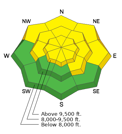
A MODERATE avalanche danger exists on many aspects and elevations. The danger is higher along the Wasatch Back near the Ant Knolls and upper Snake Creek and may more mirror the SLC area avalanche hazard. Human triggered avalanches 1-3 feet thick are possible and may be unsurvivable. Extra Caution is required on steep north to east facing slopes.
Low
Moderate
Considerable
High
Extreme
Learn how to read the forecast here
Special Announcements
A very preliminary report for the avalanche fatality in the East Bowl of Silverfork from Saturday can be found HERE>

The accident report for the avalanche fatality on Monte Cristo (Ogden mountains) from February 3rd is published HERE.
The accident report for the full burial and partial burial (live recoveries) in Dutch Draw (Park City ridgeline) from Saturday is published HERE.
Weather and Snow
Skies are mostly cloudy-becoming-overcast ahead of a weak brush-by system that may bring an inch or two of snow. Mostly, though, it'll bring much colder temps and we'll see temps straddling 0°F by tomorrow. A stronger system arrives late Thursday through Saturday. Riding conditions are good in the sun and wind sheltered terrain.
Recent Avalanches
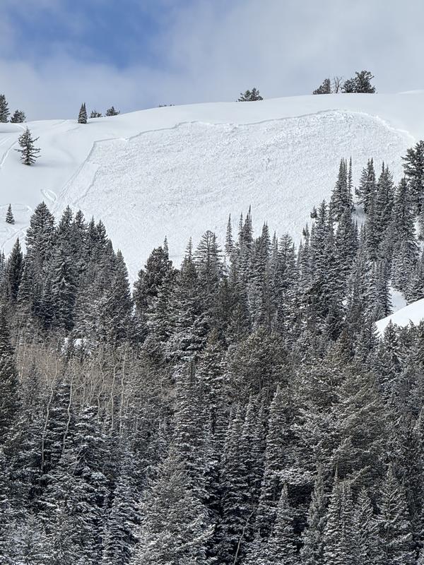
On Saturday, a snowmobiler unintentionally triggered a large avalanche near the Ant Knolls. This avalanche was 3 feet deep, 250 feet wide, and easily could have been a very close call. This was on a steep northeast facing slope at 9300'. Lots of avalanches occurred in the Salt Lake and Park City mountains over the weekend. Another snowmobile triggerd avalanche was reported in the upper Snake Creek area of the Wasatch Back, perhaps 1-3' deep and hundreds of feet deep on northeast facing aspects.
Ad
Avalanche Problem #1
Persistent Weak Layer
Type
Location
Likelihood
Size
Description
There are two buried persistent weak layers (PWL) in the snowpack:
1. The upper layer buried down 12-24 inches formed during cold, clear weather in late January and has been buried by recent storms and wind-drifted snow.
2. The lower layer, near the ground, formed in December and has caused large avalanches, including two fatalities during the Holiday Avalanche Cycle.. This layer is most problematic in steep rocky terrain or on repeater slopes that previously avalanched this winter (see recent avalanche activity photo).
Avalanche Problem #2
New Snow
Type
Location
Likelihood
Size
Description
Loose dry avalanches and pockety shallow soft slab avalanches may be triggered in steep terrain. These may be mitigated via ski cuts or cornice drops.
General Announcements
This information does not apply to developed ski areas or highways where avalanche control is normally done. This forecast is from the U.S.D.A. Forest Service, which is solely responsible for its content. This forecast describes general avalanche conditions and local variations always occur.