UDOT PLANNED AVALANCHE CLOSURES!!

Forecast for the Provo Area Mountains

Dave Kelly
Issued by Dave Kelly on
Saturday morning, January 4, 2025
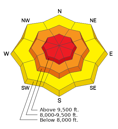
Today, the avalanche danger is HIGH in upper elevation terrain as a new storm moves in and further stresses our buried facets. The avalanche danger is CONSIDERABLE at mid elevations and MODERATE in low elevation terrain.
Avoid all terrain greater than 30° in steepness that has a layer of buried facets near the ground. This weak layer has been the culprit in two accidents in the last week and there have been numerous reports of avalanches 2'-4' deep and up to 800' wide over the last 4 days.
Low
Moderate
Considerable
High
Extreme
Learn how to read the forecast here
Weather and Snow
Under overcast skies it is snowing. There is currently 1"-2" of new snow. Temperatures are in the high 20's to low 30's °F. Winds are blowing from the southwest in the mid-teens gusting to the 20's MPH. Overnight max gusts were in the 40's.
Today, under overcast skies look for dropping temperatures with a high of 29-34 °F. Winds will shift to the northwest 10 gusting to 15 MPH at the lower ridgelines and 35 gusting to 45 MPH at the highest peaks. We can expect to see snow, 3"-10" with .60"-1.15" water.
The snowpack does not like rapid change and your best bet to enjoy this newest snow is to stay out of avalanche terrain and stick to lower angle slopes less than 30 ° in steepness.
Recent Avalanches
There were no reports of backcountry avalanches in the Provo area mountains yesterday. We got out for a field day in Tibble Fork and found weak snow with lots of signs of cracking, collapsing, and whumpfing in low angle meadows. We avoided steep terrain and had a blast. Check out our observation HERE.
Check out all recent observations and avalanches from the Provo Region HERE.
Ad
Avalanche Problem #1
Persistent Weak Layer
Type
Location
Likelihood
Size
Description
Additional snowfall and strong winds will continue to stress the buried persistent weak layer that has been the culprit in multiple avalanches and the two recent avalanche fatalities in the Central Wasatch (Porter Fork and Davenport Hill).
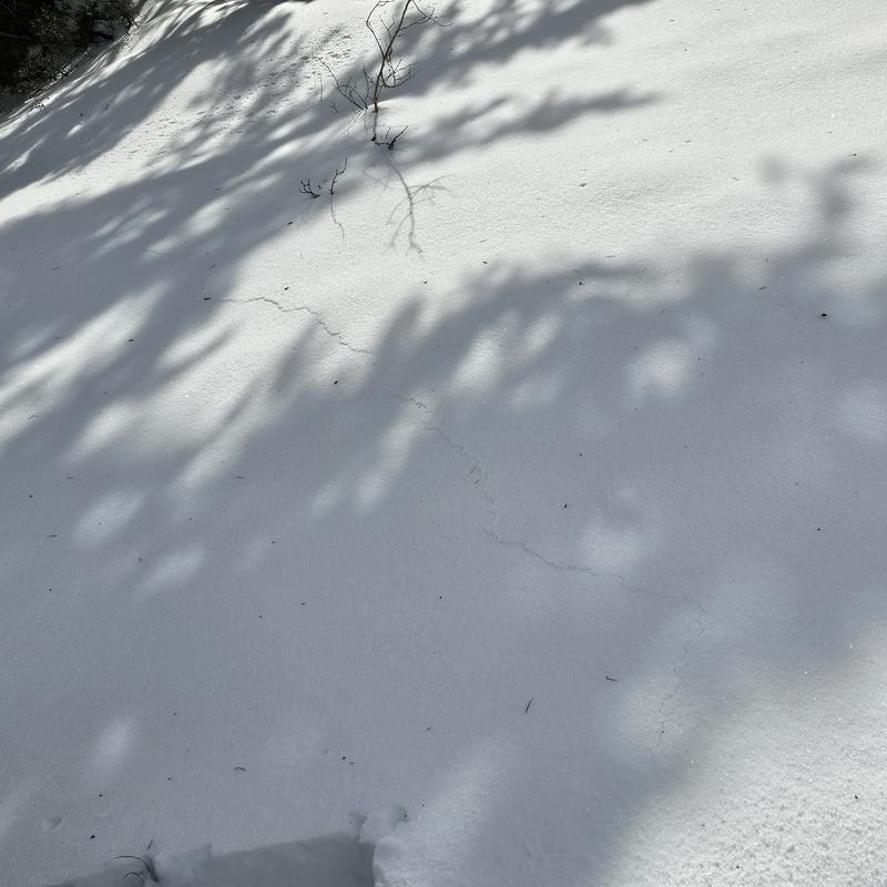
Photo below (Manship) of cracking in the snowpack on an east facing slope in Dry Fork. These cracks as well as collapsing and whumpfing are signs that the buried facets are still reactive. If this slope had been any steeper this would have been an avalanche.
Avalanche Problem #2
Wind Drifted Snow
Type
Location
Likelihood
Size
Description
Stiff wind drifts that formed during high winds yesterday and overnight are now covered over by new snow and will be hard to see. With gusty winds overnight these drifts will be lower on the slope than you may expect and I will be avoiding these areas of wind drifted snow today.
Avalanche Problem #3
New Snow
Type
Location
Likelihood
Size
Description
Expect to see soft slabs of storm snow that may be 12"-18" deep and deeper if they have been affected by wind. These soft slabs will be more than enough to catch and carry a human. When combined with the buried persistent weak layer could prove fatal on steep north-east facing aspects. During periods of increased snowfall there will be natural avalanches that run on density changes within the storm snow and you may see long running dry loose avalanches in steep terrain on all aspects.
Additional Information
Researchers Ian McCammon and Kelly McNeil looked into safety habits that would increase our margins of safety. Please take a moment to look over these Six Tips That Could Save Your Life.
General Announcements
This information does not apply to developed ski areas or highways where avalanche control is normally done. This forecast is from the U.S.D.A. Forest Service, which is solely responsible for its content. This forecast describes general avalanche conditions and local variations always occur.