UDOT PLANNED AVALANCHE CLOSURES!!

Forecast for the Ogden Area Mountains

Nikki Champion
Issued by Nikki Champion on
Wednesday morning, January 8, 2025
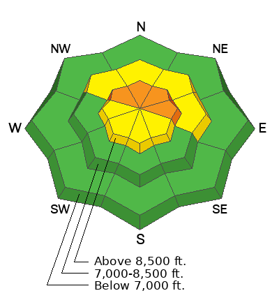
Areas of CONSIDERABLE danger exists on upper-elevation northwest through east-facing slopes, where 1-3' thick slab avalanches can be triggered on a persistent weak layer of faceted grains. These tricky avalanches can be triggered from a distance or from below. Watch for blowing and drifting snow today, as avalanches triggered in wind-drifted snow may step down deeper.
Remember: If you're heading out of bounds, you are likely entering potentially dangerous conditions.
Low
Moderate
Considerable
High
Extreme
Learn how to read the forecast here
Special Announcements
Receive forecast region-specific text message alerts to receive messages about changing avalanche conditions, watches, and warnings. Sign up and update your preferences HERE.
Weather and Snow
This Morning, skies are clear, and a temperature inversion is in place, with trailhead temperatures hovering in the low teens°F and ridgetop temperatures near 20 °F. Winds are shifting from east-northeasterly to more northwesterly and decreased drastically, with gusts below 20 mph at the highest ridgetops.
Today, Temperatures will rise into the upper 20s°F under mostly clear skies, with high clouds building this afternoon. Winds will increase, with northwesterly winds averaging 5–10 mph at mid-elevations and 15–30 mph on the highest ridgelines. Gusts at the highest peaks could reach up to 45-50 mph by late afternoon.
Overnight, little to no precipitation is expected, but strong, gusty northerly winds will accompany the storm this evening.
Outlook: Confidence is building in the incoming storm system this weekend. Water totals are expected to range from 0.25 inches to nearly 1 inch. Stay tuned for updates as we get closer.
Recent Avalanches
It was a relatively quiet day in the backcountry, with no new avalanches reported from the Ogden area. Over the past few days, ski area control teams had mixed results with ski cutting and explosives, triggering mostly soft slabs within new snow or as wind slabs. Pockety hard slabs continue to release with explosives.

Forecasters were out in the field yesterday, covering terrain from Provo to Salt Lake and up to Ogden. Take a look at the recent observations and avalanche reports to get a clear picture of current conditions across the range.
Ad
Avalanche Problem #1
Persistent Weak Layer
Type
Location
Likelihood
Size
Description
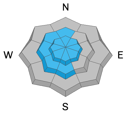
The primary concern is triggering a large, unsurvivable hard slab avalanche on a persistent weak layer of faceted snow buried 1-3+ feet deep on mid- and upper-elevation slopes facing west to northwest to east. This weak layer formed early in the season and was primed by the Christmas storm, creating a more cohesive slab. These slabs continue to be triggered at ski areas and remain dangerous in the backcountry.
Although the likelihood of triggering one is decreasing, and the snowpack is trending in the right direction, the consequences remain high. Caution is essential in this terrain.
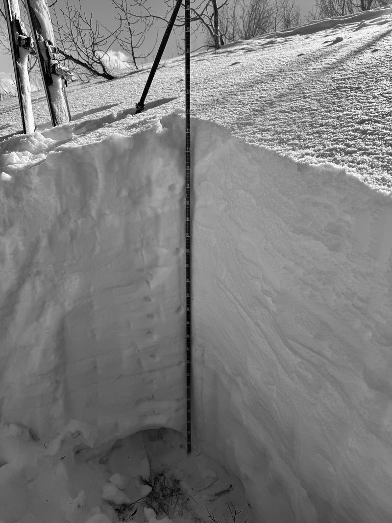
A snow profile from Culter Ridge at 7,000' on an east-facing slope showed 128 cm of snow, with a moist rounding depth hoar layer in the bottom 6" and multiple crusts in the upper snowpack. Showing the snowpack is trending in the right direction, but weak grains still exist. Bishop,Kelly, Davis, Osguthorpe
Avalanche Problem #2
Wind Drifted Snow
Type
Location
Likelihood
Size
Description
Easterly winds can be unpredictable across the Wasatch, leading to unusual avalanche conditions. Yesterday's elevated easterly winds, combined with incoming northwesterly winds, may continue to drift and form soft slabs of wind-drifted snow on upper elevations and leeward mid-elevation slopes.
Look for signs of wind-drifted snow, such as texture changes, pillow-shaped areas, or hollow spots, and avoid those slopes.

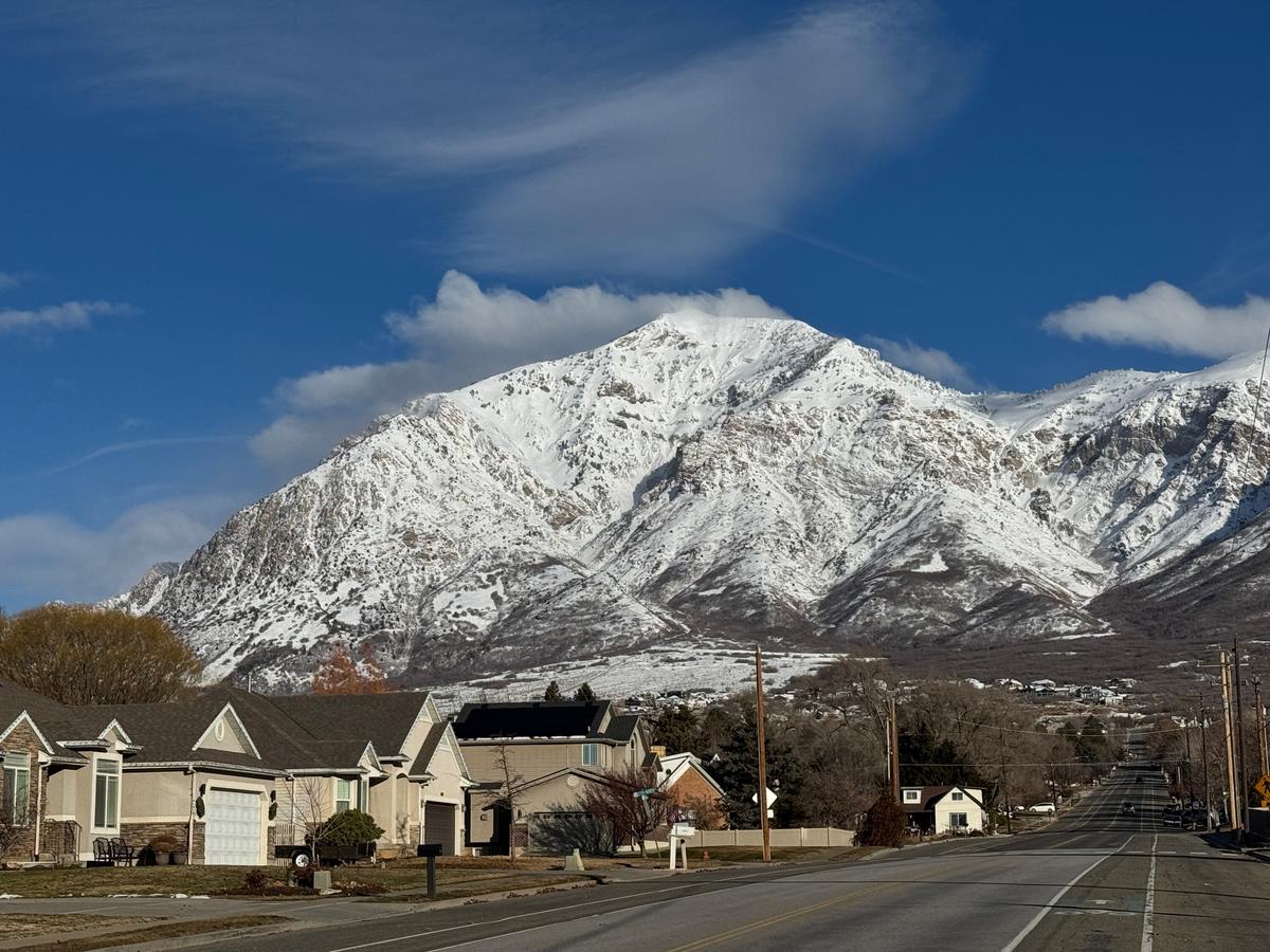
Photo of strong east winds blowing across Ben Lomond as viewed from North Ogden yesterday morning. Bishop.
Additional Information
The accident reports for the Porter Fork and Davenport Hill Accident have been completed. You can read them HERE.
At the Utah Avalanche Center, we strive to learn from every avalanche incident and share insights to help others avoid similar accidents. We have all experienced close calls and understand how easily mistakes can happen. Our goal with these reports is to provide valuable learning opportunities.
General Announcements
This information does not apply to developed ski areas or highways where avalanche control is normally done. This forecast is from the U.S.D.A. Forest Service, which is solely responsible for its content. This forecast describes general avalanche conditions and local variations always occur.