Join us at our 2nd Annual Blizzard Ball

Forecast for the Ogden Area Mountains

Drew Hardesty
Issued by Drew Hardesty on
Thursday morning, January 16, 2025
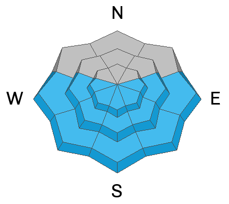
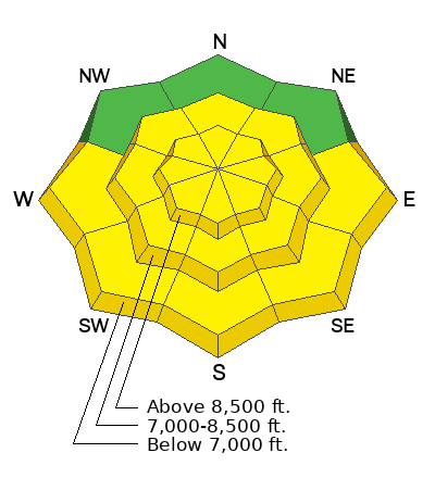
Pockets of MODERATE avalanche danger exist as it is still possible to trigger avalanches 1-3 feet thick and up to 200 feet wide in thin, rocky zones or on slopes where avalanches have occurred earlier this season. The most likely trigger spots are in steep northwest to east facing terrain.
With significant warming again today, expect solar slopes to shed loose wet sluffs with potentially deep debris piles.
Low
Moderate
Considerable
High
Extreme
Learn how to read the forecast here
Special Announcements
Join the UAC at Deer Valley on January 30th for the 2nd Annual Blizzard Ball Gala. The night will be full of fun including delicious cuisine, live music, an auction, and presentation by Bruce Tremper.
Weather and Snow
Skies are clear.
Mountain temperatures are in the low to mid-30s. Winds are light from the southwest.
We'll have sunny skies today with temps rising into the upper 30s to low 40s. Winds will increase a touch from the southwest, with higher winds speeds expected by early afternoon.
A quick-hitting storm punches through tomorrow afternoon through Saturday that could bring as much as 3-6" of cold smoke. It does appear that the DLE ('dreaded lake effect') will be in play Friday night. Temps will drop rapidly behind the front, with the temps dropping to the single digits. Ridging becomes the dominant feature for next week with some hints of a pattern change next weekend; we'll see.
Recent Avalanches
We heard of a fair bit of wet avalanche activity on the steep solar aspects along the Ogden skyline.
Ad
Avalanche Problem #1
Wet Snow
Type
Location
Likelihood
Size
Description
With morning temps already in the low to mid-30s, it will not take long for the snow on the steep sunlit slopes to become wet and unstable. Both natural and human triggered wet loose avalanches are expected today. Fortunately, they are WAY WAY more predictable and manageable than avalanches involving a PWL. If the snow is starting to feel punchy or you're seeing rollerballs, choose low angle terrain or cooler aspects.
Avalanche Problem #2
Persistent Weak Layer
Type
Location
Likelihood
Size
Description
Avalanches on this layer are more likely in thin, rocky terrain or where avalanches have already occurred this season. While the weak layer is gaining strength, some slopes are not yet stable and you have to hit the right spot on the right slope. The last reported backcountry avalanche on this layering was just prior to New Year's. Ski area control work most recent avalanches in this layering was the first week of January.
General Announcements
This information does not apply to developed ski areas or highways where avalanche control is normally done. This forecast is from the U.S.D.A. Forest Service, which is solely responsible for its content. This forecast describes general avalanche conditions and local variations always occur.