Sign Up for the Utah Snow and Avalanche Workshop (USAW) on December 7th!

Forecast for the Moab Area Mountains

Eric Trenbeath
Issued by Eric Trenbeath on
Monday morning, March 18, 2024
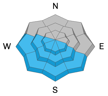
Human triggered avalanches involving slabs of wind drifted snow are still very possible on steep, wind loaded, northerly aspects near and above treeline, and the danger is strongly MODERATE in these areas. Avoid steep, wind drifted slopes. Dry, loose avalanches may also be possible in steep terrain.
In isolated areas on northerly aspects, a triggered wind slab may step down to a buried weak layer of faceted snow. Far from widespread, this layer has, nevertheless, been popping up from time to time, and the only sure way to know if it's there is to dig for it.
With a strong March sun set to show its face, we'll see a rising MODERATE danger for loose, wet avalanches on sun exposed slopes as the day heats up. Signs of instability include rollerballs, pinwheels, and sloppy wet snow. ​​​​​​
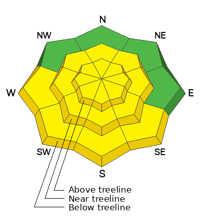
Low
Moderate
Considerable
High
Extreme
Learn how to read the forecast here
Special Announcements
Road Conditions: The Geyser Pass Road will be closed for plowing today and it's a mess up there, so please be patient.
Grooming: LUNA continues to pack in the new snow but trails remain un-groomed.
***Support the UAC website rebuild by donating to our spring campaign. Save lives by making a donation today! HERE

The Banff Film Festival is returning to Moab on Thursday 3/21 and Friday 3/22 For tickets and information visit our event page.
Weather and Snow
6:00 a.m. Snow and Weather Data
24 Hour Snow 0" 72 Hour Snow 15" Season Total Snow 168" Depth at Gold Basin 67"
Winds on Pre-Laurel Peak: S 5-10 Temp 19° F Percent of Normal: 119%

Weather
The closed low pressure system that has been parked over Arizona since Wednesday is finally moving east as ridge of high pressure moves into the Great Basin. Residual moisture may allow for some clouds and convective showers this afternoon but we should see mostly sunny skies this morning. We'll see light winds out of the SW, and high temps in the mid 30's. Tomorrow looks similar followed by dry weather and increasingly warm temperatures through the week. The next chance for snow looks to be around Sunday. Enjoy the spring weather!
General Conditions
All told, we picked up 21" of snow between Wednesday night and Saturday. There's still some great turning and riding to be had, but it's not all roses out there. Shifting winds above treeline have had some effect on the snow surface, and although the sun was mostly hidden yesterday, it came out just enough to bake exposed slopes and most south aspects will be crusted over this morning. There's been plenty of drifting at upper elevations, primarily on northerly aspects, and in our travels yesterday we observed numerous, natural wind slab avalanches that likely ran on Friday. Slabs of drifted snow will be more stubborn today, but you can still trigger an avalanche up to 2' deep that could easily bury you. As the day heats up, the threat for loose wet avalanches will increase on sun exposed slopes, and you'll want to steer clear of them as they become wet and sloppy.
Finally, triggered wind slabs may step down to a weak layer of faceted snow buried by 2'-3' of snow. The distribution of this layer is spotty at best, but it seems to be popping up in isolated areas of steep, sparsely treed terrain and it has produced a skier triggered avalanche. For more details on this weak layer see Dave's observations #1, #2. The only way to know for sure that it's there is to dig down and look.
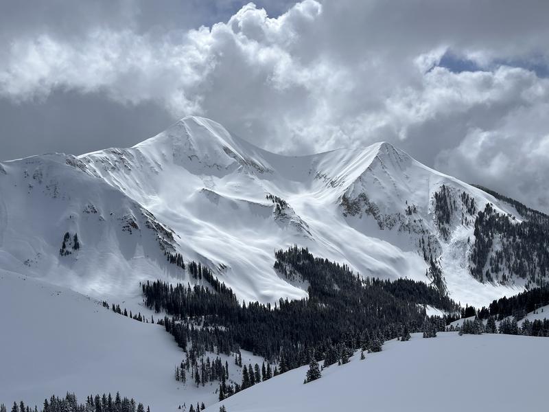
Dramatic day in the mountains yesterday. If you hunt around in this photo you can find numerous natural wind slab avalanches.
Snowpack and Weather Data
Gold Basin Storm Stake (10,000')
Gold Basin SNOTEL site (10,000')
SNOTEL site near Geyser Pass Winter Trailhead (9600')
Wind Station on Pre-Laurel Peak (11,400')
NWS forecast for the La Sal Mountains.
Recent Avalanches
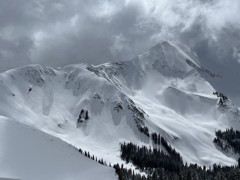
In our travels yesterday we observed numerous natural wind slab avalanches that likely ran on Friday. Although not large, most of what we saw could easily bury you if not carry you over a cliff, while avalanche activity in Horse Creek was much more significant.
Several avalanches can be seen in this photo.
Chris Benson sent in this drone footage of avalanche activity in Horse Creek, with very significant crowns visible at 0:38.
Ad
Avalanche Problem #1
Wind Drifted Snow
Type
Location
Likelihood
Size
Description
Strong easterly winds early in the storm cycle blew and drifted snow on to all aspects, particularly in the high country. SE has been the primary wind direction but we've seen winds from the NE as well. Primary deposition has been on leeward, north and westerly aspects, but cross-loading has also been a factor. I'm personally not comfortable yet with steep, wind loaded, northerly facing slopes. Human triggered avalanches 2' deep or more remain possible to likely in these areas, especially in the high country. I'd give it another day or two before stepping out into this kind of terrain, and even then I'd avoid areas of obvious drifting.
Avalanche Problem #2
Wet Snow
Type
Location
Likelihood
Size
Description
A strong March sun will rapidly warm sun exposed slopes today, and we'll see a rising danger for loose, wet avalanche activity. Be alert to signs of loose, wet snow instability such as rollerballs or pinwheels, and stay off of, and out from under steep slopes if they become wet and sloppy.
Additional Information
Want some more insight into the La Sal Mountains as well as the communal impacts of a tragic avalanche? Check out the latest UAC podcast with forecaster Eric Trenbeath where he discusses the range, it's often treacherous snowpack, and how the devastating avalanche in February, 1992, affected the Moab community.
Our avalanche beacon checker sign and beacon training park are up and running. A huge thanks to Talking Mountain Yurts for sponsoring those this season!
Sign up for forecast region-specific text message alerts. You will receive messages about changing avalanche conditions, watches, warnings and road plowing closures.
Follow us on Instagram @utavy_moab
General Announcements
This forecast is from the U.S.D.A. Forest Service, which is solely responsible for its content. This forecast describes general avalanche conditions and local variations always occur.