Sign Up for the Utah Snow and Avalanche Workshop (USAW) on December 7th!

Forecast for the Logan Area Mountains

Toby Weed
Issued by Toby Weed on
Tuesday morning, April 9, 2024
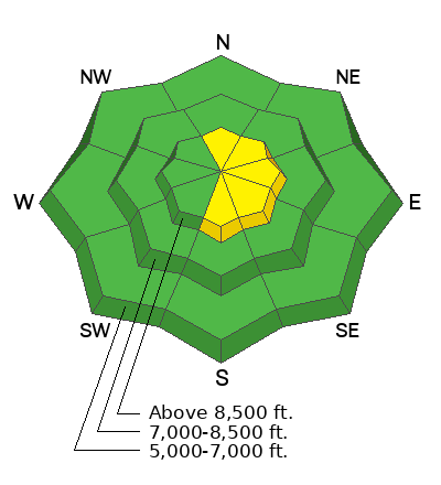
The avalanche danger is LOW, and avalanches are unlikely this morning. However, drifting by increasing winds from the west could elevate the danger of human-triggered wind slab avalanches to MODERATE in exposed upper-elevation terrain. Also, the surface snow will probably become damp in sunny terrain during the day, and small wet avalanches may become possible.

Use normal caution. Evaluate snow and terrain carefully, especially in high drifted terrain.
Low
Moderate
Considerable
High
Extreme
Learn how to read the forecast here
Weather and Snow
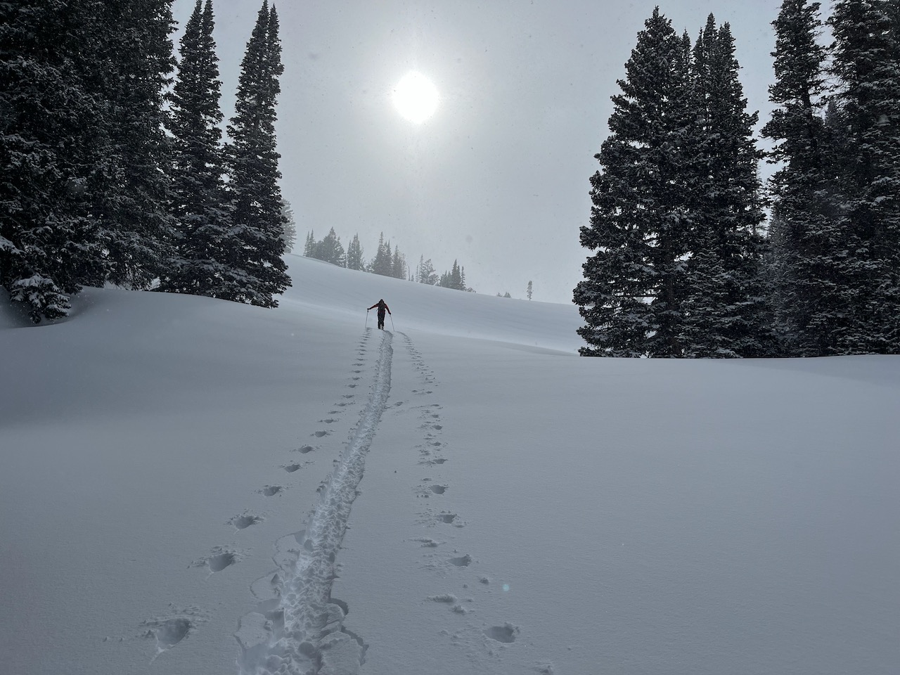
Yesterday, riders found nice shallow powder in upper-elevation terrain and dust-on-crust elsewhere. Again today, you'll find the best conditions in upper-elevation, sheltered terrain on lower-angle slopes where you won't bump into the old surface crust. Yesterday's powder became damp in sunny terrain, and it'll be crusty this morning, but the snow stayed pretty dry on northerly-facing slopes.
***Rock-hard frozen cornice chunks and debris piles from last week's wet avalanche activity lurk beneath the fresh snow on many steep upper-elevation slopes. If you hit one of these hidden "death cookies," it could ruin your day.

The Tony Grove Lake Snotel at 8400' reported 8 inches from the weekend storm. It's 22°F this morning, and there is 101 inches of total snow at the site, which contains 120% of normal snow water equivalent.
At the 9700' CSI Logan Peak weather station, increasing winds are blowing from the west-northwest at 20 mph, and it is 16°F.
At UAC's new Paris Peak weather station at 9500', it's 14°F, and at 6:00, the wind is blowing from the west-southwest at 25 mph with gusts now above 30 mph.
It's 16°F at UAC's new Card Canyon weather station at 8800', and there is 86 inches of snow total.

Expect mostly sunny skies in the mountains today. High temperatures should reach around 34° F at 8500', and the wind will blow from the west-northwest 7 to 17 mph along the ridges.
High pressure will have a hold on the weather, so expect fair weather in the mountains with increasingly warm daytime temperatures through the end of the week.
If you would like more information, you can visit our mountain weather page HERE.
Recent Avalanches
There was a small human-triggered wind slab on the north side of Mitton Peak on Sunday. No avalanches were reported yesterday, but with clearing in the afternoon, we observed a few roller ball swarms on the Folly, a (south) west-facing slope in Logan Dry Canyon.

Check out all local observations and avalanches HERE.
Ad
Avalanche Problem #1
Wind Drifted Snow
Type
Location
Likelihood
Size
Description
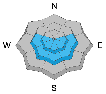
Winds blowing generally from the west increased significantly overnight, and they are blowing 25 mph on Paris Peak at 6:00 this morning. The winds are likely to increase further today. It may be possible today for people to trigger slab avalanches of stiffer drifted snow in upper and mid-elevation terrain on slopes steeper than 30°.
  • Avoid drifted snow or wind slabs on the lee side of major ridges and in and around terrain features like sub ridges, gully walls, mid-slope rollovers, scoops, and cliff bands.
  • Wind slabs may form on slopes beneath cornices on the lee side of major ridges, and the building cornices may break further back than expected.
  • Watch for obvious signs of instability, like cracking or recent avalanches on similar slopes.
  • Practice safe travel protocols to avoid exposing more than one person to avalanche danger.
Avalanche Problem #2
Wet Snow
Type
Location
Likelihood
Size
Description
Solar warmth will cause the surface snow to become damp, prone to producing loose, wet avalanches that entrain the new snow. On sustained slopes, these could produce good-sized piles of heavy cement-like debris.
  • Avoid being on steep slopes above terrain traps like trees, sinks, gullies, or rock bands that small wet avalanches could sweep you into.
Additional Information
Check out McKinley Talty's new blog post, "Do We Let Our Guard Down in the Spring?" about springtime mindsets and avalanche incidents... HERE.
Sunday, we observed periods of very heavy snowfall as well as clearing and warm sun. Sometimes, both were happening at the same time.
General Announcements
-National Forest Winter Recreation Travel Maps show where it's open to ride: UWCNF Logan, Ogden LRD Tony Grove, Franklin Basin CTNF Montpelier
-Sign up for forecast region-specific text message alerts. You will receive messages about changing avalanche conditions, watches, and warnings...HERE.
-For all questions on forecasts, education, Know Before You Go, events, online purchases, or fundraising, call 801-365-5522.
-To report an avalanche or submit an observation from the backcountry, go HERE.
-Come practice companion rescue at the Franklin Basin TH Beacon Training Park. It's free and open to everyone. For easy user instructions, go HERE.
-We will issue regular daily updates of our forecast through April 14.
-We will update this forecast tomorrow by 7:30 AM.
This forecast is from the U.S.D.A. Forest Service, which is solely responsible for its content. This forecast describes general avalanche conditions, and local variations always occur.