UDOT PLANNED AVALANCHE CLOSURES!!

Forecast for the Logan Area Mountains

Paige Pagnucco
Issued by Paige Pagnucco on
Saturday morning, January 11, 2025
The avalanche danger is CONSIDERABLE today, and people are likely to trigger soft and hard slabs of wind-drifted snow, mainly in upper and mid-elevation terrain failing on weak surface snow. Though becoming less likely, it is still possible to trigger dangerous slab avalanches failing on a persistent weak layer buried 1 to 3 feet deep on steep, northerly-facing slopes holding poor snowpack structure. You should find good powder riding conditions on slopes less than 30°, protected from the pesky wind. Cautious route-finding, conservative decision-making, and careful snowpack evaluation are your tools for the day.
Avoid recently drifted slopes, especially those with poor snow structure.
Low
Moderate
Considerable
High
Extreme
Learn how to read the forecast here
Special Announcements
Receive forecast region-specific text message alerts to receive messages about changing avalanche conditions, watches, and warnings. Sign up and update your preferences HERE
Weather and Snow
It is snowing, and the mountains have picked up 4 to 6" of snow overnight, but the biggest concern for today is the pesky wind. It is forecast to blow from the northwest at 15 to 20 MPH with gusts in the 30's MPH. It's been pretty quiet on the avalanche front, but today's winds and new snow will create some issues, especially in the high country. Drifting will form soft and stiff wind slabs in exposed upper and mid-elevation terrain on slopes facing all directions. These slabs are building on top of weak surface snow, formed over the past few clear nights. We are still tracking the old persistent weak layer from earlier in the season, but I'm not confident this storm is enough load to tip the balance. Regardless, I'm still avoiding steep slopes that harbor this poor snowpack structure, mainly facing the north half of the compass. Riding has been pretty good, and today's new snow will only improve conditions. Find sheltered terrain away from steep, wind-drifted slopes, and you should find good powder.

-The 8400' Tony Grove Snotel reports 18° F, with 61 inches of total snow.
-On Logan Peak at 9700' feet, it is blowing from the northwest around 30 mph, with gusts of 40 mph. It's 10° F and the wind chill value is -12° F.
-It's 14° F at 8800' at our Card Canyon station, with 45 inches of total snow.
-On Paris Peak at 9500' in Bloomington Canyon, it is 10° F, and winds are blowing from the west at 15 to 23 mph. The wind chill value is -7° F.
The storm is giving one last good punch this morning but should start to lose strength by mid-morning. Snow showers continue through today with a few more inches falling (favored areas may get 2-4" more). It's going to be cold today with 8500' high temps near 15° F, and a windchill of 0° F. Hand warmers, a down coat, and a thermos of cocoa will be in my kit today. Northwesterly winds will die down this evening as the storm exits to the east. Fair and cold weather returns Sunday and will persist through next week.

For more information, visit the UAC weather page here: Weather - Utah Avalanche Center
For Logan-specific weather, go here: Logan Mountain Weather - Utah Avalanche Center
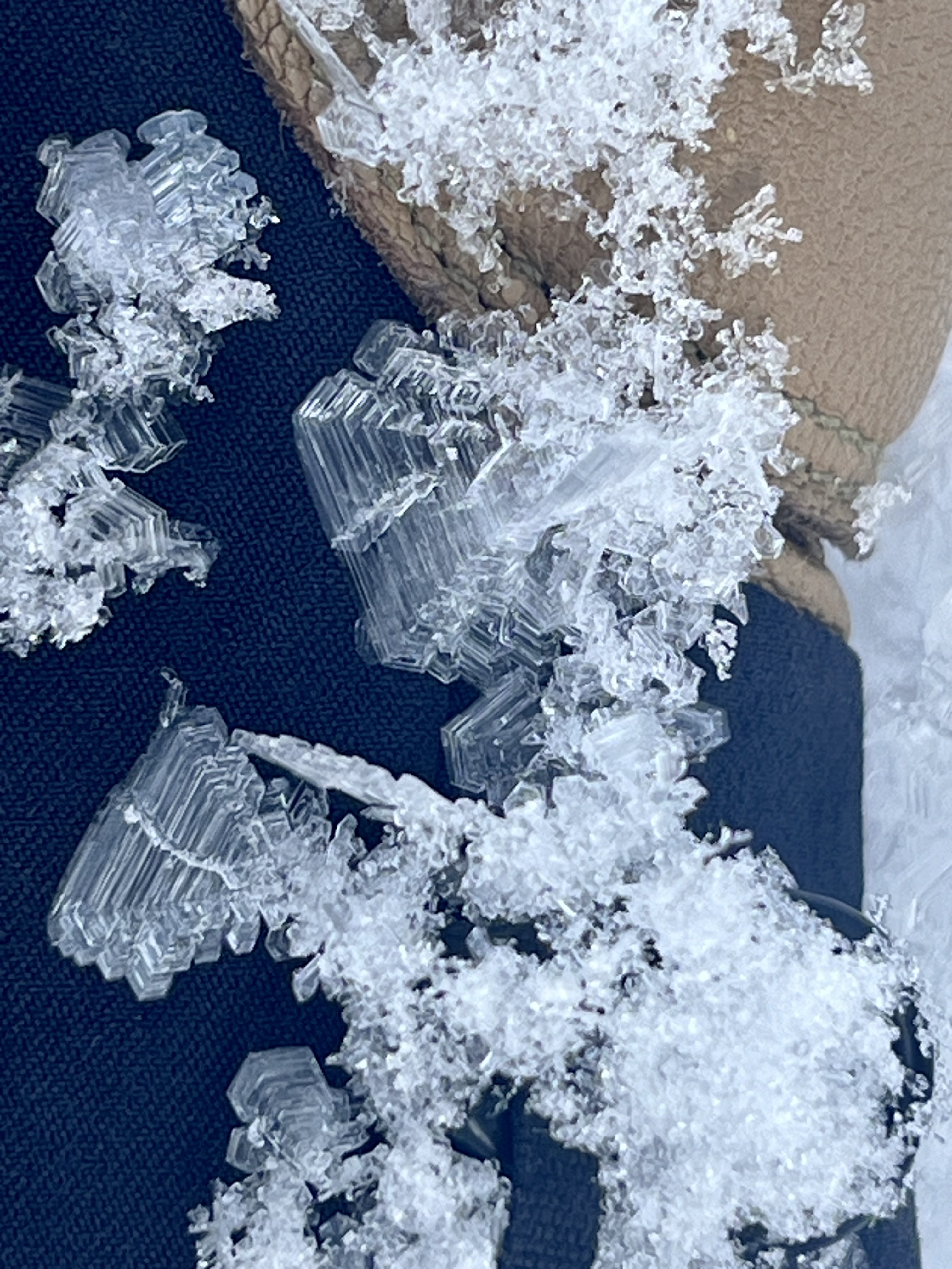
Surface hoar and near surface facets developed over the past few clear, cold nights.
Recent Avalanches
28 years ago today, three people were killed by an avalanche in Logan Dry Canyon, leaving our community deeply affected. We offer our condolences to everyone affected by this tragic accident. You can read the report HERE,

No avalanches were reported in the past week.
Read about all avalanches and all observations HERE.
Remember, the information you share about avalanches you see or trigger could save lives.
Ad
Avalanche Problem #1
Wind Drifted Snow
Type
Location
Likelihood
Size
Description
Strong winds are building soft and stiff slabs of snow, mainly in exposed upper and mid-elevation terrain on all aspects. These are forming on top of newly formed weak surface snow. Watch for and avoid areas with freshly wind-drifted snow.
  • Avalanches of wind-drifted snow are most likely on the lee side of major ridges, especially on slopes capped by cornices.
  • Wind slabs are found in exposed areas and in and around terrain features like cliff bands, sub-ridges, gullies, and scoops.
  • Hard wind slabs may allow you to get out onto them before releasing.
  • Wind slabs may have a hollow, drumlike feel. Watch for signs of instability, like cracking.
Avalanche Problem #2
Persistent Weak Layer
Type
Location
Likelihood
Size
Description
Very weak faceted snow exists near the ground on almost all northerly-facing slopes at upper and mid-elevations. While the snow is gradually becoming more stable and definitive signs of instability like collapsing are waning, the buried, sugary, persistent weak layer and poor snowpack structure remain, and people could still trigger large and potentially deadly avalanches, especially when we add weight with new snow and wind. We've found better stability in areas where the snow is deeper, (5 or 6 feet deep) and weaker snow where it is shallower, (2 to 4 feet deep).
  • Recent avalanches, shooting cracks, and collapsing (whumpfs) are signs of unstable snow, but these obvious signs of instability will not always be present when a large avalanche occurs.
  • Avalanches might be triggered remotely (from a distance) or worse, from below steep slopes in the flats.
  • We are continuing to avoid steep slopes that harbor poor snowpack structure on the north half of the compass.
Additional Information
Here is our video about the Christmas Eve Steep Hollow Accident
General Announcements
-National Forest Winter Recreation Travel Maps show where it's open to ride: UWCNF Logan, Ogden LRD Tony Grove, Franklin Basin CTNF Montpelier
-For all questions on forecasts, education, Know Before You Go, events, online purchases, or fundraising, call 801-365-5522.
-Remember the information you provide could save lives, especially if you see or trigger an avalanche. To report an avalanche or submit an observation from the backcountry, go HERE.
-The Tony Grove Road is not maintained for winter driving.

This forecast is from the U.S.D.A. Forest Service, which is solely responsible for its content. This forecast describes general avalanche conditions, and local variations always occur.