

Observer Name
B
Observation Date
Thursday, April 17, 2025
Avalanche Date
Thursday, April 17, 2025
Region
Salt Lake » Big Cottonwood Canyon » Brighton Perimeter
Location Name or Route
Brighton Periphery
Elevation
10,300'
Aspect
West
Trigger
Natural
Avalanche Type
Dry Loose
Avalanche Problem
New Snow
Weak Layer
Density Change
Depth
8"
Width
80'
Vertical
200'
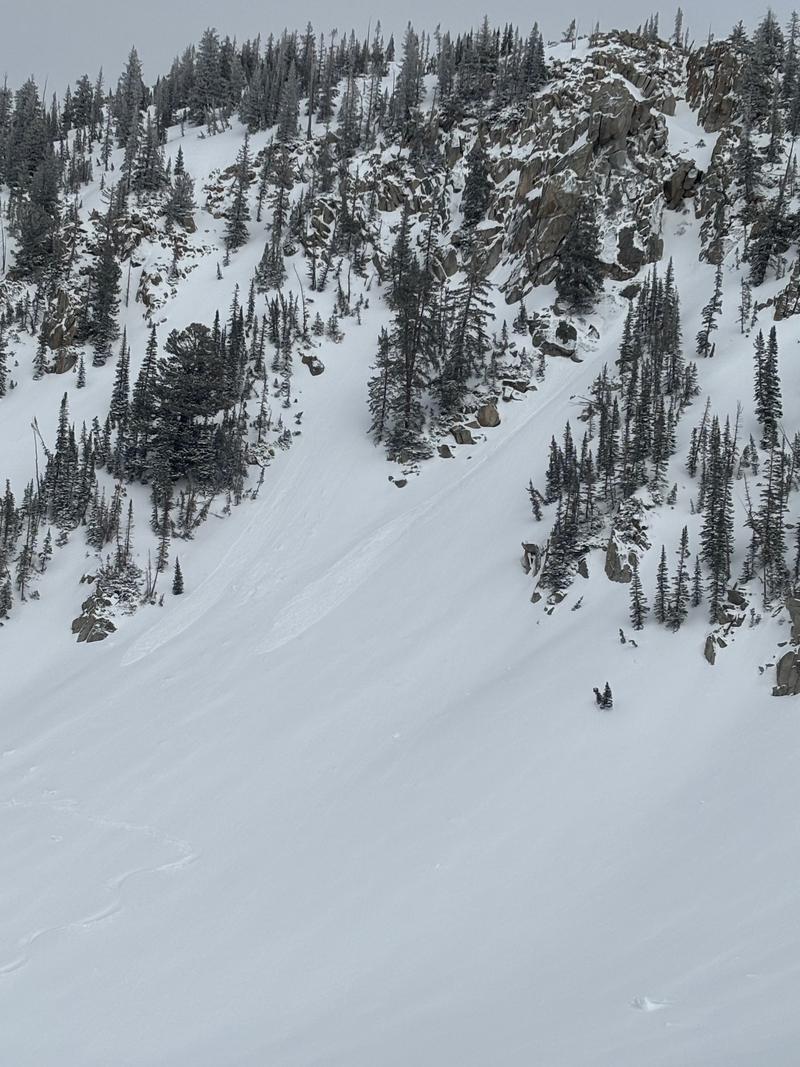
Comments
Widespread Dry Loose on all steep slopes: the entire Wolverine Cirque and Back Bowls had shallow Dry Loose avalanche activity that occurred during the High PI in the late afternoon. There was a density break with the weak layer being light density snow directly above the first inch of dense/damp snow that fell overnight. VE shears in hasty pits identified this weak layer as well. Cracking observed, and there was a contributing factor of Wind Loading that appeared to make this shallow/easily manageable weakness reactive. HST at 9800' and above at 1800 hours was 20 to 25cm of medium density snow with the aforementioned first initial inch very dense and heavy. Excellent riding with "bottom feeding" on slopes with angles greater than 25 degrees. HST at 8000' at least 10cm of with the lower half of this new snow very dense and wet. Sun did not appear to adversely effect any aspect above 8000'. S-1 throughout the day with occasional micro bursts of S3 to S4. New snow bonded well to the old snow interface. Caution for "Clinkers".
Coordinates