Observer Name
Little, Zebrack
Observation Date
Monday, January 8, 2024
Avalanche Date
Monday, January 8, 2024
Region
Salt Lake » Big Cottonwood Canyon » Days Fork » Two Dogs
Location Name or Route
Days Fork
Elevation
10,400'
Aspect
Northeast
Slope Angle
38°
Trigger
Skier
Avalanche Type
Soft Slab
Avalanche Problem
New Snow
Weak Layer
Density Change
Depth
14"
Width
60'
Vertical
150'
Comments
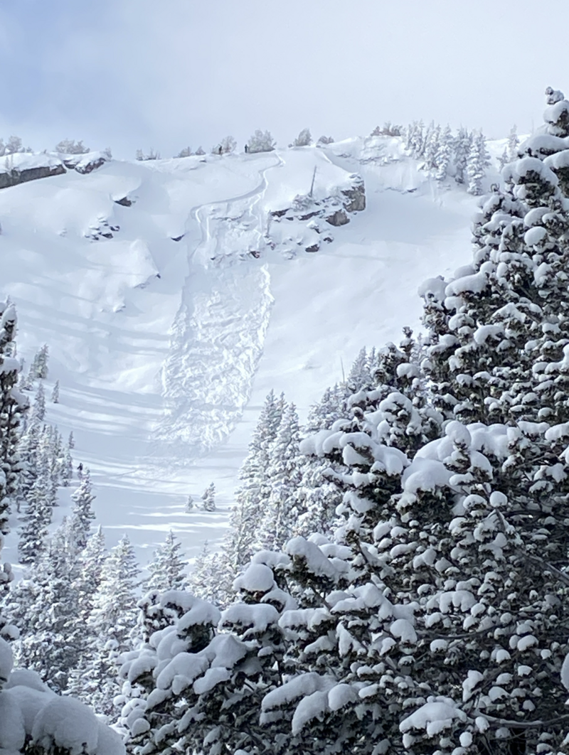
SS-AS-R1-D1. From across the basin, we watched another skier trigger a small soft slab avalanche within the new snow in Upper Days fork today. As the skier made quick work of the slope, their slow-moving sluff entrained enough volume to trigger the avalanche behind them, and they were well below the slab by the time it released. We could not access the avalanche as we were already headed elsewhere. Still, based on the structure found on similar aspects and elevations throughout our tour, it seems that this slab failed on a density change within the new snow. Wind loading did not seem to be a factor as the slab was well below the ridgeline in a relatively sheltered part of the slope. See picture.

Comments
General observations for the day- We traveled on all sides of the compass above 9,000', and it was very cold and windy. Little to no loose snow was present on the ridge tops above 10k, as most of it had been stripped away by moderate winds during the storm. Throughout the day, steady 10-15mph winds removed whatever snow was left, but plenty of great unconsolidated powder skiing could be had just below the ridges. We observed very little slab development aside from the very soft slab mentioned above, and most signs of instability were slugish loose-dry avalanches which there were plenty of. There were a few slab avalanches on Cardiac Ridge (E-SE facing) that occurred at some point during the storm yesterday, all of similar character to the skier-triggered avalanche we observed. We did have one collapse with cracking in a pocket of wind-loaded snow just below a ridge line on an east aspect. South facing slopes had 12-20 inches of low density snow lying above a STOUT crust, which has sintered facets below that. Below 9500' the surface snow on these aspects was beginning to get wet by 12:00. The polar aspects had the same new snow totals which sat above the various NSF formations from the drought, although it seemed like the slab to make things happen wasn't quite there, yet.
Coordinates


