Observer Name
Grainger
Observation Date
Friday, December 8, 2023
Avalanche Date
Friday, December 8, 2023
Region
Salt Lake » Park City Ridgeline
Location Name or Route
PC Ridgeline
Elevation
9,600'
Aspect
Northeast
Slope Angle
39°
Trigger
Skier
Trigger: additional info
Remotely Triggered
Avalanche Type
Soft Slab
Avalanche Problem
Wind Drifted Snow
Weak Layer
New Snow/Old Snow Interface
Depth
14"
Width
90'
Vertical
Unknown


Comments
Traveling from Empire Pass to the head of Millcreek along the PC ridge today showed wind effect to be the primary avalanche problem in multiple areas. Overall rugged walking conditions. With a consistent 11-16" of new snow at ridgeline, battling terrain-driven and prevailing WNW winds have created soft but moderately-sensitive windslab that will take time to heal at the new/old interface.
Wind-affected snow was more prevalent on the southern half of the ridgeline but human triggers will be possible throughout it for the next days. Digging/walking produced one Sudden Planar (SP) result but mostly Resistant Planar (RP) failure ~12-15" down.
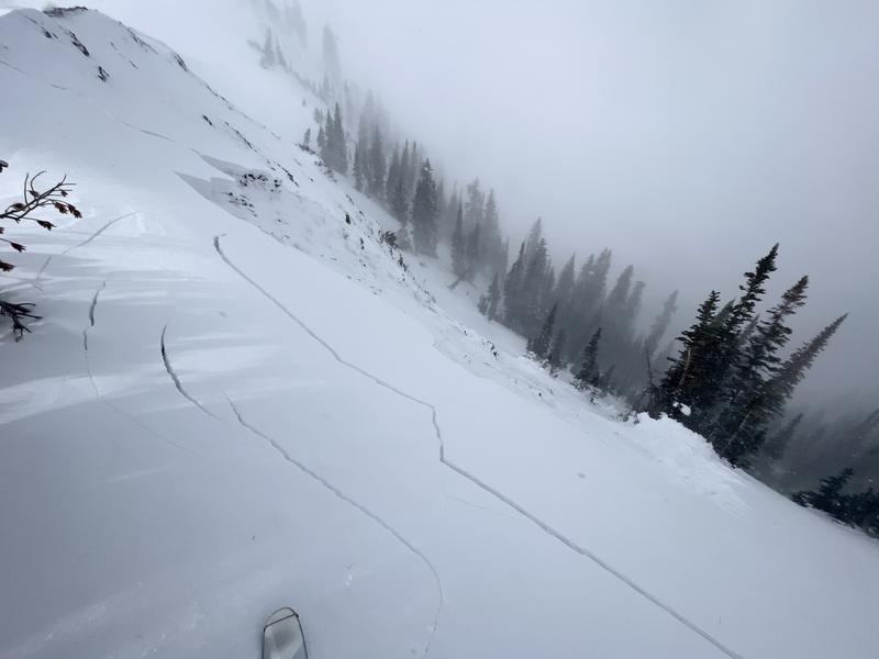
While walking I observed one natural and remotely-triggered at least 2 soft wind-slabs from the ridge; all on steeper, rocky features (Pic 1).
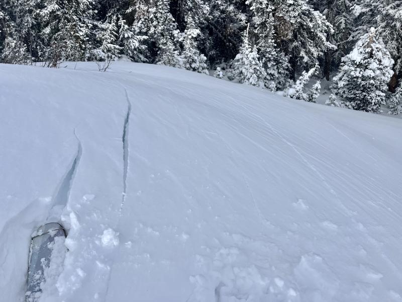
Many areas produced cracking on the new/old interface (Pic 3).
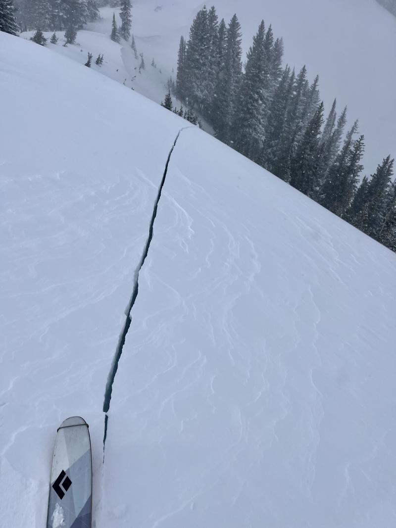
After this week's dense snow settling and weather warming, the persistent weak layer from mid-November is less reactive. However, the odds are low but stakes are really high, Areas like the PC Ridgeline have a lower HS and are still prime for triggering a large and hard slab. I was reminded of this as I had a pole-deep crack propagate at ski tip (Pic 2) from well back on the ridge. This wind-loading has the potential to tip the scale in areas that haven't yet run on this layer.
Coordinates


